Slot canyons and the world's longest natural arch are among the geologic features found at this park in southwestern Utah.
Published Jun 19, 2016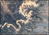
The park sits at the eastern edge of the Paunsaugant Plateau, and the ridgeline offers stunning views across southern Utah.
Published Jun 25, 2006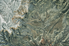
Winter weather has helped sculpt the natural amphitheaters and hoodoos found at Utah’s Bryce Canyon.
Published Apr 1, 2017
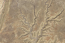
The highlights of this landscape in southern Utah tend to reach down into the Earth, rather than soaring above it.
Published Aug 20, 2017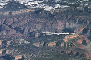
Grand Canyon National Park spans 277 river miles and often stretches 10 miles wide. But the true wonder arises from its depth...or height, depending on where you stand.
Published Apr 24, 2016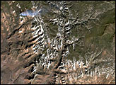
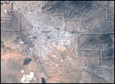
The park encompasses about 37,000 hectares of the Sonora Desert.
Published Jul 24, 2005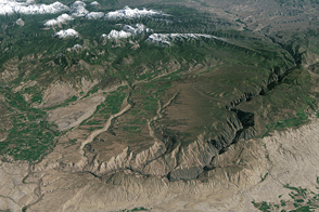
The Gunnison is forced to stay on this beaten path, unable to leave the valley.
Published Dec 17, 2016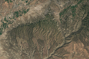
Falling blocks of rock in cliff alcoves became building materials for Ancestral Puebloans—and a popular draw for tourists visiting the park.
Published Aug 26, 2016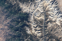
Acquired October 22, 2008, this true-color image of Sequoia National Park shows a network of varied ecosystem, including conifer forests, river valleys, alpine vegetation, and bare rocks.
Published Nov 15, 2009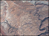
Situated in Utah, the park is home to 2,000 arches and windows in rock, as well as rock spires and pinnacles.
Published May 8, 2005
The colonial communities of “America’s historic triangle” played defining roles in the road to American independence.
Published Jul 4, 2018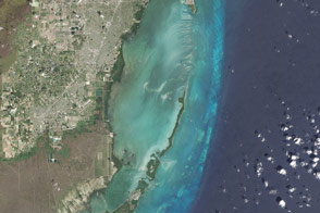
Maps of the underwater topography reveal reefs and sandbars within the largest marine park in the U.S. National Park System.
Published May 1, 2016
Americans celebrate the 75th anniversary of Shenandoah National Park, just 75 miles from Washington, DC, but worlds away in spirit.
Published Jun 25, 2011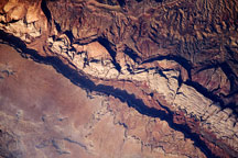
One hundred million years of rock formation are visible in exposed layers at Waterpocket Fold in Capital Reef National Park. This astronaut photo from June 14, 2009, shows the layered, multi-colored rock formations.
Published Jul 6, 2009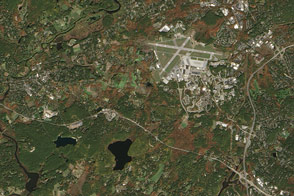
Sites relevant to the start of the American Revolutionary War are interspersed throughout the modern-day Boston metropolitan region.
Published Jul 4, 2016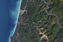
State parks had already been established in the region when the U.S. Congress established northern California’s Redwood National Park in 1968.
Published Feb 22, 2009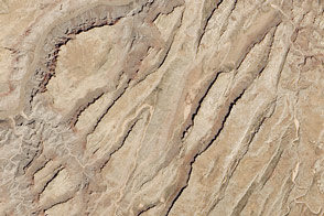
Sinking blocks of rock created this distinctive network of valleys.
Published Jun 6, 2014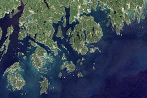
Mountains and hills roll right up to the Atlantic Ocean in this rocky landscape that became the first national park east of the Mississippi River.
Published Jul 31, 2016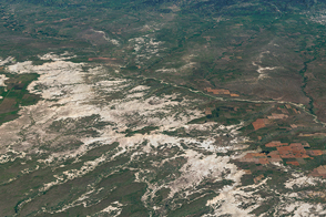
Over epochs, deposition and erosion have carved sharp spires and deep canyons out of this South Dakota landscape.
Published Aug 27, 2016
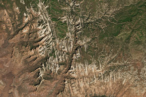
Acquired May 15, 2005, this natural-color image shows part of the Grand Staircase-Escalante National Monument in south-central Utah.
Published Oct 13, 2010