With each passing month, 2015 looks more and more like 1997.
Published Oct 13, 2015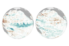
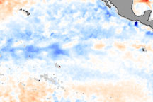
The near-record water temperatures of 2015-16 has been followed by a modest, quiet appearance of La Niña.
Published Jan 6, 2017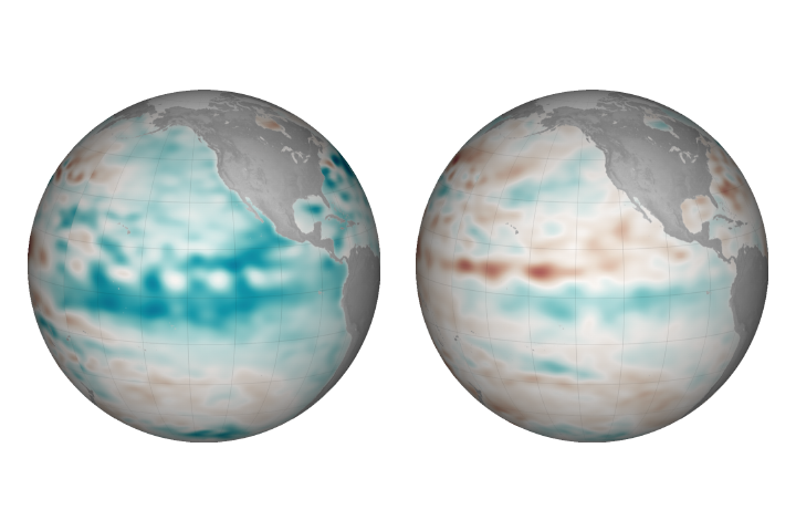
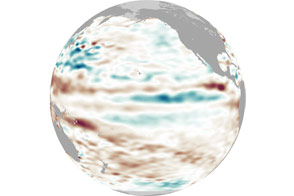
Cooler than normal conditions prevail in the central and eastern Pacific, but the event is so far considered weak.
Published Dec 22, 2017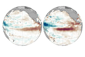
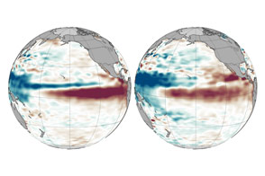
Weakening trade winds are allowing warm water to move east across the Pacific in a telltale pattern.
Published Aug 5, 2015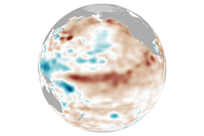
Ocean conditions are not likely to help drought-stressed regions this spring. However, some broader changes might be coming in the Pacific.
Published Mar 25, 2015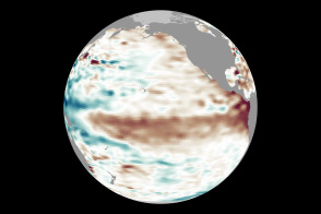
Conditions in May 2014 look similar to those in May 1997, a year that brought one of the most potent El Niño events of the 20th century.
Published May 14, 2014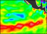
After appearing for two consecutive winters, La Niña appears to be taking some time off.
Published May 4, 2012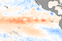
These color-coded images show the strengthening of El Niño between October and November 2009. In the November image, warm waters (indicated in red) have spread across the Pacific.
Published Dec 11, 2009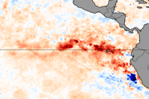
A patch of warmer than average ocean temperatures in the eastern Pacific on July 26, 2009, revealed the onset of El Niño conditions.
Published Jul 28, 2009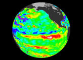
La Niña is an occurrence of unusually cold water temperatures in the Pacific Ocean along the equator (the precise area affected is outlined in black in the image above). La Niña and its opposite, El Niño, are linked to seesaw variations in air pressure over the tropical Pacific and affect weather patterns across the globe. NASA monitors developing El Ni&ntidle;o and La Niña events by observing sea surface temperatures. This image compares the water temperatures observed in late January 2006 to long-term average conditions for that time of year. The recent data were collected by the Advanced Microwave Scanning Radiometer for EOS (AMSR-E). Red shows where sea surface temperatures are warmer than normal and blue where they are colder than normal.
Published Feb 9, 2006