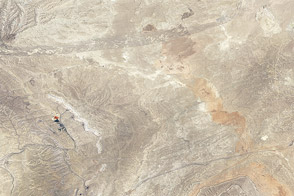
Geologists and satellite sensors see similar features in Wyoming’s Great Divide Basin.
Published Nov 9, 2012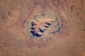
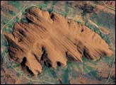
This ancient rock is one of Australia’s major tourist attractions and a sacred place for indigenous people.
Published Dec 19, 2016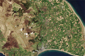
The Zagros Mountains in southwestern Iran present an impressive landscape of long linear ridges and valleys. Formed by collision of the Eurasian and Arabian tectonic plates, the ridges and valleys extend hundreds of kilometers. Stresses induced in the Earth’s crust by the collision caused extensive folding of the preexisting layered sedimentary rocks. Subsequent erosion removed softer rocks, such as mudstone and siltstone while leaving harder rocks, such as limestone and dolomite. This differential erosion formed the linear ridges of the Zagros Mountains. This astronaut photograph of the southwestern edge of the Zagros mountain belt includes another common feature of the region—a salt dome (Kuh-e-Namak or “mountain of salt” in Farsi).
Published Apr 17, 2006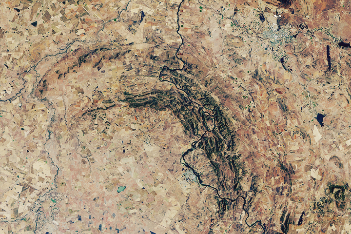
The world’s oldest and largest known impact structure shows some of the most extreme deformation conditions known on Earth.
Published Sep 1, 2018
This true-color image shows the Joggins Fossil Cliffs and nearby Cumberland Basin.
Published May 10, 2009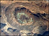
Upheaval Dome is a striking geologic structure in the Canyonlands National Park of southern Utah. The alternating rock layers make a nearly circular, 5.5-kilometer- (3.4-mile-) diameter “bull’s-eye.” This photograph of Upheaval Dome was taken by an astronaut onboard the International Space Station. The oblique viewing angle—in other words, not looking straight down—provides a sense of the topography within and around the structure. The dome appears more like an ellipse than a circle due to the oblique viewing perspective.
Published Jul 23, 2007
The lack of soil and vegetation allows parallel lines and sweeping curves of geological structure to appear quite clearly.
Published Mar 31, 2014
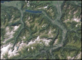
Geologically recent events sculpted the rocks of Glacier National Park into sharp mountain peaks and steep-walled valleys.
Published Aug 21, 2008
Despite being quite close to each other, two mountain ridges in western Virginia have very different origins.
Published Mar 15, 2017