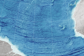
Scientists read the bumps on the ocean surface to understand the shape of the seafloor below.
Published Dec 29, 2015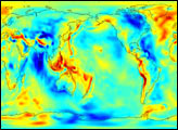
The Gravity Recovery and Climate Experiment (GRACE) has released its first science product: the most accurate map yet of Earth’s gravity field.
Published Jul 30, 2003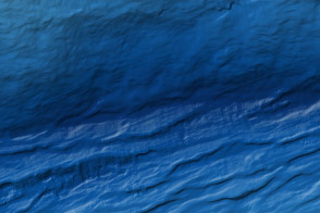
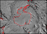
Oceanographers make new maps of the Mariana Trench that are 20 times better than anything before.
Published Apr 14, 2012
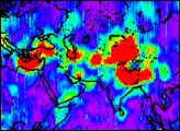
The first image released from the Gravity Recovery and Climate Experiment (GRACE), a joint NASA-German Aerospace Center mission, graphically illustrates the sensitivity of the mission’s twin spacecraft to changes in Earth’s gravity
Published Dec 11, 2002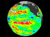
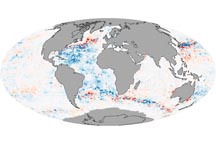
When scientists corrected errors in ocean temperature data, a mysterious cooling trend that appeared to occur between 2003 and 2005 disappeared.
Published Nov 6, 2008