Images related to Soil Composition Across the U.S.

Soil Moisture Maps
Image

Soil Moisture Maps

Published Sep 5, 2003

Image of the Day Land

Soil Moisture Around the World
Image

Soil Moisture Around the World

Satellite sensors uncover a global view of the water hidden between soil particles.

Published Nov 12, 2015

Image of the Day Water Remote Sensing

Soil Moisture in the United States
Image

Soil Moisture in the United States

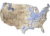
Views from the ground and from space are helping scientists understand how soil moisture affects U.S. agriculture.

Published Nov 25, 2015

Image of the Day Water Remote Sensing

Soggy Soil in the Eastern United States
Image

Soggy Soil in the Eastern United States

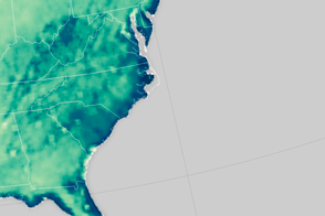
An extreme rainfall event saturated the soil along the U.S. East Coast.

Published Oct 8, 2015

Image of the Day Water Severe Storms Remote Sensing

Signs of the U.S. Drought Are Underground
Image

Signs of the U.S. Drought Are Underground

The GRACE satellites can detect the movement and depletion of water supplies at and below Earth’s surface.

Published Sep 20, 2012

Image of the Day Heat Land Drought

Water Cycle is Speeding Up Over Much of the U.S.
Image

Water Cycle is Speeding Up Over Much of the U.S.

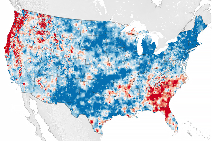
Scientists have developed a new way to measure water cycle intensity over time.

Published Jul 26, 2019

Image of the Day Water Remote Sensing

Image

"Fossil Water" in Libya

Published Apr 12, 2006

Image of the Day Land Life

Looking for Salt, Seeing Soil Moisture
Image

Looking for Salt, Seeing Soil Moisture

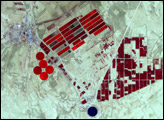
The Aquarius instrument was designed to study ocean salinity, but it is also making an important contribution to studies of the water cycle on land.

Published Jul 15, 2014

Image of the Day Land Water

Freshwater Stores Shrank in Tigris-Euphrates Basin
Image

Freshwater Stores Shrank in Tigris-Euphrates Basin

An arid region grew even drier between 2003 and 2009 due to human consumption of water for drinking and agriculture.

Published Mar 13, 2013

Image of the Day Water Remote Sensing

Water Use On Idaho’s Snake River Plain
Image

Water Use On Idaho’s Snake River Plain

Natural vegetation and irrigated farmland along the Snake River Plain in Idaho use dramatically different amounts of water during the growing season.

Published Jan 26, 2010

Image of the Day Atmosphere Land Life Human Presence

NASA Soil Moisture Data Advances Global Crop Forecasts
Image

NASA Soil Moisture Data Advances Global Crop Forecasts

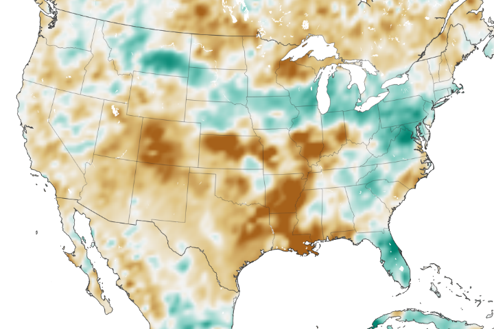
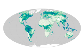
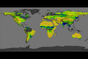
The amount of water contained in the top few centimeters of soil is small on a global scale, but it is critical for agriculture analysts trying to monitor commodity production and humanitarian need.

Published Jun 2, 2018

Image of the Day Land Remote Sensing

The Water Planet
Image

The Water Planet

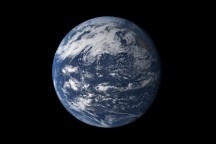
Earth is a water planet. Three-quarters of the planet’s surface covered by ice or oceans, and the sky is filled with clouds.

Published Oct 2, 2010

Image of the Day Water