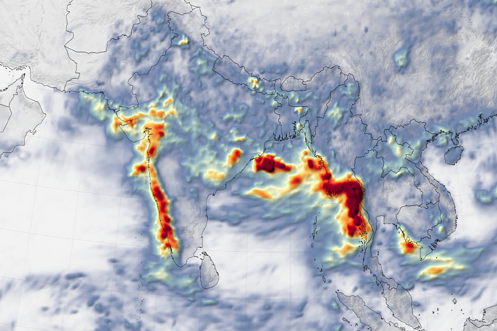
Western India and Burma (Myanmar) suffered through dramatic flooding and landslides in early August 2019.
Published Aug 14, 2019Image of the Day Atmosphere Land Water Drought Floods Severe Storms Human Presence Remote Sensing Temperature Extremes
Hurricane Maria delivered a tremendous amount of rain in a short period of time.
Published Sep 24, 2017Image of the Day Land Water Severe Storms Human Presence Remote Sensing
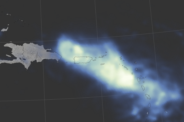
Hurricane Joaquin never made landfall, yet the weather system has wreaked havoc in the Americas.
Published Oct 6, 2015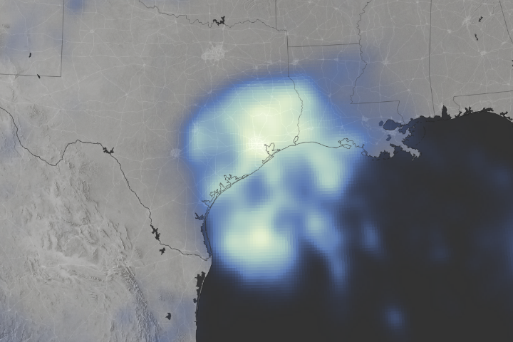
Space-based measurements show regions where Harvey delivered unprecedented rainfall.
Published Aug 30, 2017Image of the Day Land Water Severe Storms Human Presence Remote Sensing
Historic rain around the Atacama Desert led to devastating floods and mud flows.
Published Apr 11, 2015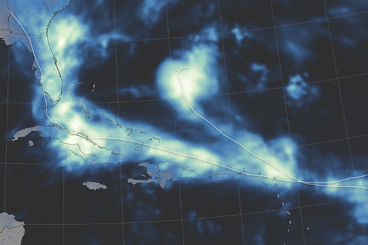
Rainfall from Hurricane Irma affected people on land, while most of Jose’s rain fell over the Atlantic Ocean.
Published Sep 14, 2017Image of the Day Land Water Severe Storms Human Presence Remote Sensing
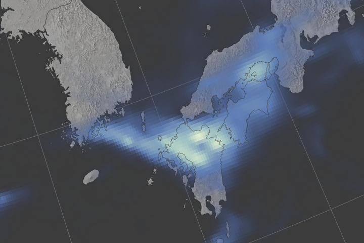
Following closely after a tropical storm, a rainstorm triggered deadly floods and landslides in Japan’s southern island of Kyushu.
Published Jul 8, 2017Image of the Day Atmosphere Land Floods Severe Storms Human Presence
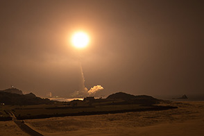
On a clear night in southern Japan, a new precipitation-monitoring satellite blasted into orbit.
Published Feb 28, 2014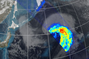
Eleven days after launch, the Global Precipitation Mission acquired this unique view of an extra-tropical cyclone over the North Pacific Ocean.
Published Mar 26, 2014Image of the Day Atmosphere Water Snow and Ice Remote Sensing
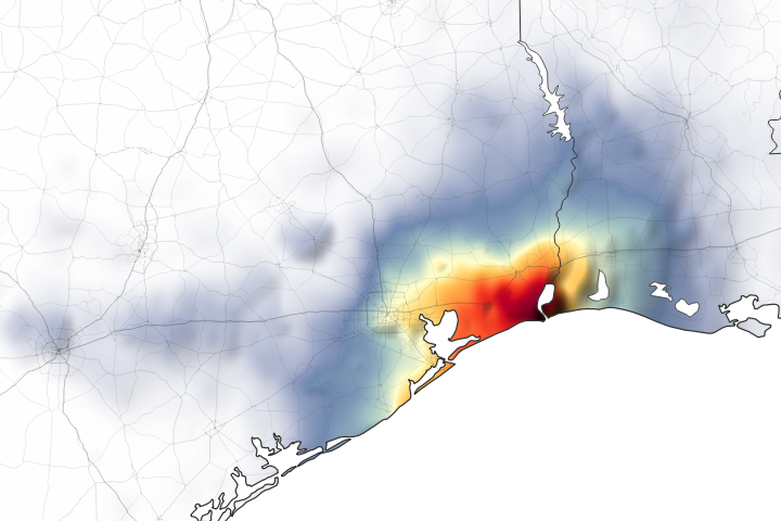
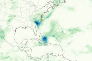
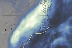
Parts of Houston and Beaumont are underwater after the remnants of Tropical Storm Imelda moved through the area.
Published Sep 20, 2019Image of the Day Land Water Floods Severe Storms Human Presence Remote Sensing
Super typhoon Koppu (Lando) dropped nearly a meter of rain on parts of Luzon, leading to destructive floods and landslides.
Published Oct 22, 2015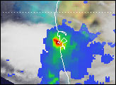
The storm has come and gone, but the effects linger due to exceptional rainfall.
Published Oct 11, 2016
The newly launched Global Precipitation Mission expands on its predecessor, the Tropical Rainfall Measuring Mission, in its geographic coverage and its measurement capabilities.
Published Mar 11, 2014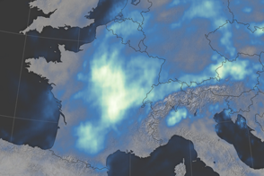
After days of downpours, water levels on the Seine River rose to heights not seen in 34 years.
Published Jun 8, 2016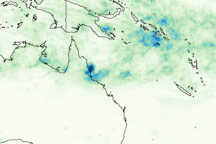
This image shows rainfall totals for January 27 through February 3, 2009, for northeastern Australia and the surrounding region, where Cyclone Ellie made landfall on February 2.
Published Feb 4, 2009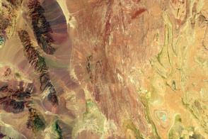
False-color satellite imagery offers insight that goes beyond what the human eye can see.
Published Mar 6, 2016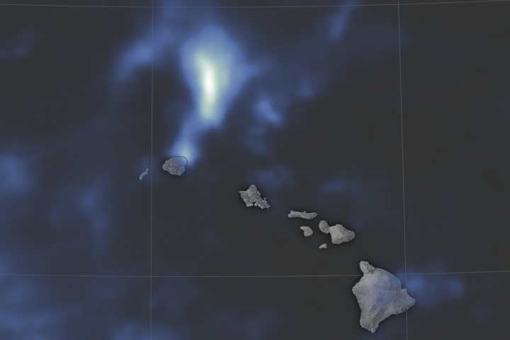
Torrential flooding on the northern shore of Kauai may have set a national record for the most rainfall ever in a 24-hour period.
Published May 2, 2018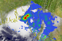
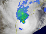
This image shows the rainfall associated with Tropical Cyclone Bijli as observed by the TRMM satellite.
Published Apr 20, 2009
Satellites observed more than 800 millimeters (30 inches) of rain falling in parts of Haiti.
Published Oct 7, 2016