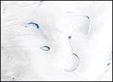
Thinner than the 2.3-kilometer-thick center, the outer edges of the Greenland ice sheet develop melt zones like the one shown here during the warm summer months.
Published Apr 7, 2007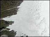
Although 2005 overall saw a new record, the extent of June melting in 2005 was unexceptional. The same held true for 2006, when this picture was taken.
Published Jun 30, 2006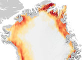
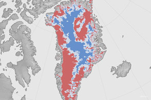
A new map shows where the bottom of the Greenland Ice Sheet is likely thawed.
Published Aug 4, 2016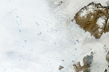
To understand ice sheets, glaciologists venture both below the surface with ice cores, and into the sky with satellites. Satellite imagery of the Greenland Ice Sheet reveals melt ponds that can affect glacier flow and sea level.
Published Oct 29, 2008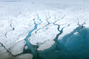
A summer field campaign examines the hydrology of the water streaming across the top of the ice sheet.
Published Aug 30, 2015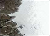
Researchers working in Antarctica have found evidence of large-scale ice making at the bottom of that continent's massive ice sheets.
Published Apr 21, 2011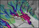
The image above depicts the region of West Antarctica where scientists measured ice speed. The fast-moving central ice streams are shown in red. Slower tributaries feeding the ice streams are shown in blue. Green areas depict slow-moving, stable areas. Thick black lines depict the areas that collect snowfall to feed their respective ice streams.
Published Jan 25, 2002
Melt ponds on the surface of Greenland’s ice sheet are an important indicator of the strength of the 2013 melt season.
Published Jul 9, 2013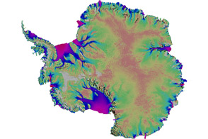
Scientists mapped the motion of Antarctica’s ice sheets and revealed unexpected patterns.
Published Aug 19, 2011