A succession of storms in January and February dumped huge amounts of snow on the Sierra Nevada.
Published Feb 13, 2019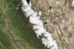
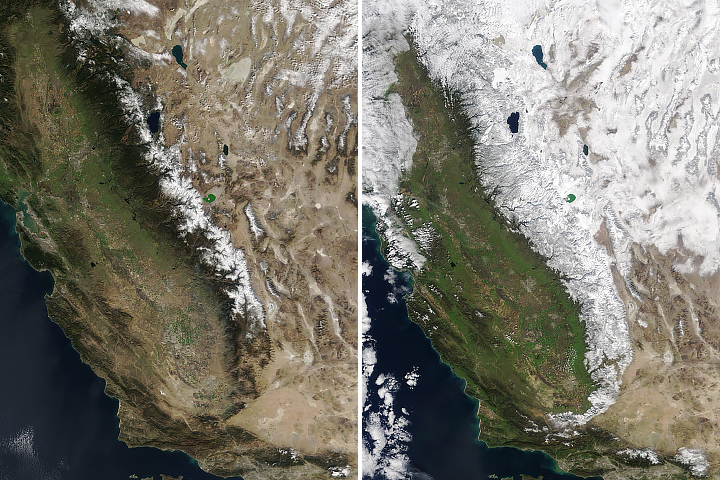
El Niño brought more rain and snow to California this winter, but not enough to offset the water deficit built up over four years.
Published Apr 14, 2016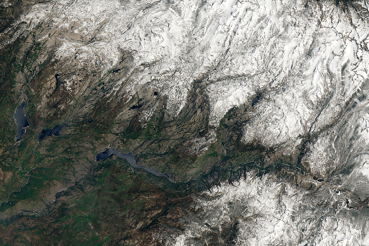
Thanks to a series of drought-busting storms, the mountain range has unusually thick and extensive snow cover this year.
Published Jun 15, 2017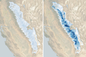
The water stored as snow in the 400-mile long range is now 185 percent of normal for the beginning of March.
Published Mar 3, 2017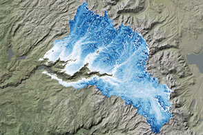
NASA airborne snow surveys provide key information for California water managers.
Published Apr 22, 2017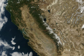
From brown landscapes to snow-free mountains, California was startlingly dry as a serious drought prompted a state of emergency.
Published Jan 23, 2014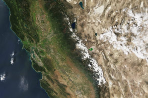
Snow cover in late March 2015 was significantly lower than the previous worst year on record. The landscape change is stark since 2010, the last time the region saw average snowfall.
Published Apr 3, 2015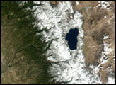
A blanket of white comes and goes from the mountains and deserts of the American West.
Published Apr 16, 2018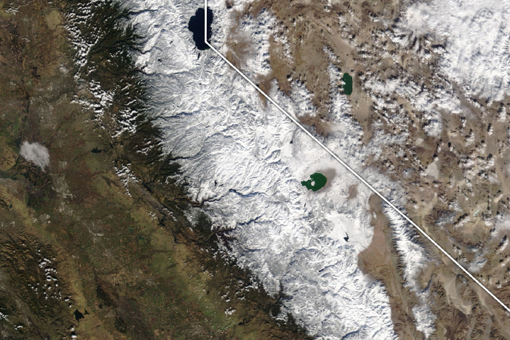
As November 2018 came to a close, mountain areas saw their first significant snowfall of the season.
Published Dec 3, 2018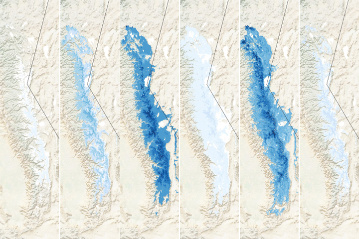
The winter of 2019-2020 was much drier than usual in California, as evidenced by the dearth of snow in the mountains.
Published Mar 13, 2020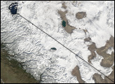
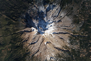
Mount Shasta is usually snow-capped. But this winter, it is a lot more brown than white, as drought deepens in California.
Published Jan 17, 2014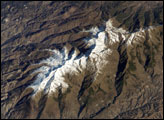
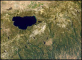
The Sierra Nevada, part of the Betic Cordillera of southern Spain, were formed during the Alpine Orogeny, a mountain-building event that also formed the European Alps to the east and the Atlas Mountains of northern Africa across the Mediterranean Sea. Veleta Peak, at an elevation of 3,398 meters (11,148 feet) above sea level, is a popular destination for skiers and snowboarders. This astronaut photograph depicts the Veleta Peak region of the range and illustrates the sharp contrast between the snow-capped mountains, adjacent dry lowlands to the west and north, and the Mediterranean Sea to the south.
Published Jan 30, 2006
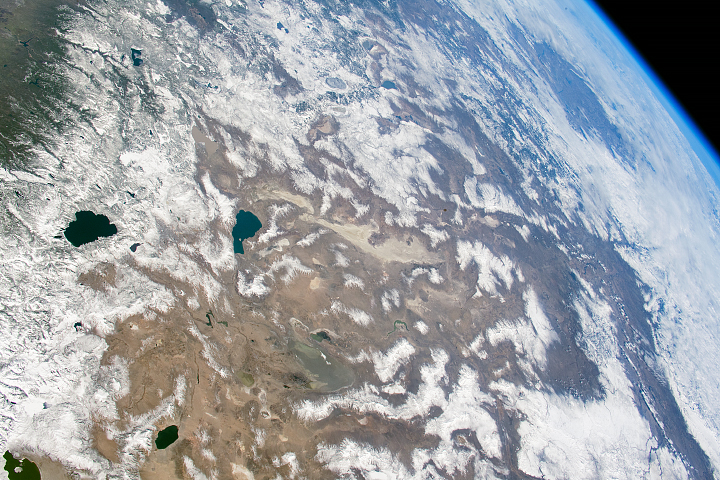
Astronauts aboard the International Space Station looked obliquely down at the steep eastern flank of California’s Sierra Nevada. Even from space the topography is impressive. The range drops nearly 11,000 feet from Mt. Whitney (under cloud, arrow), the highest mountain in the lower 48 states (14,494 ft), to the floor of Owens Valley (the elevation of the town of Lone Pine is 3,760 ft). The Sierra Nevada landscape is well known for deep, glacially scoured valleys, like Kern Canyon west of Mt. Whitney.
Published Mar 9, 2003
Groundwater supplies are decreasing across much of the world.
Published Nov 1, 2013