Flooded rice fields in the winter help farmers soften plant stubble for spring tilling. They also provide an oasis for migratory birds.
Published Mar 26, 2019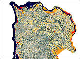
Scientists at the U.S. Forest Service and the Bureau of Land Management are using satellites -- Landsat 5 and Landsat 7 -- to determine where spotted owls are likely to nest.
Published Jun 23, 1999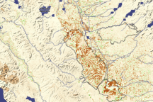
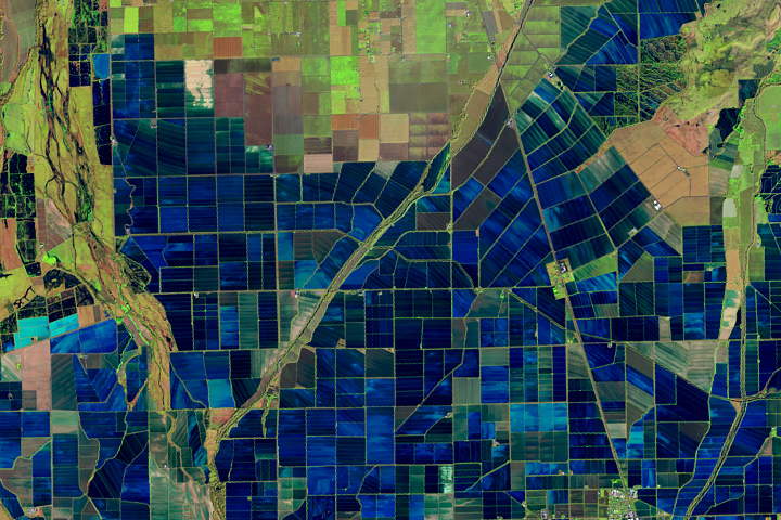
Dark brown squares mark fields that would ordinarily support irrigated crops in California’s Central Valley in this vegetation image. In 2009, a lack of water meant that the crops were not growing well or the fields lay fallow.
Published Aug 16, 2009
The Klamath Basin, on the California-Oregon border, had been in the news because of water shortages due to the drought in the United States’ Pacific Northwest. Diverse interest groups have come into conflict over the limited availability of Klamath Project water. In order to protect endangered Sucker Fish and threatened Coho Salmon in Upper Klamath Lake, the U.S. Bureau of Reclamation cut off the flow of irrigation water to farmers in the project in April 2001.
Published Aug 19, 2001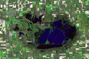
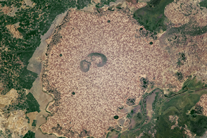
Kansas wetlands dry out across two rain-scarce summers.
Published Oct 7, 2012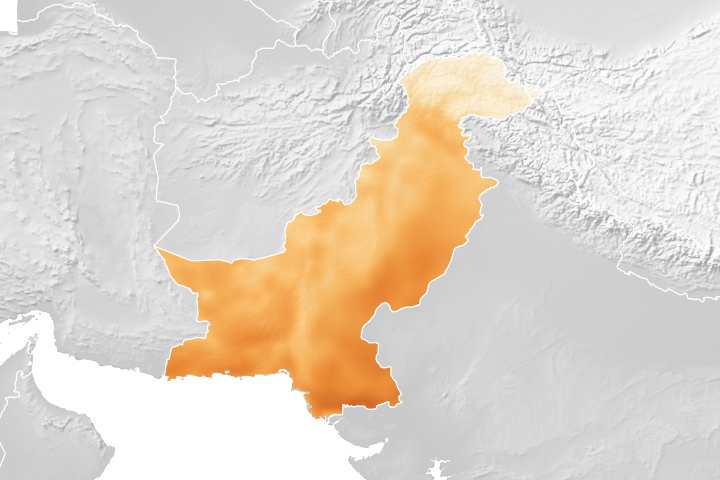
A project using NASA satellite data helps reduce overwatering and enhances crop yields for Pakistani farmers.
Published Oct 18, 2018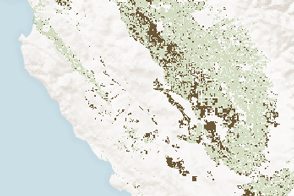
Analysis of Landsat and MODIS data showed where agricultural production was affected by long-term drought in California.
Published Jan 30, 2015
Reservoirs, lakes, and mountainsides are brimming with water and snow, though scientists caution that underground aquifers are a long way from having the same bounty.
Published Apr 21, 2017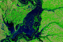
Acquired may 4, 2011, April 29, 2011, and April 29, 2010, these false-color images show the confluence of the Ohio and Mississippi Rivers.
Published May 4, 2011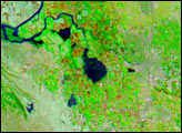
Standing beside floodplains and wetlands, the highlands are packed with farms.
Published Apr 3, 2017
For more than 100 years, groups in the western United States have fought over water. During the 1880s, sheep ranchers and cattle ranchers argued over drinking water for their livestock on the high plains. In 1913, the city of Los Angeles began to draw water away from small agricultural communities in Owen Valley, leaving a dusty dry lake bed. In the late 1950s, construction of the Glen Canyon Dam catalyzed the American environmental movement. Today, farmers are fighting fishermen, environmentalists, and Native American tribes over the water in the Upper Klamath River Basin. The Landsat 7 satellite, launched by NASA and operated by the U.S. Geological Survey, documented an extreme drought in the area along the California/Oregon border in the spring of 2001.
Published Sep 8, 2001
Satellite imagery illustrates the beginning of a land reclamation project that will transform one of the largest tidal estuaries along the Yellow Sea into farmland and a fresh-water reservoir.
Published May 17, 2007
After four years of shrinking due to drought, the largest reservoir in California got a much-needed boost from El Niño-fueled winter precipitation.
Published Apr 7, 2016
Natural vegetation and irrigated farmland along the Snake River Plain in Idaho use dramatically different amounts of water during the growing season.
Published Jan 26, 2010