Global sea level rise poses very local challenges for the many NASA centers situated on U.S. coasts.
Published Sep 30, 2015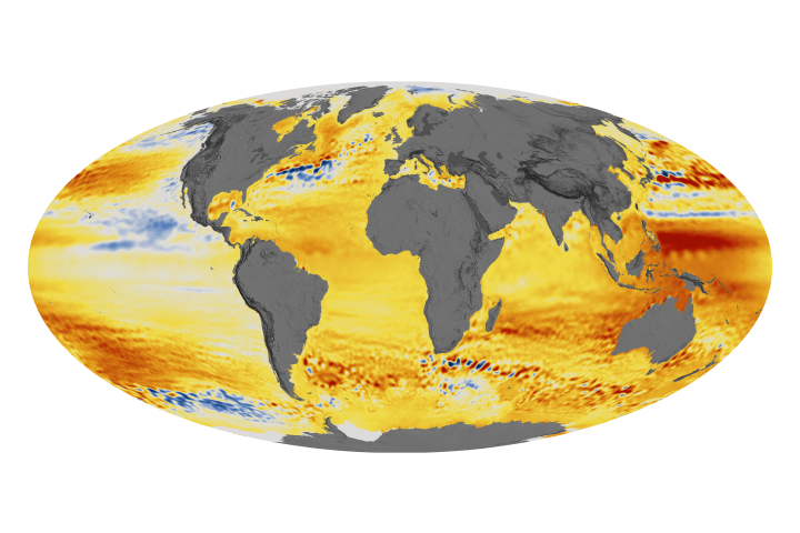
The acceleration has been driven mainly by increased ice melting in Greenland and Antarctica, and it has the potential to double the total sea level rise projected by 2100.
Published Feb 20, 2018
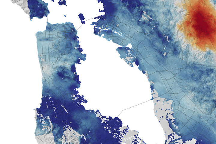
Millions of people in the state live in low-lying coastal areas where land subsidence is exacerbating the risks of sea level rise.
Published Oct 23, 2020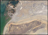
The arrow-shaped island in the Aral Sea used to be a 35-kilometer-long visual marker, indicating the Aral Sea to astronauts. An image from the present International Space Station increment shows how much the coastline has changed as the sea level has dropped during the last three decades.
Published Aug 15, 2005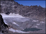

The first global catalog of glaciers is helping scientists get a better handle on how much sea levels could rise in coming years.
Published Jun 26, 2014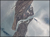
This view shows the sun reflecting off the surface waters that surround the spit that defines the Zaliv Kara-Bogaz-Gol from the open Caspian Sea. The sunglint reveals the flow of fresher water through the spit channel and into the bay.
Published Jul 14, 2002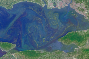
Freshened surface water and abundant nutrients lead to an explosion of algae in the inland sea.
Published May 31, 2015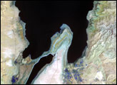
The lowest spot on dry land, the Dead Sea depression sinks 400 meters (1,300 feet) below sea level.
Published Nov 12, 2006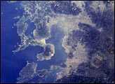
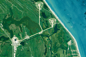
The Isahaya Bay Reclamation project separated approximately 3,000 hectares of tidal flats from the Ariake Sea in 1997. This photograph was taken from the Space Shuttle on April 27, 1998, a year after the sea wall separating Isahaya Bay from the rest of the Ariake Sea was closed.
Published Apr 1, 2001