Sections of the Greenland Ice Sheet that end on land are slowing—a sliver of good news for sea level rise.
Published Oct 30, 2015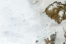
To understand ice sheets, glaciologists venture both below the surface with ice cores, and into the sky with satellites. Satellite imagery of the Greenland Ice Sheet reveals melt ponds that can affect glacier flow and sea level.
Published Oct 29, 2008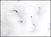
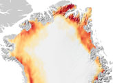
Thinner than the 2.3-kilometer-thick center, the outer edges of the Greenland ice sheet develop melt zones like the one shown here during the warm summer months.
Published Apr 7, 2007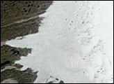
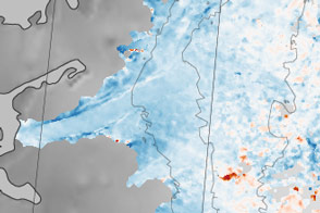
Although 2005 overall saw a new record, the extent of June melting in 2005 was unexceptional. The same held true for 2006, when this picture was taken.
Published Jun 30, 2006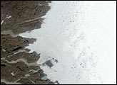
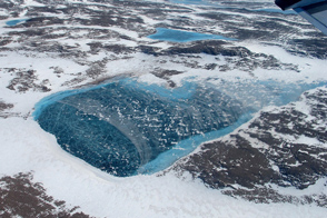
Meltwater accumulates in the rocky terrain near the northeastern coast.
Published May 31, 2012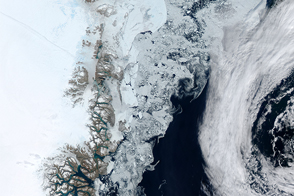
Summer is a dynamic time for ice in Arctic waters—melting, drifting, and even forming occasionally.
Published Aug 2, 2015
Researchers working in Antarctica have found evidence of large-scale ice making at the bottom of that continent's massive ice sheets.
Published Apr 21, 2011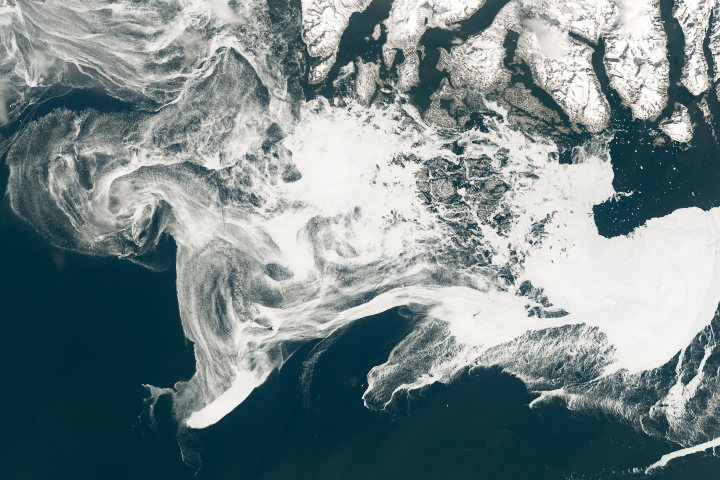
Filaments of sea ice stretch across the waters off southern Greenland, an area that is typically ice-free.
Published May 18, 2019
New elevation measurements will give researchers an unprecedented understanding of the thickness of sea ice, which will be used to help improve climate modeling and forecasts.
Published Dec 18, 2018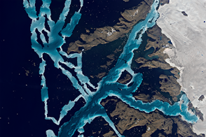
Oceanographers and ice experts have begun a five-year field campaign to study how the ocean might be melting Greenland’s icy edges.
Published Apr 5, 2016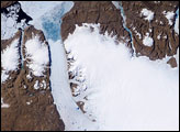
On Greenland, tens of thousands of years of snowfall have settled and solidified into a massive sheet of ice. Each summer, snow retreats briefly at low elevations, and a narrow strip of rocky coastline emerges. While some seasonal thawing is typical on Greenland, more dramatic changes are probably in store for the Greenland Ice Sheet in coming decades and centuries.
Published Aug 30, 2007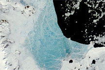
Changing weather conditions left their mark on sea ice along the Antarctic Peninsula in late 2008 and early 2009. In mid-December 2008, melt water resting on the sea ice colored it sky blue. At the beginning of 2009, however, the sea ice appeared snowy white, and cracks had begun along the ice margin.
Published Jan 9, 2009