High-latitude springtime snow cover declined substantially between 1967 and 2012.
Published Jan 8, 2013
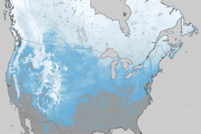
This satellite map of snow cover shows that every state in the contiguous U.S., except for Florida, received snow in January 2011.
Published Feb 25, 2011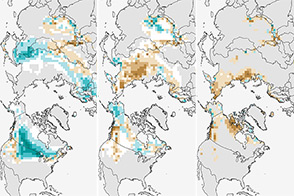
The climate of Earth is changing; fewer days of snow cover is yet another indicator.
Published Jan 3, 2014
The natural mountain storage of summer meltwater is significantly below normal.
Published May 17, 2015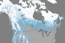
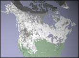
Snow cover across North America in April 2010 was the lowest since records began in 1967.
Published May 27, 2010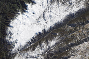
The start of winter in the Southern Hemisphere brought snow to the continent’s highest peak.
Published Jun 13, 2015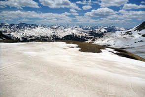
Scientist Tom Painter examines the differences between pure and dirty snow. A rise in dust can be a critical influence on snow-fed water supplies in the American West.
Published Sep 1, 2013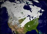
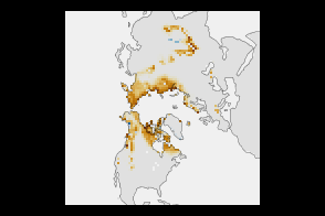
What a difference one year has made in the snow cover over North America.
Published Mar 30, 2012