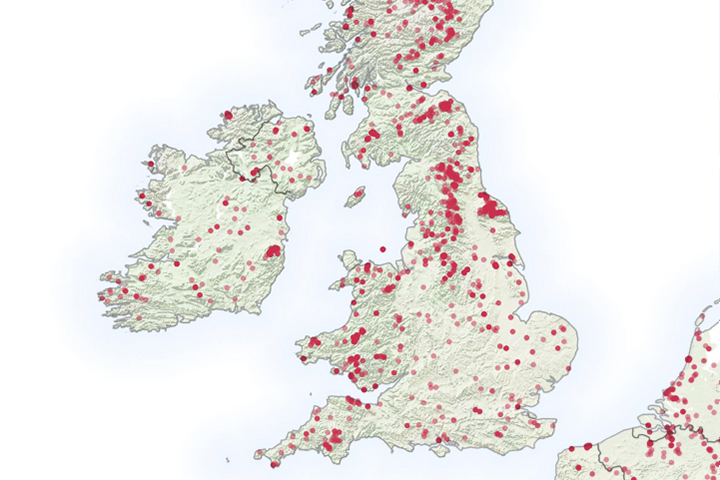
It is not even summertime, but already the United Kingdom has seen a significant number of wildfires.
Published May 6, 2019
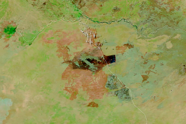
The blaze is the largest in Arizona this year and the largest in the United States right now.
Published Jun 16, 2020Image of the Day Heat Land Fires Human Presence Remote Sensing
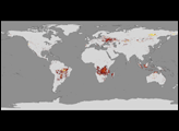
Satellites detect fires that are not necessarily being reported. Scientists are taking note and compiling global views of fire behavior and evolution.
Published Oct 22, 2018
Temperature, humidity, and winds contributed to the rapid spread of fire in Lake County, about 100 miles northwest of Sacramento.
Published Jun 27, 2018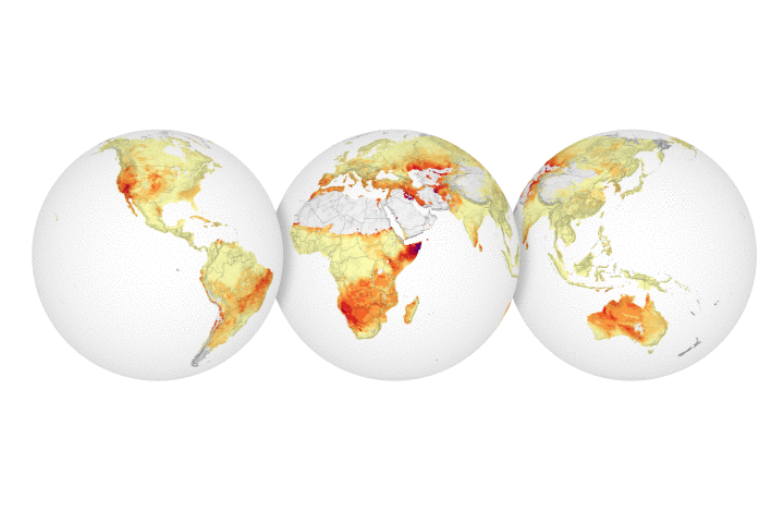
NASA researchers have created a model that analyzes various weather conditions, including rainfall, to predict the formation and spread of fires.
Published Jul 3, 2018
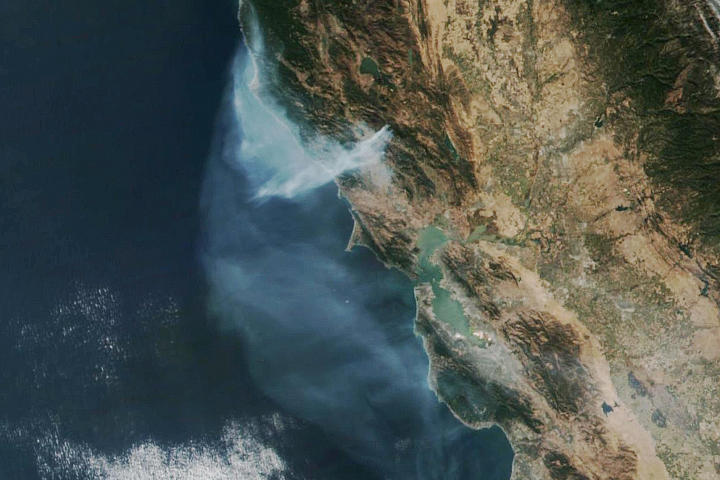
A wildfire burning in Los Padres National Park charred more than 500 acres—including the home of Big Sur’s fire chief.
Published Dec 17, 2013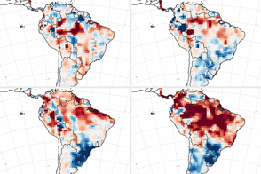
The 2015-16 El Niño has primed the rainforest and watershed for burning.
Published Jul 5, 2016
The Thomas fire has set new records while ravaging several communities.
Published Dec 24, 2017
The fast-moving King fire burned in Eldorado National Forest in September 2014.
Published Sep 18, 2014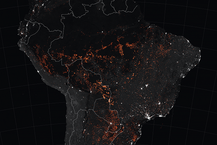
Satellites have detected an increase in fire activity early in the 2019 dry season in the southern Amazon.
Published Aug 23, 2019Image of the Day Atmosphere Heat Land Fires Human Presence Remote Sensing
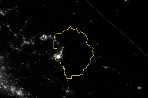
The VIIRS instrument on the Suomi NPP satellite tracked the growth of the fire between August 20 and September 4.
Published Sep 8, 2013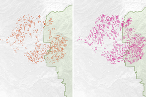
Scientists have found a way to detect nighttime fires even sooner, when they are still relatively small.
Published Apr 7, 2017
An expansive, destructive wildfire north of Los Angeles is visible from space by day and night.
Published Jun 28, 2016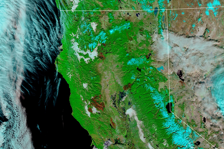
Record-setting fire activity in 2018 fits with a longer trend of larger and more frequent California fires since 2000.
Published Nov 27, 2018
A wildfire in Fresno County, California has burned more than 28,000 acres.
Published Jul 20, 2020
At 369 square miles in size, the Rim Fire is the largest in the United States in 2013.
Published Sep 4, 2013
This image from June 9, 2011, shows Arizona’s Wallow Fire in the White Mountains near the border with New Mexico.
Published Jun 10, 2011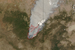
Dense smoke billows from a massive wildfire—the Wallow Fire—in eastern Arizona in this photo-like image from June 4, 2011.
Published Jun 6, 2011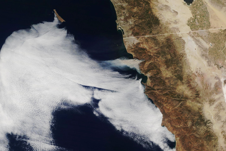
Hot, dry weather and fierce easterlies fanned the flames of several blazes, endangering homes and lives.
Published Oct 25, 2019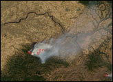
The eastern part of the fire was active overnight, expanding the burned area to 76,000 acres.
Published Oct 30, 2019
On May 2, 2013, the MODIS instrument on NASA’s Aqua satellite captured this view of wildfires burning near Lassen Volcanic National Park.
Published May 3, 2013