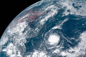
The storm has central Taiwan in its sights.
Published Aug 8, 2015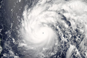
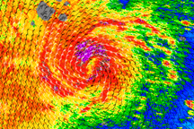
In early July 2016, storm clouds churned above the western Pacific Ocean as a super typhoon swept toward Taiwan.
Published Jul 7, 2016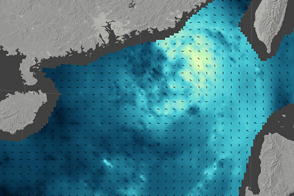
Typhoon Nida brought strong winds and rain to southern China, causing travel delays in Hong Kong.
Published Aug 2, 2016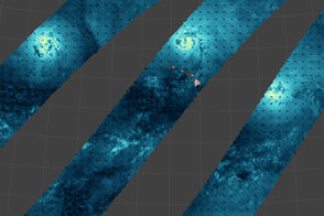
A map reveals the wind fields of storms that marched across the Pacific Ocean in late summer 2015.
Published Sep 4, 2015
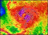
Although Mirinae was weakening, its winds maintained the classic spiral structure associated with well-organized tropical cyclones in this image of the storm’s wind structure on November 1, 2009.
Published Nov 3, 2009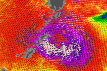
This image depicts winds associated with Typhoon Melor on October 7, 2009.
Published Oct 7, 2009
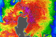
As this wind speed image illustrates, Tropical Storm Parma still had a core of strong winds on October 5, 2009.
Published Oct 5, 2009
In July 2016, Super Typhoon Nepartak became the season’s first major storm to strike the northeast Pacific.
Published Aug 7, 2016Image of the Day Water Severe Storms Human Presence Remote Sensing
Strong winds surround a calm center in this image of Tropical Storm Molave over the Philippines on July 17, 2009.
Published Jul 20, 2009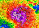
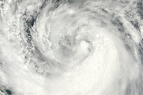
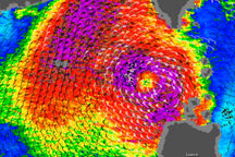
Acquired August 6, 2012, this image shows Haikui approaching the China coast, just a few days after two other severe storms made landfall.
Published Aug 6, 2012