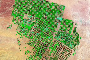
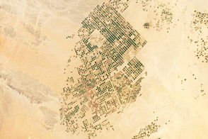
Over the course of 25 years, farms have sprouted in the Arabian Desert, fueled by deep and old groundwater.
Published May 12, 2012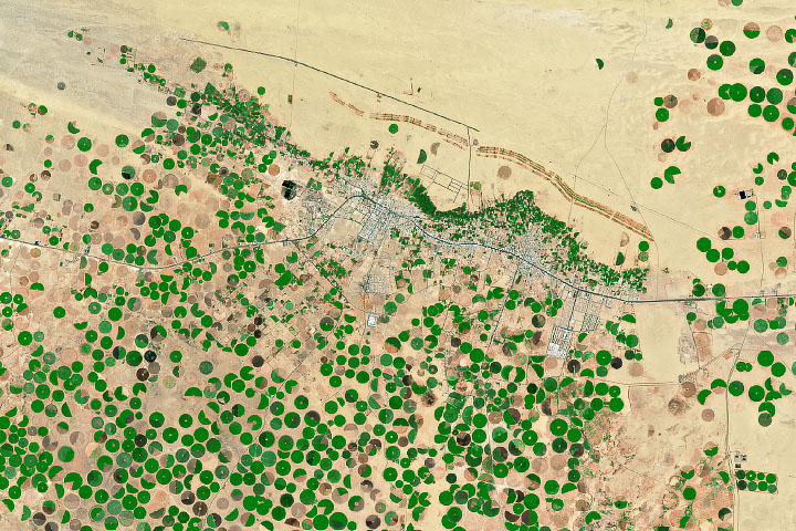
Water tables have dropped beneath the Saudi Arabian town of Wadi ad-Dawasir.
Published Dec 14, 2019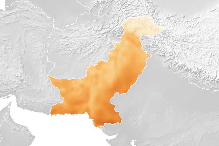
A project using NASA satellite data helps reduce overwatering and enhances crop yields for Pakistani farmers.
Published Oct 18, 2018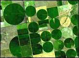

Natural vegetation and irrigated farmland along the Snake River Plain in Idaho use dramatically different amounts of water during the growing season.
Published Jan 26, 2010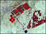
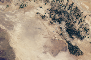
This photograph from the International Space Station presents an almost surreal view of abundant green fields in the midst of a barren desert.
Published Mar 5, 2012
An arid region grew even drier between 2003 and 2009 due to human consumption of water for drinking and agriculture.
Published Mar 13, 2013
Water shortages in the Middle East lead to sanitation issues in schools, resulting in periodic school closures. NASA is working to change that.
Published Jul 27, 2018
For more than 100 years, groups in the western United States have fought over water. During the 1880s, sheep ranchers and cattle ranchers argued over drinking water for their livestock on the high plains. In 1913, the city of Los Angeles began to draw water away from small agricultural communities in Owen Valley, leaving a dusty dry lake bed. In the late 1950s, construction of the Glen Canyon Dam catalyzed the American environmental movement. Today, farmers are fighting fishermen, environmentalists, and Native American tribes over the water in the Upper Klamath River Basin. The Landsat 7 satellite, launched by NASA and operated by the U.S. Geological Survey, documented an extreme drought in the area along the California/Oregon border in the spring of 2001.
Published Sep 8, 2001
Underground channels have supplied towns in southeastern Morocco for centuries.
Published Nov 19, 2016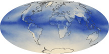
The tiny amount of water vapor in our atmosphere has an outsized influence on the planet as a potent greenhouse gas.
Published Oct 7, 2010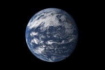
Earth is a water planet. Three-quarters of the planet’s surface covered by ice or oceans, and the sky is filled with clouds.
Published Oct 2, 2010