Flowing down a gentle gradient, the river often spills onto floodplains during the rainy season.
Published Apr 6, 2013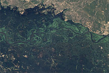
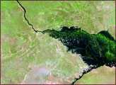
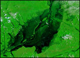
This pair of images illustrates the dramatic flooding of the Zambezi River in Namibia in late March 2009.
Published Apr 2, 2009
Zambia’s Chambeshi River had been transformed from a barely visible line to a broad lake more than 20 kilometers wide on February 6, 2007. Many rivers in southern Africa, including the Zambezi, pushed over their banks in early 2007 under the onslaught of an exceptionally early and heavy rainy season.
Published Feb 13, 2007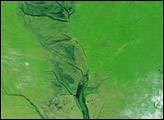
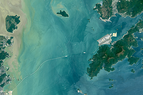
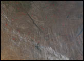
Once completed, the Hong Kong-Zhuhai-Macau Bridge will be one of the longest water crossings in the world.
Published May 15, 2016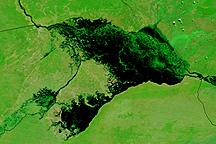
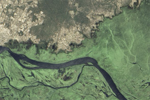
Water stretches across kilometers of land in Namibia's Caprivi strip in this Terra MODIS image from April 14, 2009.
Published Apr 16, 2009