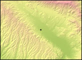
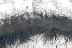
Using satellite radar sensors, scientists have been able to detect the rising and falling of the landscape in the Himalayas caused by the Gorkha earthquake.
Published May 14, 2015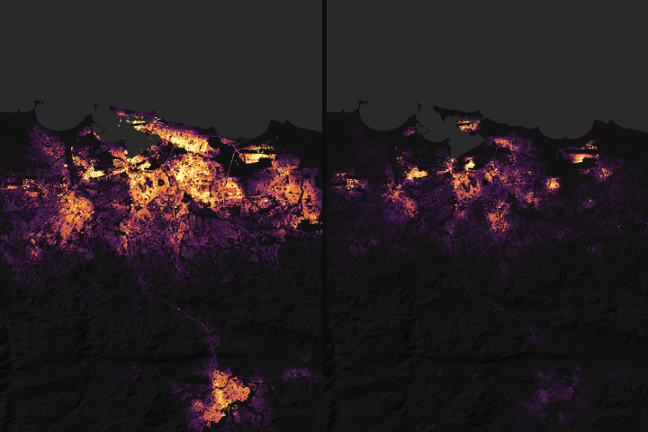
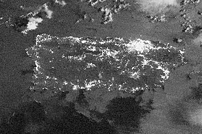
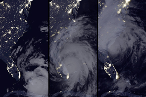
Satellite data on city lights could aid rescue and recovery efforts after Hurricane Maria.
Published Sep 29, 2017Image of the Day Severe Storms Human Presence Remote Sensing
A power plant fire left much of the island without electricity.
Published Sep 23, 2016Image of the Day Land Fires Unique Imagery Human Presence Remote Sensing
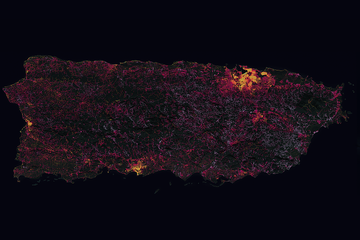
The hurricane took a disproportionate toll on power supplies in remote areas of Puerto Rico.
Published Dec 12, 2018Image of the Day Atmosphere Land Severe Storms Human Presence
Hurricane Matthew knocked out power for more than one million customers as it grazed the coasts of Florida, Georgia, and South Carolina.
Published Oct 9, 2016Image of the Day Atmosphere Life Severe Storms Human Presence Remote Sensing
The powerful earthquake in Nepal triggered a destructive landslide that completely buried a village.
Published May 5, 2015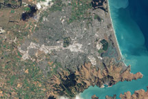
This natural color image of Christchurch, New Zealand, is overlain with a measure of the ground shaking in the area during the February 2011 earthquake.
Published Mar 9, 2011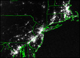
A power outage left many major American cities in the dark on August 14, 2003. The blackout was apparent from the perspective of space in this pair of DMSP satellite images.
Published Aug 17, 2003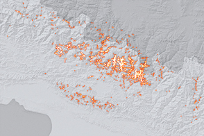
Scientists from around the world banded together to analyze landslides in the wake of a potent temblor. They found fewer scars on the landscape than past events would have predicted.
Published Dec 17, 2015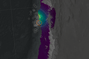
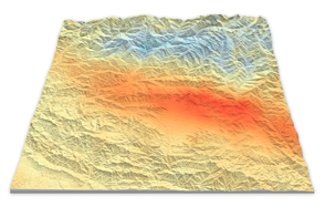
Scientists have projected the size and location of changes in Earth’s surface following the September 2015 earthquake and tsunami off Chile.
Published Oct 1, 2015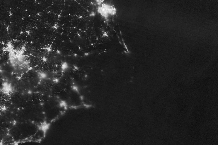
A power outage brought darkness to parts of North Carolina’s Outer Banks.
Published Jul 31, 2017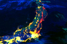
This color-coded composite image shows lights working or not after the earthquake and tsunami in Japan. The image compares observations from March 12, 2011, to data collected in 2010.
Published Mar 19, 2011
Unique satellite instruments capture the view of the Olympic host city at night.
Published Jul 26, 2012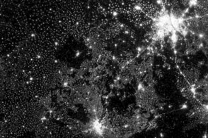
New images from Suomi NPP are an order of magnitude better than previous satellite views of city lights.
Published Dec 14, 2012Image of the Day Land Fires Unique Imagery Human Presence Remote Sensing
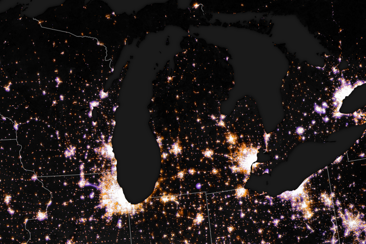
Tracking the brightness and location of manmade lights offers researchers an innovative way to track human activity on a global scale.
Published Dec 27, 2017
Sobering satellite views reveal massive damage on the Indonesian island of Sulawesi.
Published Oct 3, 2018Image of the Day Land Water Human Presence Remote Sensing Earthquakes
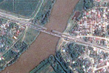
The day after a powerful 7.3-magnitude earthquake shook Honduras, Taiwan’s Formosat-2 satellite captured this detailed, photo-like image showing the collapsed span of the earthquake-damaged Democracy bridge.
Published Jun 3, 2009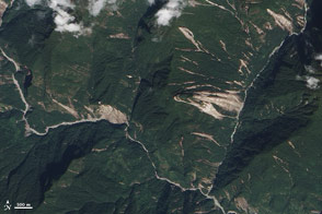
Acquired October 19, 2011, this natural-color image shows landslides in the northern Indian state of Sikkim. The landslides likely resulted from an earthquake to the northwest.
Published Oct 20, 2011