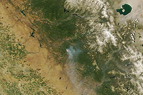
On June 17, 2013, NASA’s Terra satellite captured this image of the Carstens fire burning southwest of California’s Yosemite National Park.
Published Jun 19, 2013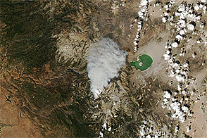
Authorities used helicopters to evacuate dozens of hikers and climbers from Yosemite National Park due to a fire burning in Little Yosemite Valley.
Published Sep 9, 2014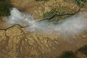
The Terra satellite captured an image of a wildfire blazing in central Washington on July 27, 2013.
Published Jul 29, 2013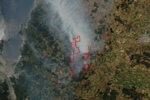
Hundreds of people evacuated under threat from the large wildfire shown in this image of central Chile.
Published Jan 6, 2012
A wildfire burning in Los Padres National Park charred more than 500 acres—including the home of Big Sur’s fire chief.
Published Dec 17, 2013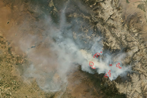
In early September 2015, the Rough Fire was the largest active wildfire in California.
Published Sep 8, 2015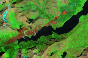
Hundreds of visitors to Glacier National Park were forced to flee their campgrounds and cabins because of a wildfire near Saint Mary Lake.
Published Jul 24, 2015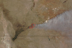
Smoke streams east from a fire in Carlsbad Caverns National Park in this true-color image from June 14, 2011.
Published Jun 14, 2011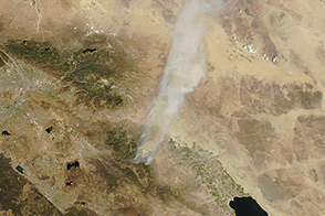
On July 16, 2013, the Aqua satellite captured this image of a fire burning in southern California.
Published Jul 17, 2013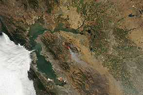
On September 10, 2013, a wildfire burned east of San Fransisco.
Published Sep 10, 2013
On May 2, 2013, the MODIS instrument on NASA’s Aqua satellite captured this view of wildfires burning near Lassen Volcanic National Park.
Published May 3, 2013