Archaeologists and navigators have a new tool for locating shipwrecks in near-shore waters.
Published Mar 12, 2016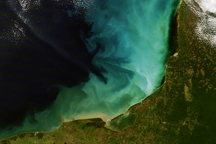
A burst of color lit the shallow waters of the Gulf of Mexico off the Yucatan Peninsula on December 14, 2008.
Published Jan 3, 2009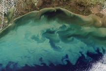
Tan and green clouds of sediment clouded the Gulf of Mexico on November 10, 2009.
Published Nov 13, 2009
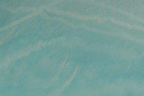
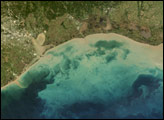
Soft shades of turquoise and tan color the waters of the Gulf of Alaska and Prince William Sound in this photo-like image captured by the Moderate Resolution Imaging Spectroradiometer (MODIS) on NASA’s Aqua satellite on March 13, 2008. Though the swirls may look delicate from space, they hint at an ocean in turmoil. Strong winds and high waves likely churned the ocean, bringing sediment to the surface in the shallow waters over the continental shelf. The deeper waters beyond the shelf edge in the lower right corner of the image are dark blue, not clouded by sediment.
Published Apr 1, 2008
Sediment and runoff plumes highlight the coast at the base of Italy’s boot.
Published Jan 19, 2015
These maps illustrate how much sediment flowed into the Gulf of Mexico during the floods on the Mississippi River in May and June 2011. The nutrient-rich sediment is expected to contribute to the development of a record dead zone this summer.
Published Jun 24, 2011
The potent storm has discolored the Gulf of Mexico near Florida and Alabama.
Published Oct 15, 2018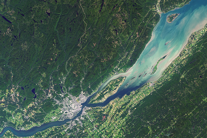
Québec City is one of the oldest continuously inhabited cities in the Americas, and the one that still feels closest to its roots.
Published Feb 12, 2018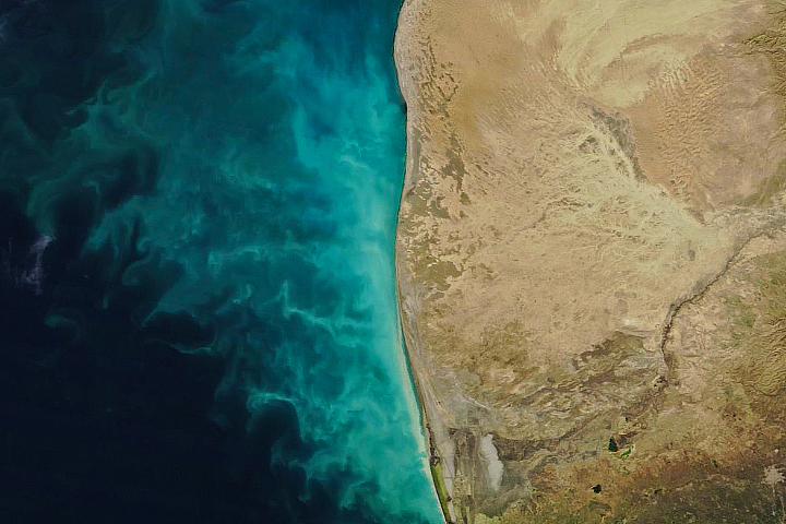
The southeast Caspian is marked by colorful swirls of perpetually turbid seawater.
Published Feb 4, 2018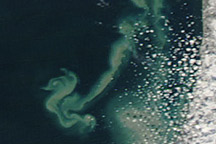
Acquired December 17, 2010, and December 10, 2010, these natural-color images show suspended sediments changing the appearance of Lake Michigan.
Published Jan 11, 2011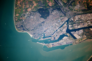
The second largest container port in France is also a World Heritage Site for its unique concrete buildings.
Published Nov 18, 2013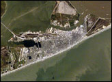
Galveston Island has alternately been a home to Native Americans, a base for Mexico’s rebellion against Spain, a pirate kingdom, a sea port, and even the capital of the Republic of Texas. In September 1900, the city was largely destroyed by a powerful hurricane. This storm damage, combined with construction of the Houston Ship Channel and discovery of oil in eastern Texas, shifted the center of trade northwest to Houston. This astronaut photograph shows some of the human impacts in Galveston that are easily observed from the vantage point of low-Earth orbit. The city of Galveston dominates the eastern half of Galveston Island, appearing as the gray-white region at center right. A large seawall along the Gulf of Mexico—shown here along the southern coastline of Galveston Island—protects most of the city. To the west of Galveston, coastal wetlands are largely submerged by regional subsidence—sinking of the land as a result of ground water withdrawal by the petrochemical industry of Houston and Texas City.
Published Nov 27, 2006
Flood water continues receding from Thailand’s historic city of Ayutthaya in December 2011 and January 2012.
Published Jan 12, 2012