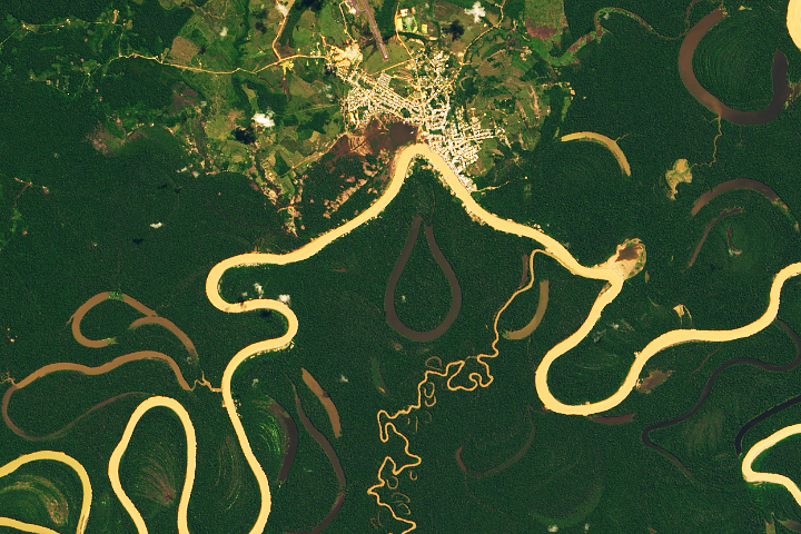
Heavy sediment loads play a role in making it one of the most sinuous rivers in the Amazon Basin.
Published Nov 13, 2019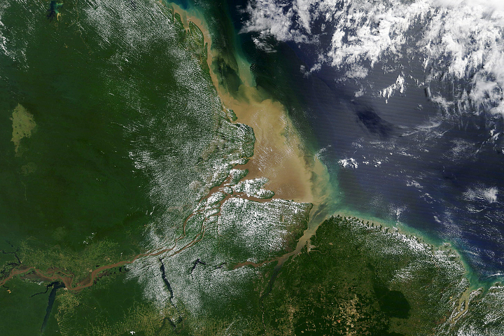
Most of the sediment that flows into the Atlantic Ocean from the mouth of the river comes from thousands of miles upstream.
Published Oct 2, 2020
The largest river on the planet, the Amazon, forms from the confluence of the Solimões (the upper Amazon River) and the Negro at the Brazilian city of Manaus in central Amazonas. At the river confluence, the muddy, tan-colored waters of the Solimões meet the “black” water of the Negro River. The unique mixing zone where the waters meet extends downstream through the rainforest for hundreds of kilometers, and is a famous attraction for tourists from all over the world. The tourism contributes to substantial growth in the city of Manaus. Twenty years ago the large park near the city center (center) lay on the eastern outskirts of Manaus.
Published Feb 12, 2005
As they prepare for a satellite that will measure the height and areal extent of rivers in unprecedented detail, hydrologists have released a better map of North American river widths.
Published Jul 9, 2015
Canada’s largest and longest river delivers vast amounts of fresh water and sediment to the sea.
Published Aug 6, 2017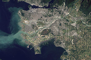
Flowing past the city of Vancouver, the Fraser River delivers a thick plume of sediment to the Strait of Georgia.
Published Mar 14, 2012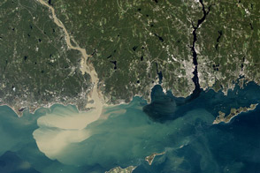
Nearly a week after Hurricane Irene drenched New England, the river was spewing large amounts of muddy sediment into Long Island Sound.
Published Sep 9, 2011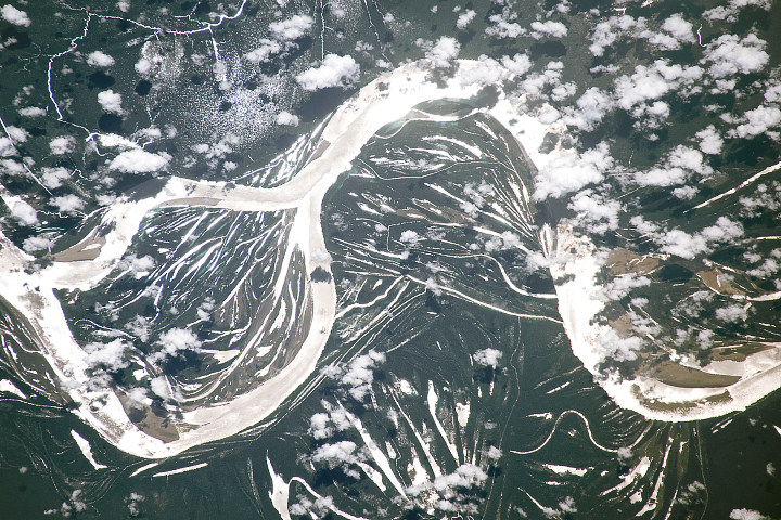
The largest river in the world is full of bends and meanders, a result of the water course snaking back and forth across the landscape over time.
Published Jul 2, 2018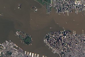
These images from September 12, 2011, and September 2, 2010, compare conditions in the Hudson River near Ellis Island. In the wake of storms, sediment filled the river in 2011.
Published Sep 13, 2011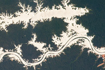
In this astronaut photo, the mirror-like reflection of sunlight off water makes the Trombetas River and Lake Erepecu in the Brazilian Amazon stand out from the deep green forest.
Published Sep 21, 2009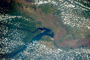
Two rivers meet near the port city of Santarém in the interior of Brazil.
Published Nov 2, 2015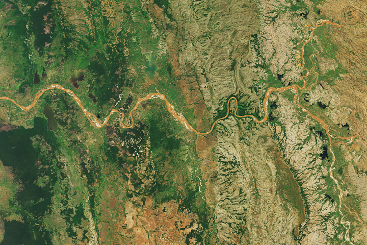
Gullies in the highlands called lavakas are a major source of sediment.
Published Feb 10, 2018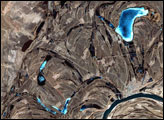
This false-color image from April 1, 2002, shows numerous braided channels and oxbow lakes along the Songhua River in northeastern China, just upstream of the city of Harbin.
Published Dec 27, 2005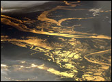
The setting sun glints off the Amazon River and numerous lakes in its floodplain in this astronaut photograph from August 19, 2008. Large areas of sunglint are common in oblique views. Sunglint images reveal great detail in surface water—in this case the marked difference between the smooth outline of the Amazon and the jagged shoreline of the Uatumã River.
Published Sep 8, 2008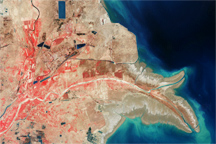
China’s Yellow River, or Huang He, travels through soft plateaus of silt, picking up a massive sediment load on its journey. The sediment carried by the river has reshaped China’s coast, adding several hundred square kilometers of land.
Published Jan 4, 2009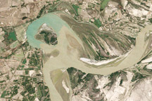
Between 1992 and 2009, a section of the lower Indus River changes course following the formation of an oxbow lake.
Published May 9, 2010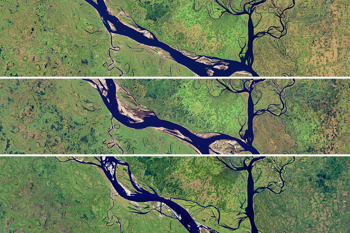
The lower portion of the Padma River has wide meandering curves, an indicator of extensive erosion.
Published Aug 28, 2018
Floods and new infrastructure have long since separated the distinctive bend in the river that was portrayed by landscape painter Thomas Cole in 1836.
Published Oct 15, 2017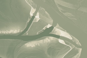
This model of the land elevation between the Mississippi, the Atchafalaya, and the Old River show the uphill fight to control river flow.
Published Jun 4, 2011