The largest river in the world is full of bends and meanders, a result of the water course snaking back and forth across the landscape over time.
Published Jul 2, 2018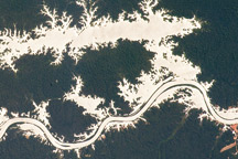
In this astronaut photo, the mirror-like reflection of sunlight off water makes the Trombetas River and Lake Erepecu in the Brazilian Amazon stand out from the deep green forest.
Published Sep 21, 2009
The setting sun glints off the Amazon River and numerous lakes in its floodplain in this astronaut photograph from August 19, 2008. Large areas of sunglint are common in oblique views. Sunglint images reveal great detail in surface water—in this case the marked difference between the smooth outline of the Amazon and the jagged shoreline of the Uatumã River.
Published Sep 8, 2008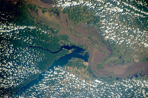
Two rivers meet near the port city of Santarém in the interior of Brazil.
Published Nov 2, 2015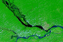
The impact of severe drought on the Negro River, a tributary of the Amazon River, and other rivers in the basin is dramatically evident in this pair of images, which show that every body of water has shrunk in 2010 compared to 2008.
Published Dec 11, 2010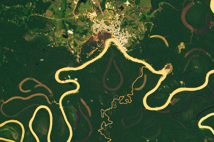
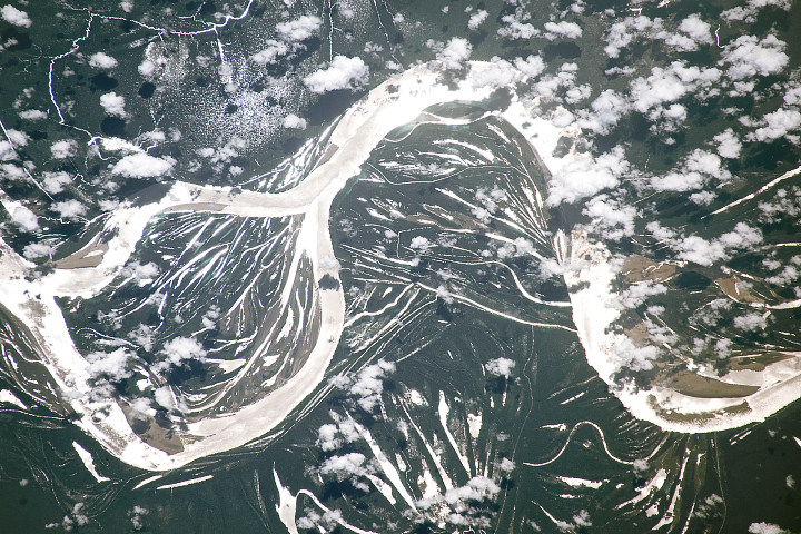
Heavy sediment loads play a role in making it one of the most sinuous rivers in the Amazon Basin.
Published Nov 13, 2019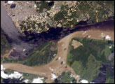
The largest river on the planet, the Amazon, forms from the confluence of the Solimões (the upper Amazon River) and the Negro at the Brazilian city of Manaus in central Amazonas. At the river confluence, the muddy, tan-colored waters of the Solimões meet the “black” water of the Negro River. The unique mixing zone where the waters meet extends downstream through the rainforest for hundreds of kilometers, and is a famous attraction for tourists from all over the world. The tourism contributes to substantial growth in the city of Manaus. Twenty years ago the large park near the city center (center) lay on the eastern outskirts of Manaus.
Published Feb 12, 2005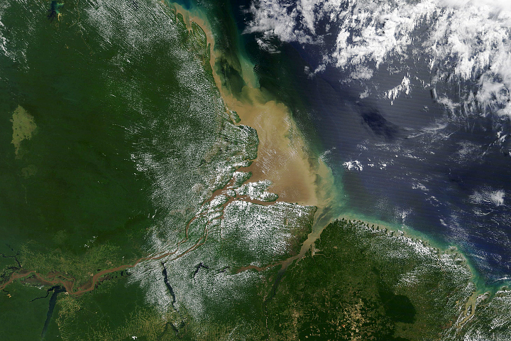
Most of the sediment that flows into the Atlantic Ocean from the mouth of the river comes from thousands of miles upstream.
Published Oct 2, 2020
Buenos Aires, the largest city in Argentina, sits near the outflow of the second largest river in South America.
Published Jun 1, 2015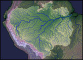
The Salmon River in Idaho, one of the longest free-flowing rivers in the United States, rushes through a geologic wonderland of wooded ridges, eroded bluffs, and stone towers and crags.
Published Jul 22, 2020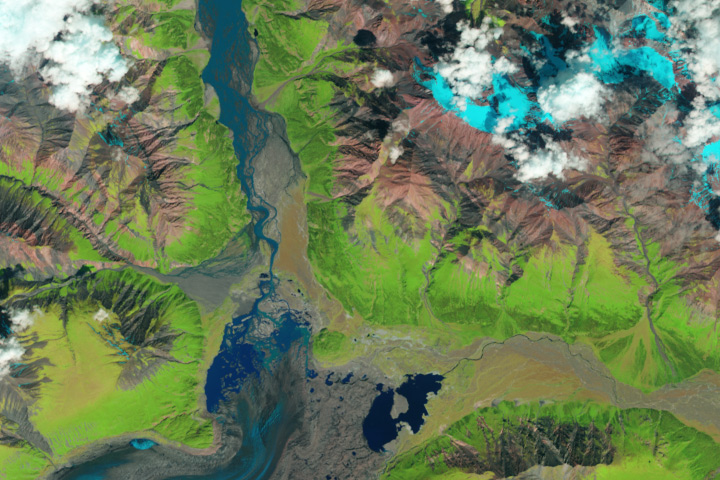
The Kaskawulsh River stole most of the water from the Slims River, dramatically reshaping the region’s drainage.
Published Apr 28, 2017
In the past few centuries, a river in northwestern Canada stopped wandering and assumed a more direct route to the sea.
Published Sep 4, 2012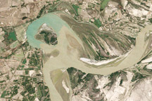
Between 1992 and 2009, a section of the lower Indus River changes course following the formation of an oxbow lake.
Published May 9, 2010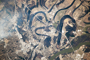
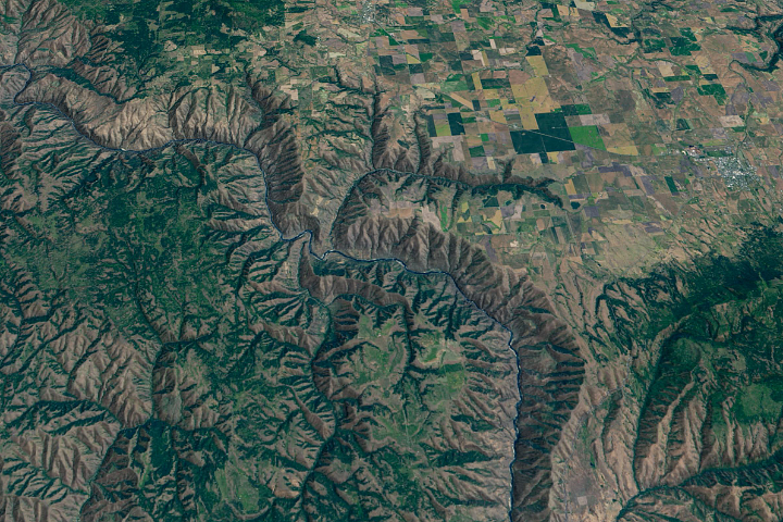
Near the city of Little Rock, the river has meandered for decades, leaving its marks across the landscape.
Published Apr 21, 2014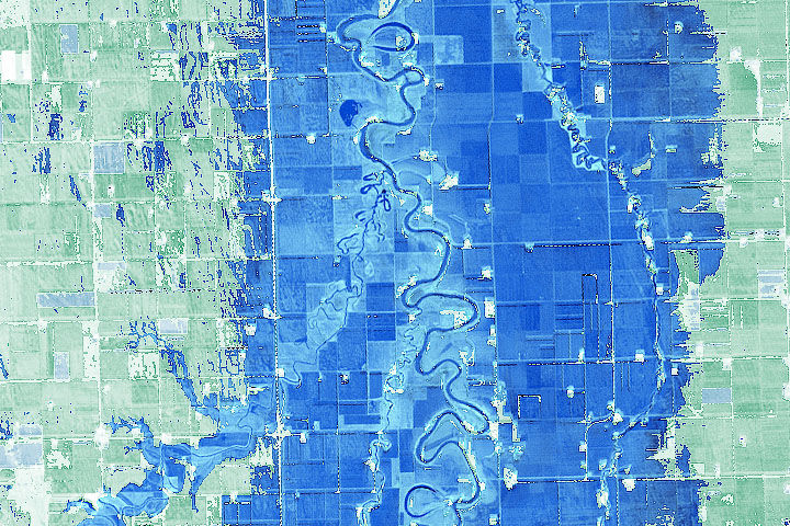
Geography and a prolonged period of wet weather have made flooding common on this river in the Northern Plains.
Published Apr 21, 2020Image of the Day Land Water Floods Human Presence Remote Sensing
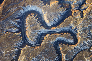
The Green River in eastern Utah once carved soft sediment into meanders on a floodplain. Then the land and mountains rose and the river dug deep, preserving those meanders in stone.
Published Mar 17, 2014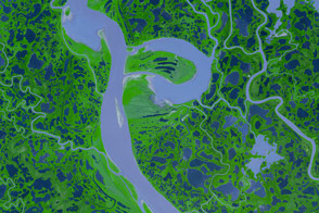
Canada’s Mackenzie River, the country’s longest, spills out of Great Slave Lake, just north of the border between Alberta and Northwest Territories.
Published Dec 20, 2007