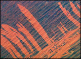
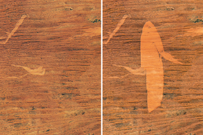
Bright orange fire scars show up the underlying dune sand in the Simpson Desert, 300 kilometers east of Alice Springs, in this astronaut photograph taken from the International Space Station in November, 2003. The fire scars were produced in a recent fire, probably during the same year. The image suggests a time sequence of events. Fires first advanced into the view from the lower left—parallel with the major dune trend and dominant wind direction. Then the wind shifted direction by about 90 degrees so that fires advanced across the dunes in a series of frond-like tendrils.
Published Jun 13, 2005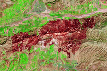
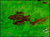
This false-color image shows the brick-red burn scar left behind by the Guiberson Fire in Ventura County, California, on September 26, 2009.
Published Sep 28, 2009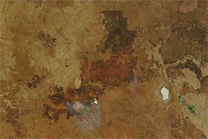
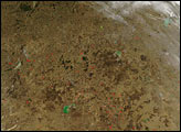
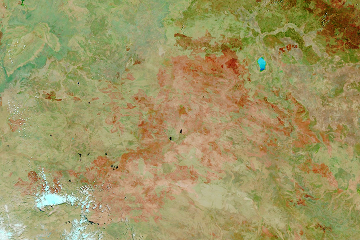
A grass fire burning in Australia’s Northern Territory charred an area as large as Massachusetts in October 2014.
Published Oct 9, 2014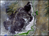
Burn scars have gotten larger near Australia’s Lake Mackay.
Published Sep 25, 2016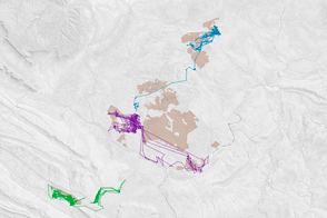
The lure of recently burned land causes feral cats in Australia to extend their hunting range.
Published Jun 9, 2016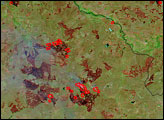
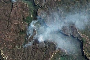
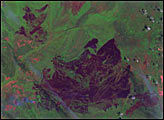
A rash of fires raged through Australia’s Blue Mountains in October 2013. The EO-1 satellite captured this view of a portion of the burn scar left by the State Mine fire.
Published Oct 29, 2013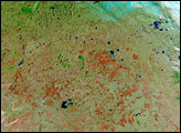
The satellite-based atlas includes information about more than 13 million fires.
Published Aug 8, 2019