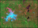
Although nearly a century has passed since its last eruption, signs of volcanic activity are still visible in this false-color image.
Published Jan 29, 2006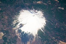
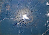
The snow-covered southeastern flank of Mount Fuji Volcano appears in this astronaut photograph from April 8, 2009.
Published Jun 29, 2009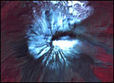

The park includes Earth’s largest volcano, Mauna Loa.
Published Aug 3, 2016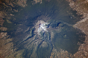
Though there are no historical accounts, geologic evidence suggests an eruption about 3,100 years ago affected Pre-Columbian settlements in Mexico.
Published Nov 25, 2013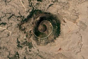
Nestled in the northeast corner of New Mexico, Capulin protrudes from the flat expanse, an anthill of giant proportions.
Published Aug 24, 2016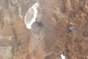
Acquired February 4, 2003, this natural-color image shows Parque Nacional Llullaillaco along the Chile-Argentina border.
Published Oct 9, 2011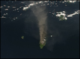
The lush forests of Egmont National Park, on New Zealand‘s North Island, contrast with the pasturelands outside the circular park boundaries. The unique shape of the park results from its first protection in 1881, which specified that a forest reserve would extend in a 9.6-kilometer radius from the summit of Mt. Taranaki (named Mt. Egmont by Captain Cook). The park covers about 33,500 hectares and Mt. Egmont stands 2518 meters tall. The volcano began forming 70,000 years ago, and last erupted in 1755. A series of montane habitats occur in procession up the flanks of the volcano—from rainforest, to shrubs, to alpine, and finally snow cover.
Published Jun 2, 2002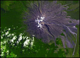
Lahars present an ongoing threat to those living around New Zealand’s Mount Ruapehu. On March 18, 2007, one such slurry burst out of Mount Ruapehu’s caldera and flowed down the side of the volcano.
Published Mar 28, 2007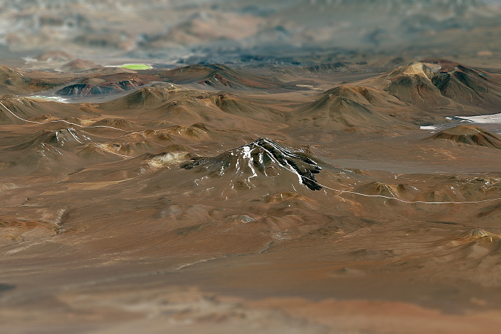
The dry climate around the world's second tallest volcano provides a good habitat for preserving archeological discoveries.
Published Feb 16, 2019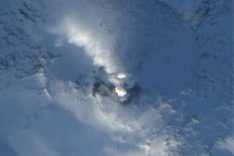
Antarctica’s Mount Erebus may be covered with glaciers, but they do little to cool the volcano’s molten core. A lava lake is visible at the volcano’s summit.
Published Feb 19, 2009Image of the Day Atmosphere Heat Land Volcanoes Remote Sensing
