
A wildfire burning in Los Padres National Park charred more than 500 acres—including the home of Big Sur’s fire chief.
Published Dec 17, 2013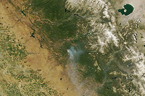
On June 17, 2013, NASA’s Terra satellite captured this image of the Carstens fire burning southwest of California’s Yosemite National Park.
Published Jun 19, 2013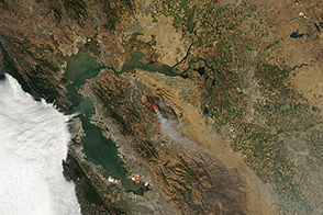
On September 10, 2013, a wildfire burned east of San Fransisco.
Published Sep 10, 2013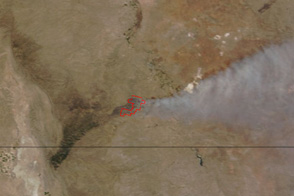
Smoke streams east from a fire in Carlsbad Caverns National Park in this true-color image from June 14, 2011.
Published Jun 14, 2011
An expansive, destructive wildfire north of Los Angeles is visible from space by day and night.
Published Jun 28, 2016
On May 2, 2013, the MODIS instrument on NASA’s Aqua satellite captured this view of wildfires burning near Lassen Volcanic National Park.
Published May 3, 2013
The fast-moving King fire burned in Eldorado National Forest in September 2014.
Published Sep 18, 2014
Smoke billowed from a wildfire burning east of San Francisco on September 9, 2013.
Published Sep 10, 2013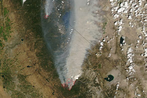
A large wildfire raged near Yosemite National Park in August 2013.
Published Aug 24, 2013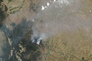
A fire west of Fort Collins had burned more than 58,000 acres on June 19, 2012.
Published Jun 19, 2012
Better management should prevent fire from raging out of control in one of Namibia’s most prized wildlife preserves.
Published Apr 5, 2013