False-color satellite imagery offers insight that goes beyond what the human eye can see.
Published Mar 6, 2016
Lava lakes and gas plumes near Goma, Democratic Republic of the Congo.
Published Jul 2, 2014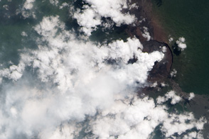
A volcanic plume rises from magma within Nyamuragira Volcano, Democratic Republic of the Congo.
Published Jul 18, 2013
While a typical digital camera takes one picture of a scene based on information from the visible spectrum, Landsat generates multiple views of everything it images.
Published Aug 1, 2012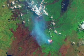
These African volcanoes are among the most active on Earth.
Published Aug 1, 2013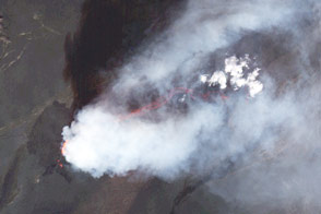
Satellites continue to capture spectacular views of the ongoing eruption near Bardarbunga.
Published Sep 16, 2014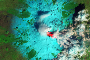
After maintaining a low simmer for 10 months, Italy’s Etna Volcano boiled over in early February, with three outbursts in 36 hours.
Published Feb 22, 2013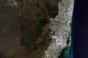
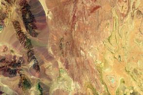
The variety of landscapes in southeastern Florida and the northern Everglades illustrates why you might want to see the world in false color.
Published Apr 1, 2014
For now, the eruption at the Icelandic volcano has come to an end.
Published Apr 10, 2015
Satellite observations detected a glowing lava flow on the slopes of the Kamchatkan volcano.
Published Sep 19, 2013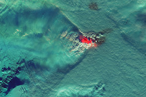
Heat, steam, and sulfur dioxide from the fissure eruption appear to affect cloud patterns around the volcano.
Published Nov 12, 2014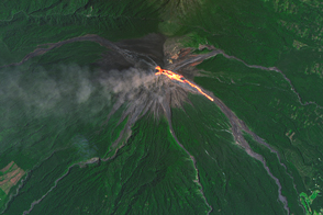
In September 2016, one of Central America’s most active volcanoes began to stir.
Published Sep 18, 2016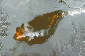
The Holuhraun lava field in Iceland continues to grow.
Published Jan 8, 2015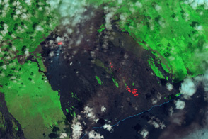
Infared satellite imagery shows how lava tubes carry molten basalt from Pu'u 'O'o to the coastal plain.
Published Oct 23, 2012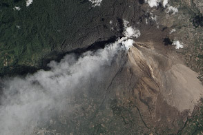
Infrared imagery reveals a pyroclastic flow on the Sumatran Volcano.
Published Mar 11, 2014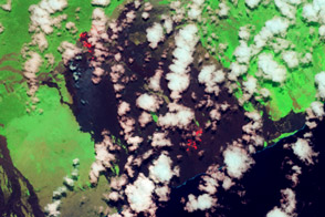
Two active lave flows: the Kahaulae’a 2 flow and the Peace Day flow, extend north and south from Kilauea’s Pu’u O’o.
Published Jul 9, 2013