With limited resources to monitor often-unpredictable blooms, water managers are turning to new technologies to detect and keep track of hazards.
Published Jun 22, 2019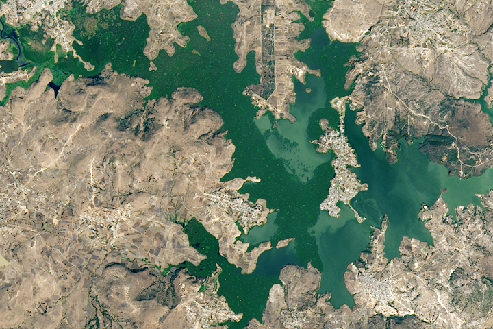
A new study found that the abundance of these floating plants has increased due to urbanization.
Published Sep 2, 2020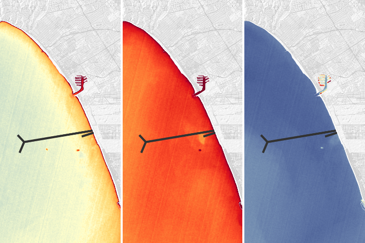
A NASA team was able to use satellite imagery to observe effects of a repair of Los Angeles' largest wastewater treatment plant.
Published Oct 30, 2018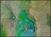
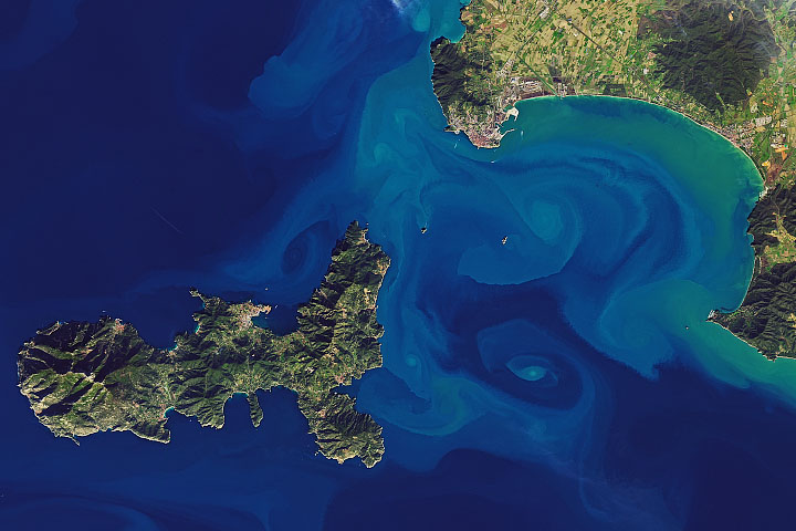
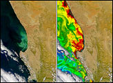
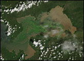
Natural-color satellite images can capture art-like beauty when sediments trace water currents and eddies; other kinds of data can make that art intersect with scientific understanding.
Published Feb 1, 2020
Acquired June 27, 2011, and May 28, 2011, these false-color images compare conditions along the Yangtze River before and after torrential rains.
Published Jun 28, 2011
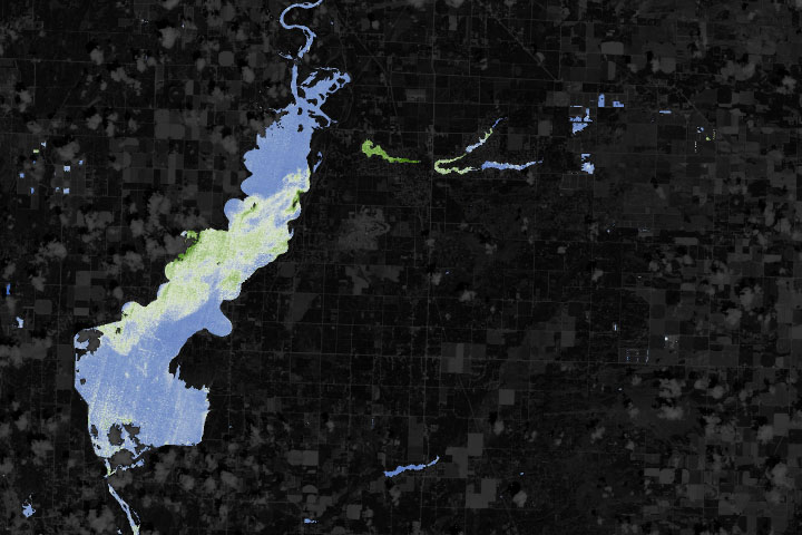
An early summer algae bloom in Florida’s Lake Okeechobee has been blamed for affecting water quality downstream all the way to the Atlantic Ocean.
Published Jul 6, 2016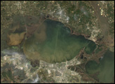

Natural vegetation and irrigated farmland along the Snake River Plain in Idaho use dramatically different amounts of water during the growing season.
Published Jan 26, 2010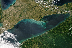
Algae blooms, whiting events, and wind-stirred sediments are part of a dynamic yearly pattern in the surface waters of this Great Lake.
Published Jun 16, 2016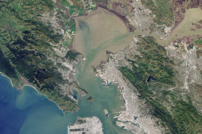
Landsat 8 can observe wavelengths of blue light that will make it easier to observe the swirl of life and water along the world’s coastlines.
Published May 31, 2013
Native to the tropics of South America, the water hyacinth now thrives on every continent except Europe. It was introduced in Africa around 1879, and 110 years later, established itself on the continent’s largest lake, Lake Victoria.
Published Feb 21, 2007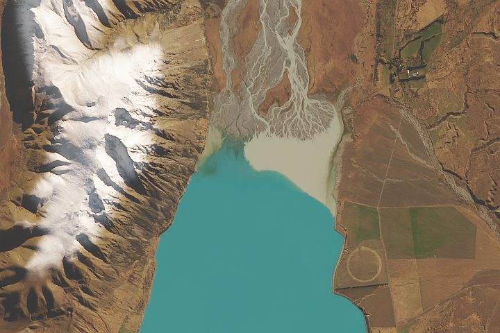
Fine particles of pulverized rock absorb and scatter sunlight in ways that can give water a striking blue-green color.
Published May 20, 2019
For more than 100 years, groups in the western United States have fought over water. During the 1880s, sheep ranchers and cattle ranchers argued over drinking water for their livestock on the high plains. In 1913, the city of Los Angeles began to draw water away from small agricultural communities in Owen Valley, leaving a dusty dry lake bed. In the late 1950s, construction of the Glen Canyon Dam catalyzed the American environmental movement. Today, farmers are fighting fishermen, environmentalists, and Native American tribes over the water in the Upper Klamath River Basin. The Landsat 7 satellite, launched by NASA and operated by the U.S. Geological Survey, documented an extreme drought in the area along the California/Oregon border in the spring of 2001.
Published Sep 8, 2001
Persistent drought and intensive water use has proven too much for this lake in Chile.
Published Apr 18, 2019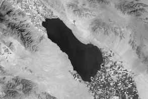
Thermal infrared imagery of the Southern California desert picks up the invisible water in the farmland around the Salton Sea.
Published Apr 23, 2013Image of the Day Heat Land Water Drought Temperature Extremes