
These iconic photos are not new, but their message never gets old.
Published Dec 24, 2018
Cameras on a lunar orbiter and some clever image processing techniques led to a new take on a historic image of the Earth and Moon.
Published Dec 25, 2015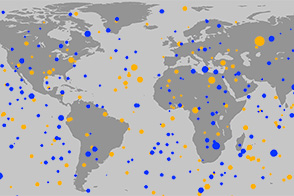
Over 20 years, more than 550 small asteroids streaked across our skies.
Published Nov 21, 2014
A powerful telescope on a satellite orbiting Mars turned its gaze back on Earth.
Published Jan 21, 2017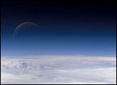
Atmospheric gases scatter blue wavelengths of visible light more than other wavelengths, giving the Earth’s visible edge a blue halo. At higher and higher altitudes, the atmosphere becomes so thin that it essentially ceases to exist. Gradually, the atmospheric halo fades into the blackness of space. This astronaut photograph captured on July 20, 2006, shows a nearly translucent moon emerging from behind the halo.
Published Feb 2, 2007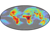
The map shows average yearly counts of lightning flashes per square kilometer, based on data collected by NASA satellites between 1995 and 2002.
Published Jun 23, 2006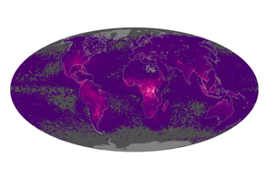
Space-borne sensors extend the record of global lightning detection.
Published Mar 31, 2015
When the Apollo 11 astronauts left the surface of the Moon on July 21, 1969, they brought home samples of solar wind particles, lunar rocks and dirt, and a big helping of perspective.
Published Jul 20, 2019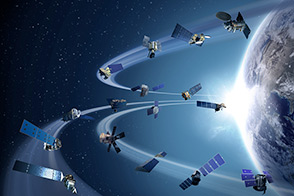
Sixteen operating satellites monitor Earth. Four more are scheduled to launch in 2014.
Published Jul 5, 2013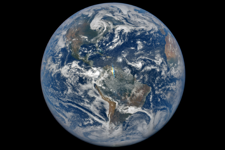
The Earth Polychromatic Imaging Camera detects unusual flashes of light from our atmosphere.
Published May 24, 2017
The smoky remnants of October’s devastating fires still filled the southern California Central Valley on November 2, 2003. This “upside down” digital photograph was taken from the International Space Station from a position over the Pacific Northwest looking southward toward southern California. At the time this image was acquired, the fires had finally been brought under control, but ash and smoke remained trapped in the atmosphere above the valley, a bowl of land ringed by the Sierra Nevada Mountains to the east (left) and the Coast Range Mountains to the west (right).
Published Nov 24, 2003
Fifty years ago today, the first American to orbit the planet took this photo of home.
Published Feb 21, 2012
Storms and a lunar eclipse are a few of the phenomena visible in animations of Earth’s full disk.
Published Dec 16, 2015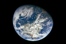
This stunning photo came back to Earth with the Apollo 8 astronauts in late December 1968.
Published Nov 27, 2008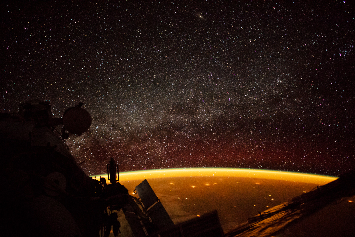
City lights sprawl across Earth’s surface below a constant glow in the upper atmosphere.
Published Oct 23, 2018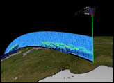
Orbiting the Earth at nearly 17,000 miles per hour, NASA's Ice, Cloud and land Elevation Satellite (ICESat) is collecting spectacular new three-dimensional measurements of the Earth's surface and atmosphere.
Published Dec 10, 2003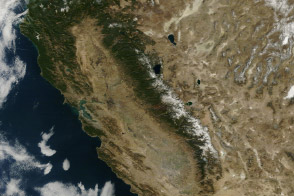
From brown landscapes to snow-free mountains, California was startlingly dry as a serious drought prompted a state of emergency.
Published Jan 23, 2014
You know the photo, but do you know the story behind it? A new video explains the circumstances that gave rise to the famous Apollo “Earthrise” photo while recreating the experience with modern data.
Published Dec 24, 2013Image of the Day Atmosphere Land Water Snow and Ice Remote Sensing
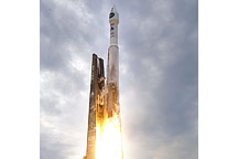
After waiting out a thunderstorm, NASA’s Lunar Reconnaissance Orbiter and Lunar Crater Observation and Sensing Satellite rocketed off the launch pad at Kennedy Space Center in Cape Canaveral, Florida, at 5:32 p.m. Eastern Daylight Time on June 18, 2009. This photograph captures the pair of spacecraft as they were lifting off.
Published Jun 20, 2009