
The category 3 storm swept over the Philippines on August 12, 2013.
Published Aug 13, 2013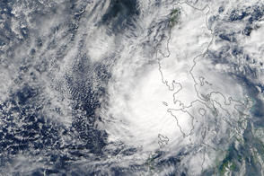
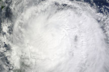
The typhoon was the strongest on record in the Northwest Pacific to make landfall so late in the year.
Published Dec 27, 2016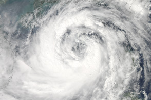
Moving northwest toward southern China and Vietnam, the massive Typhoon Nesat covers most of the South China Sea in this photo-like satellite image from September 28, 2011.
Published Sep 29, 2011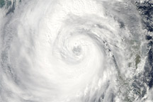
Category 4 Typhoon Megi sprawls over much of the South China Sea in this true-color image from October 20, 2010.
Published Oct 20, 2010
Typhoon Haima is the second typhoon in the span of a week to bring heavy wind and rain to the Philippines.
Published Oct 20, 2016Image of the Day Water Severe Storms Human Presence Remote Sensing
The category 2 typhoon brought soaking rain and landslides.
Published Oct 30, 2018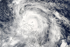
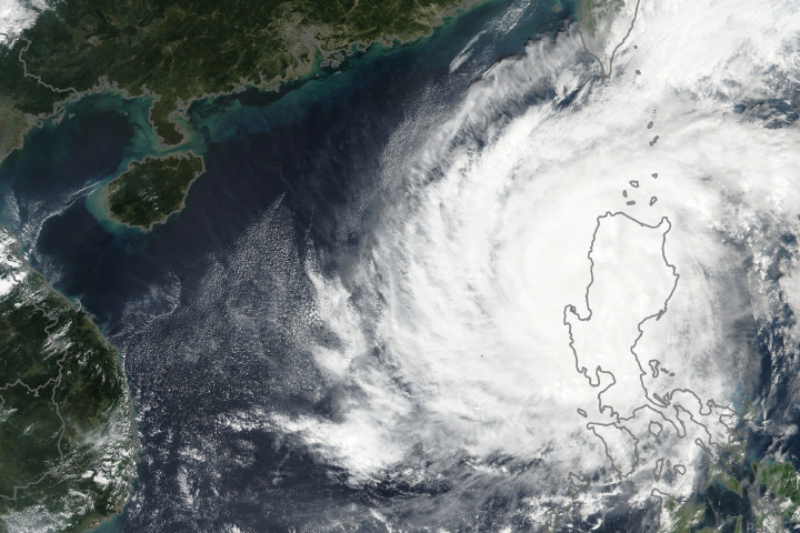
The storm brought high winds and heavy rains to the Philippines before heading toward China and Vietnam.
Published Oct 17, 2016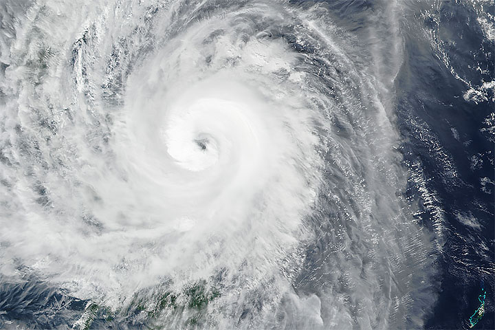
A powerful typhoon brought violent winds and torrential rainfall, causing thousands to evacuate.
Published Dec 2, 2019Image of the Day Atmosphere Land Water Severe Storms Remote Sensing
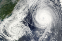
A little over 1,000 kilometers separated the center of Tropical Storm Parma from the center of Typhoon Melor on October 6, when the this composite image was taken.
Published Oct 7, 2009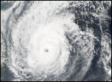
Acquired October 22, 2009, this true-color image shows the outer bands of Typhoon Lupit overlapping the northern end of the Philippine island of Luzon.
Published Oct 22, 2009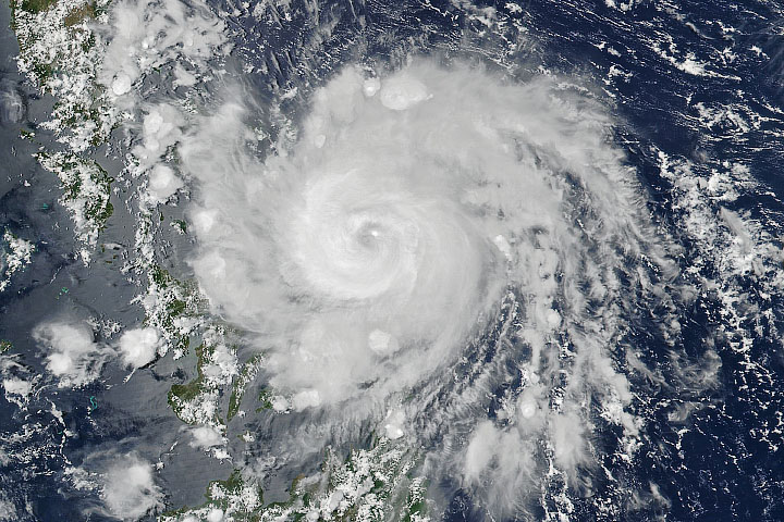
The first typhoon of the year in the Western Pacific was later than usual and quite potent.
Published May 14, 2020Image of the Day Atmosphere Land Severe Storms Human Presence
Acquired October 3, 2009, this true-color image shows Typhoon Parma hovering over the island of Luzon. Storm clouds stretch from the Philippine Sea to the South China Sea.
Published Oct 4, 2009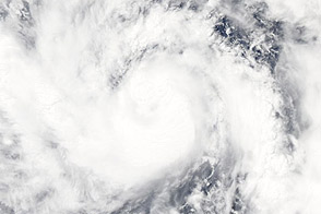
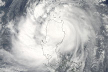
Acquired May 24, 2011, this image shows Typhoon Songda off the Philippines.
Published May 24, 2011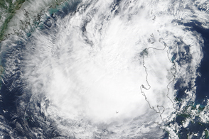
Typhoon Koppu has weakened, but the system is still expected to bring widespread flooding to the Philippine’s Luzon Island.
Published Oct 19, 2015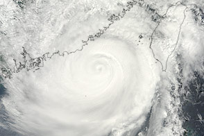
The most potent tropical cyclone of 2013 battered the Philippines and the Chinese coast.
Published Sep 24, 2013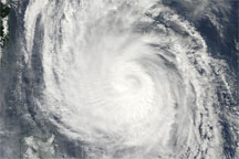
Acquired at 1:05 p.m. Manila time on October 21, 2009, this true-color image shows Typhoon Lupit raging off the northeastern coast of the Philippine island of Luzon.
Published Oct 21, 2009