
Views from the ground and from space are helping scientists understand how soil moisture affects U.S. agriculture.
Published Nov 25, 2015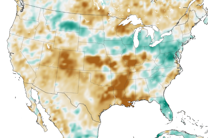
The amount of water contained in the top few centimeters of soil is small on a global scale, but it is critical for agriculture analysts trying to monitor commodity production and humanitarian need.
Published Jun 2, 2018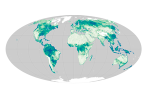
Satellite sensors uncover a global view of the water hidden between soil particles.
Published Nov 12, 2015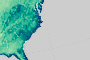
An extreme rainfall event saturated the soil along the U.S. East Coast.
Published Oct 8, 2015
Harvey dropped buckets of rain on areas that were already very dry or very wet.
Published Aug 31, 2017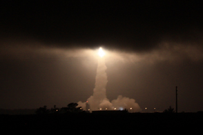
The SMAP mission lifts off to make the most accurate, high-resolution soil moisture measurements ever collected from space.
Published Feb 1, 2015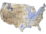
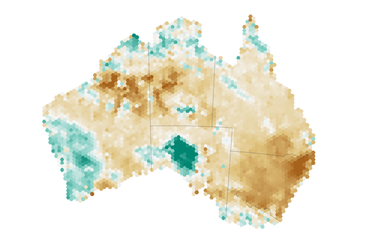
Eastern Australia has been hit particularly hard by drought, taking a toll on the region’s soil moisture and agriculture.
Published Aug 9, 2018Image of the Day Land Water Drought Human Presence Remote Sensing

The proportion of sand, silt, and clay contained in soil across the U.S. affects the amount of water it can hold.
Published Jan 9, 2016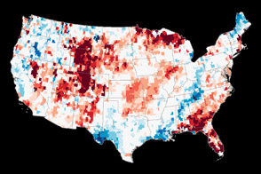
Though a series of winter storms provided some relief, a pair of satellites operated by NASA shows that groundwater supplies remained unusually low in many parts of the country.
Published Jan 19, 2013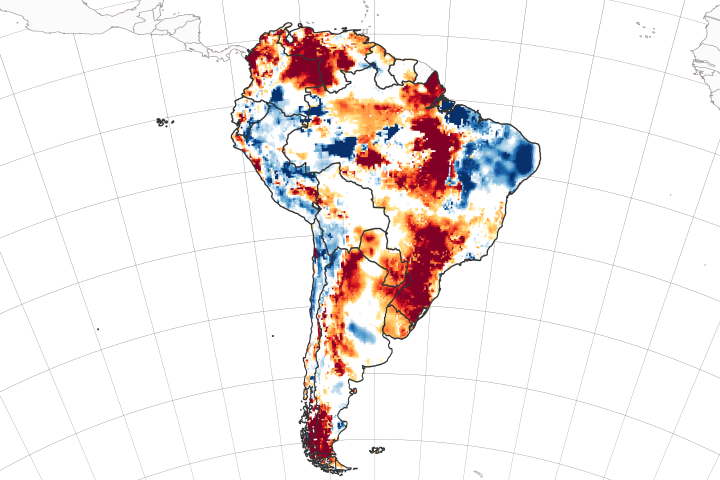
Twin satellites are assessing the state of soil moisture and groundwater on the continent and around the world.
Published Apr 6, 2020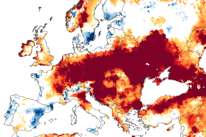
Long-term rainfall deficits, heat waves, and increased evaporation have depleted some of the groundwater supply beneath central and eastern Europe.
Published Jun 25, 2020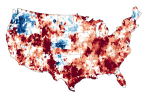
The GRACE satellites can detect the movement and depletion of water supplies at and below Earth’s surface.
Published Sep 20, 2012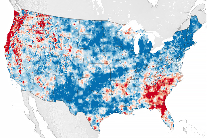
Scientists have developed a new way to measure water cycle intensity over time.
Published Jul 26, 2019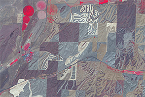
By planting in narrow strips and plowing in patterns that mimic the natural contours of the land, farmers in southeastern Washington are trying to prevent productive soils from washing away.
Published Aug 31, 2014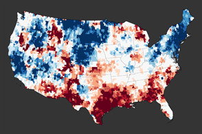
A new map reveals the extreme depletion of groundwater in Texas and other parts of the southern United States due to drought.
Published Dec 1, 2011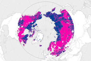
Nearly all fresh water at Earth’s highest northern latitudes is frozen. But just a short distance to the south, the landscape comes alive each year after the spring thaw.
Published Jan 2, 2016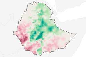
Following Ethiopia’s worst drought in decades, rainfall in 2016 is off to an uneven start.
Published Apr 19, 2016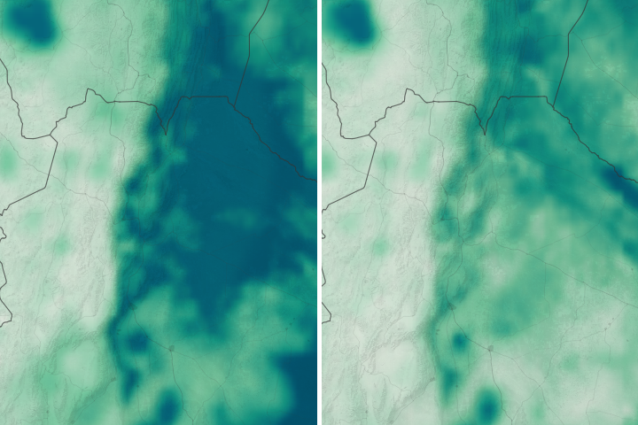
A hot, dry growing season has scorched soybean and corn crops in the Pampas.
Published Apr 17, 2018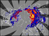
Researchers are using satellite data to understand where locusts may spread during the largest infestation in eastern Africa in decades.
Published Mar 30, 2020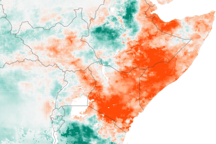
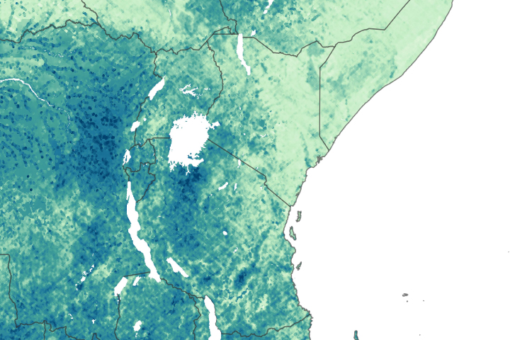
Drought is apparent across much of East Africa after seasonal rains failed to deliver much moisture to the region.
Published May 30, 2019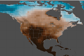
A study using historical data and 17 climate models projects that decades-long droughts will become much more likely if greenhouse gas emissions continue at their current rate.
Published Feb 15, 2015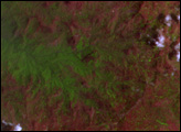
In the first weeks of June 2010, winter snow disappears from the lake-dotted tundra of Alaska’s North Slope like a dust cover whisked off a stained glass work of art.
Published Jun 17, 2010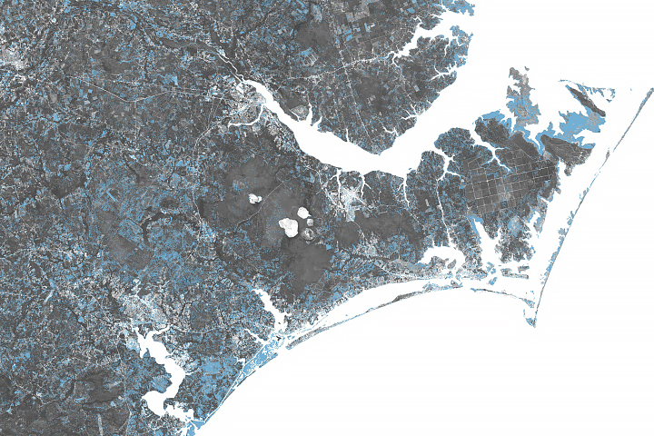
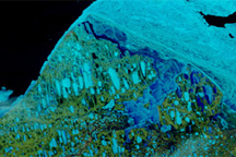
As the Carolinas flood from Hurricane Florence, NASA is providing valuable information for rescue and recovery efforts.
Published Sep 18, 2018Image of the Day Atmosphere Land Water Severe Storms Human Presence Remote Sensing
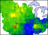
These images show how terrestrial water storage in the four major sub-basins of the United States’ Mississippi River basin differed from average in January and July 2005.
Published Jan 26, 2007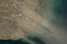
A checkerboard of growing (dark green) and fallow (tan) fields in northern Patagonia appears beneath a rippling plume of beige dust in this natural-color image from the Moderate Resolution Imaging Spectroradiometer (MODIS) on NASA’s Aqua satellite on September 11, 2009.
Published Sep 15, 2009