Parallel rows of clouds can stretch for hundreds of kilometers over the open ocean.
Published Jul 27, 2013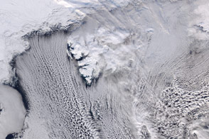
Cool air moving across Arctic sea ice gives rise to long parallel bands of cumulus clouds over the Norwegian Sea.
Published Mar 31, 2016Image of the Day Atmosphere Land Water Unique Imagery Snow and Ice
Cold winds blowing over the sea helped form rows of cumulus clouds.
Published Mar 4, 2020Image of the Day Atmosphere Water Unique Imagery Snow and Ice
Cold air blows over warmer water to produce thin, parallel lines of clouds.
Published Oct 8, 2018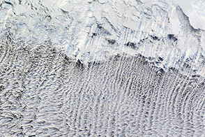
Most of us prefer our winter roads free of ice, but some cloud formations depend on it.
Published Jan 12, 2012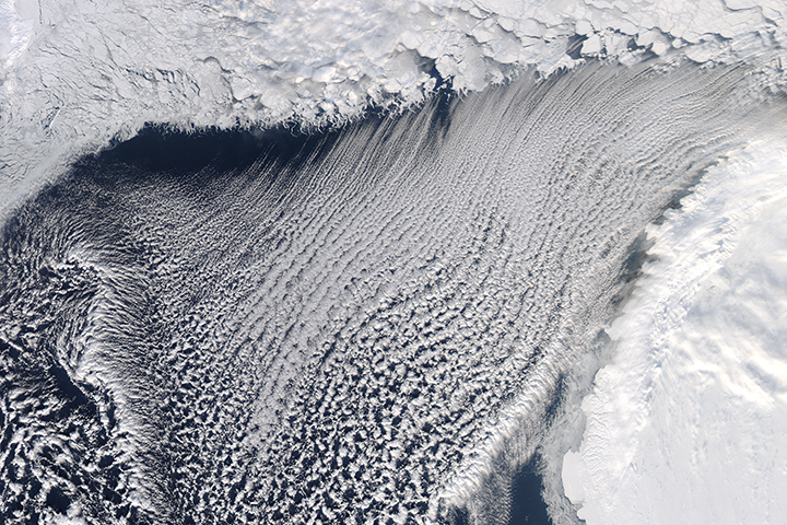
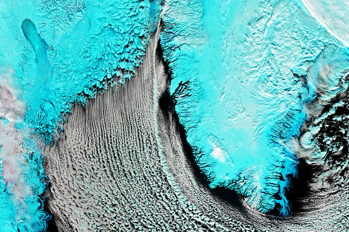
Cool air blowing southward across the sea ice and over the comparatively warmer open water produced long, parallel bands of cumulus clouds.
Published Mar 30, 2018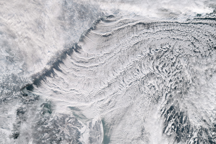
The Sea of Okhotsk is a winter ice factory and a year-round cloud factory.
Published Jan 3, 2018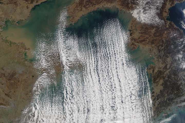
Cold and dry air from Siberia typically produce this cloud formation over the sea from November through January.
Published Jan 7, 2018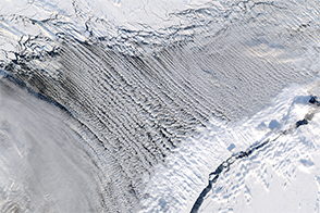
Cloud streets form thousands of feet above the Earth’s surface.
Published Mar 12, 2017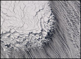
Tucked between Siberia and Russia's frozen Kamchatka Peninsula, the Sea of Okhotsk was a field of ice in February 2007.
Published Feb 8, 2007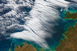
An uncommon display of cloud streets formed off of the northern coast of Australia.
Published Jul 24, 2016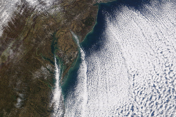
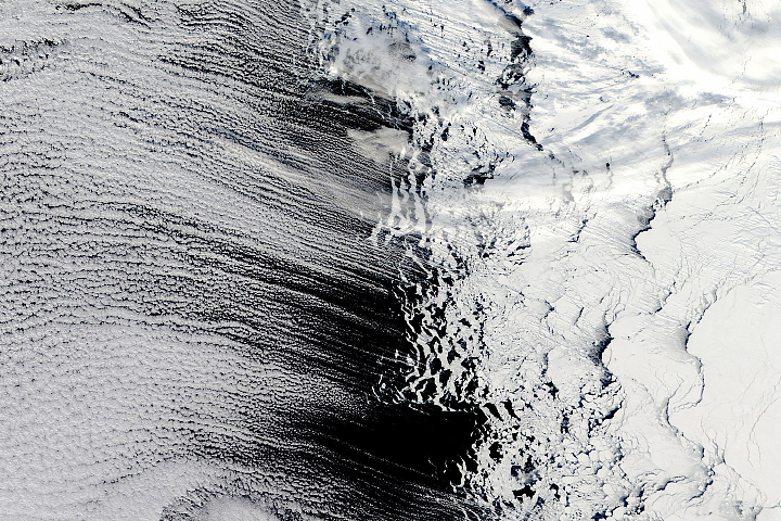
Cold air moving over relatively warm ocean water produced a pattern of clouds that lined up in organized rows.
Published Nov 14, 2019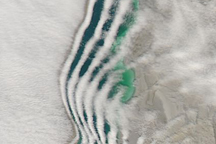
Distinctive lines of clouds that mirror the shape of the shore hang over the Aral Sea in this photo-like image.
Published Mar 25, 2009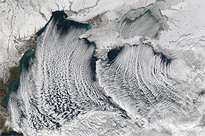
The Aqua satellite captured this image of cloud streets over the Black Sea in January 2015.
Published Jan 9, 2015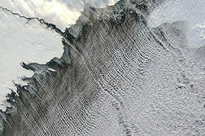
Cold air blowing between warmer water and warm upper-level air masses can produce long lines of cumulus clouds.
Published Nov 20, 2012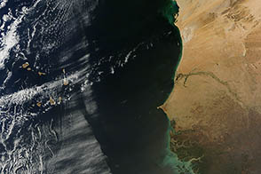
Dry air surging off the western coast of Africa ran into a wall of moist air over the Atlantic, creating a distinctive line in a marine cloud layer.
Published Feb 28, 2013
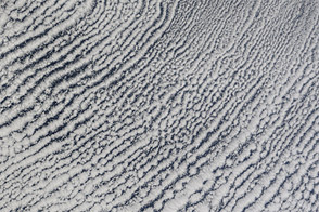
Like the freshly raked white sand of a well-tended Japanese garden, rows of clouds stream over the Bering Sea from the edge of the sea ice.
Published Jan 31, 2006Image of the Day Atmosphere Water Unique Imagery Snow and Ice

The MODIS instrument on NASA’s Terra satellite collected this natural-color view of cloud streets over the ocean off of New England and the Canadian Maritimes on January 24, 2011.
Published Feb 15, 2011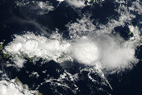
Impressive thunderclouds run along the spine of the Indonesian island of Flores, a result of ocean breezes and steep mountains.
Published Dec 11, 2013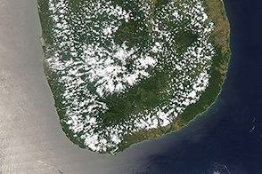
Sea breezes and differential heating fill the afternoon sky with puffs of white clouds.
Published Aug 11, 2013