NASA aircraft return to the Arctic to assess the health of the region’s ice.
Published May 3, 2012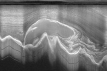
Researchers working in Antarctica have found evidence of large-scale ice making at the bottom of that continent's massive ice sheets.
Published Apr 21, 2011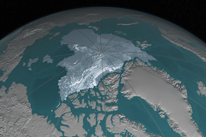
In 1984, there were 1.86 million square kilometers of old ice spread across the Arctic at its yearly minimum extent. In September 2016, there were only 110,000 square kilometers of old ice left.
Published Nov 4, 2016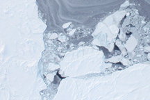
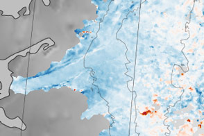
Taken from a low-flying airplane on March 26, 2011, these detailed photos of Arctic sea ice show the richly varied texture in the ice floe.
Published Apr 1, 2011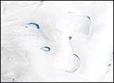
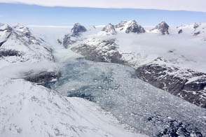
Thinner than the 2.3-kilometer-thick center, the outer edges of the Greenland ice sheet develop melt zones like the one shown here during the warm summer months.
Published Apr 7, 2007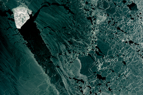
A diamond-shaped piece of ice is a stranger amid thin ice.
Published Mar 1, 2017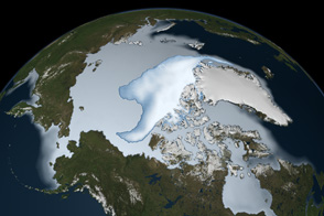
Thick ice that used to last through multiple summers has been in steep decline for three decades.
Published Mar 1, 2012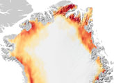
Sections of the Greenland Ice Sheet that end on land are slowing—a sliver of good news for sea level rise.
Published Oct 30, 2015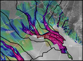
The image above depicts the region of West Antarctica where scientists measured ice speed. The fast-moving central ice streams are shown in red. Slower tributaries feeding the ice streams are shown in blue. Green areas depict slow-moving, stable areas. Thick black lines depict the areas that collect snowfall to feed their respective ice streams.
Published Jan 25, 2002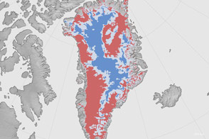
A new map shows where the bottom of the Greenland Ice Sheet is likely thawed.
Published Aug 4, 2016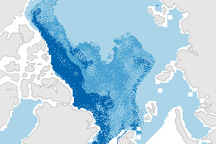
This pair of maps shows how the sea ice covering the Arctic at winter maximum in 2009 is younger than it was in the past.
Published Apr 10, 2009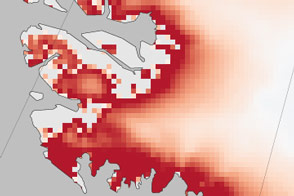
By 2090, the scale could tilt in the favor of ice loss instead of buildup.
Published Jan 31, 2017Image of the Day Heat Human Presence Snow and Ice Remote Sensing
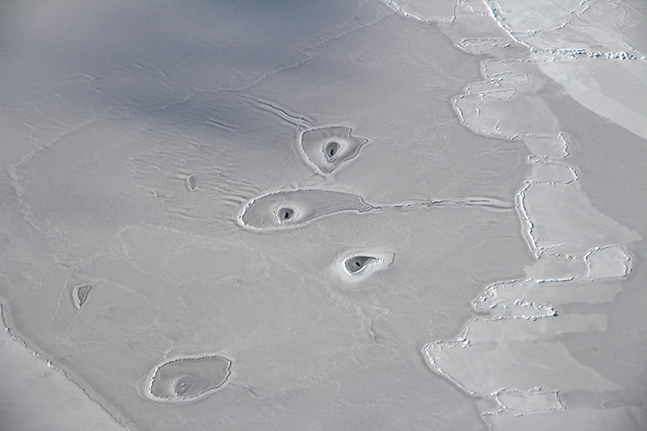
Scientists pose an array of explanations for the strange circular features visible on sea ice in the eastern Beaufort Sea.
Published Apr 21, 2018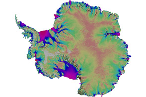
Scientists mapped the motion of Antarctica’s ice sheets and revealed unexpected patterns.
Published Aug 19, 2011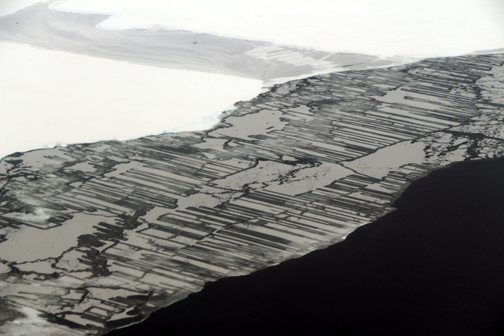
As a result of the collision, blocks of ice slide above and below each other in a pattern that resembles a zipper or interlocking fingers.
Published Nov 22, 2017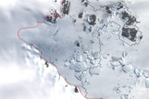
This image shows the latest estimate of the ice edge around Law Promontory, which juts out from East Antarctica’s coastline near Stefansson Bay.
Published Jul 23, 2010