Winds and waves from a February 2013 nor'easter churned up the seafloor and beaches around coastal Massachusetts.
Published Feb 27, 2013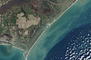
Long before Cape Lookout National Seashore was declared a national tourist treasure, it was home to an important lighthouse and a commercial port. The park has its 50th anniversary this week.
Published Mar 8, 2016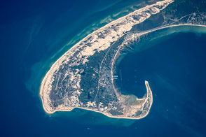
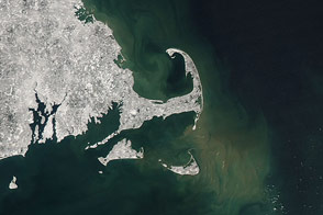
Winds and wave refraction give the area around Provincetown a distinctive hook shape.
Published Aug 31, 2015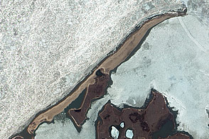
A new survey observes that 12.7 percent of all barrier islands—a total of 272—surround the Arctic Ocean.
Published Jun 16, 2011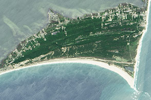
On most summer days, a trip to North Carolina’s Outer Banks means a peaceful day at the beach, but there is evidence all around that this beach is not always so serene.
Published Aug 25, 2016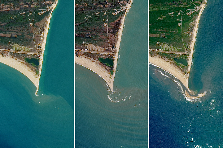
The natural movement of sediment has built up a shoal island off the Outer Banks in North Carolina.
Published Jul 12, 2017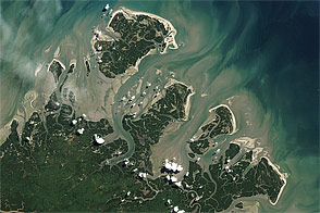
Barrier islands are found along the edge of every continent except Antarctica, and in 2011 scientists and naturalists are still finding new ones, including this chain along the equatorial coast of Brazil.
Published Jun 3, 2011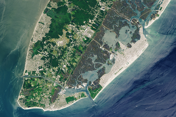
For many people, there is great joy and good summer business to be found on the widest beach in New Jersey and one of the widest on any coast.
Published Aug 5, 2019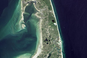
“A man may stand there and put all America behind him.”
Published Nov 25, 2016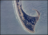
This astronaut photograph, taken from the International Space Station, shows the northernmost parts of the Cape Cod National Seashore, also known as Provincetown Spit.
Published Oct 19, 2005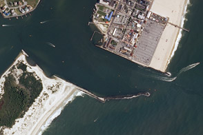
Jetties near Ocean City, Maryland, have interrupted natural coastal processes such as longshore transport, altering the shape of the coastline.
Published Aug 4, 2011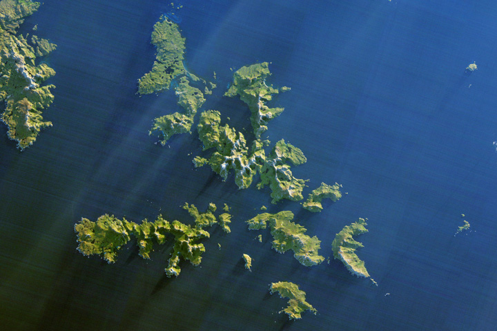
Ferocious winds and huge waves have long made it perilous to navigate around the southernmost tip of South America.
Published Dec 24, 2017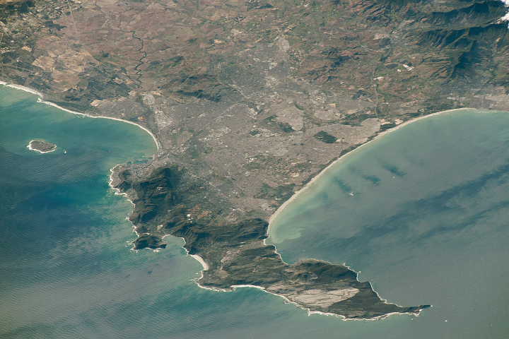
Originally named the Cape of Storms, it was later renamed to Good Hope in order to attract more people to the Cape Sea Route.
Published Aug 18, 2019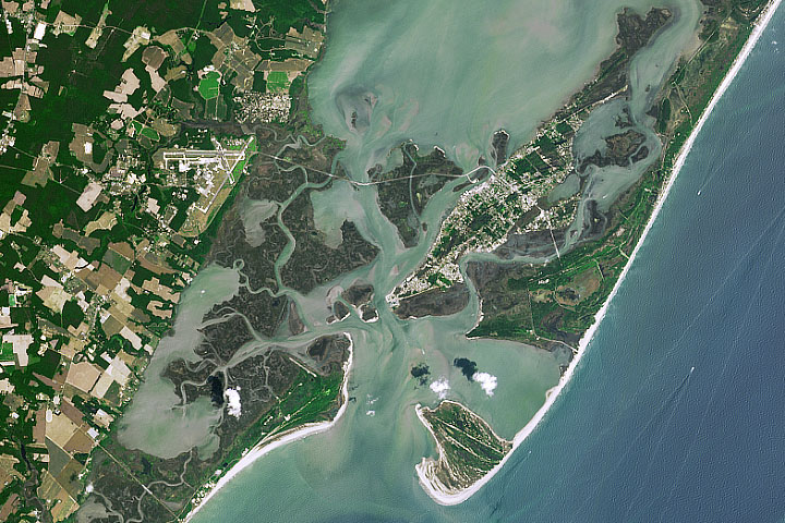
Assateague, Chincoteague, and Wallops provide a rare example of overlapping barrier islands. All of them are constantly in motion.
Published Oct 9, 2019
A series of storms has redistributed the sand and the so-called "Shelly Island" is no longer an island.
Published Mar 8, 2018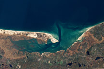
This natural color image of Sandy Neck and Barnstable Harbor, on the north side of Cape Cod, Massachusetts, was acquired on November 4, 2005, by the Advanced Land Imager (ALI) on NASA’s EO-1 satellite.
Published Feb 19, 2011
The supply of sediment is gradually diminishing under the combined pressure of human and natural causes.
Published Jan 13, 2013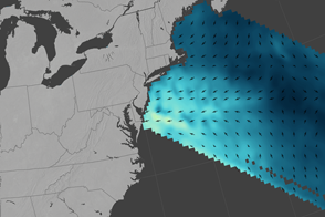
Hurricane-force winds remade beaches in Virginia, Maryland, Delaware, and New Jersey.
Published Jan 29, 2016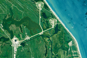
Global sea level rise poses very local challenges for the many NASA centers situated on U.S. coasts.
Published Sep 30, 2015
Warm and cool ocean currents collide near South Africa’s Cape Agulhas and Cape of Good Hope.
Published Jan 27, 2017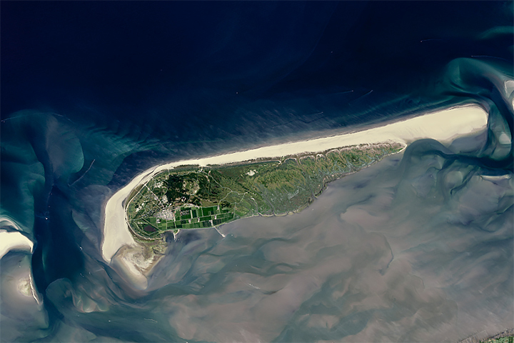
Sandy beaches are growing in some parts of the world and shrinking quickly in others, including one-third of marine protected areas.
Published Aug 2, 2018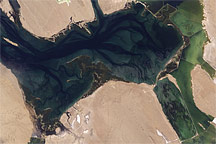
Acquired September 18, 2009, this true-color image of Laguna Ojo de Liebre on Baja California shows the margins of industrialized salt works in the east and a famed marine mammal wintering site in the west.
Published Sep 27, 2009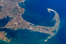
Cape Cod is a haven for rocks and people who have washed up on American shores.
Published Nov 21, 2010