
In 1984, there were 1.86 million square kilometers of old ice spread across the Arctic at its yearly minimum extent. In September 2016, there were only 110,000 square kilometers of old ice left.
Published Nov 4, 2016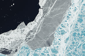
A mixture of ice types exists where frozen water meets open water.
Published Mar 11, 2015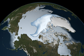
Thick ice that used to last through multiple summers has been in steep decline for three decades.
Published Mar 1, 2012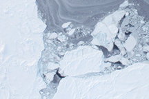
Taken from a low-flying airplane on March 26, 2011, these detailed photos of Arctic sea ice show the richly varied texture in the ice floe.
Published Apr 1, 2011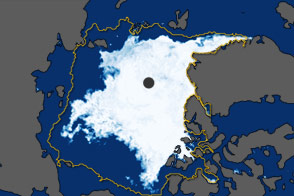
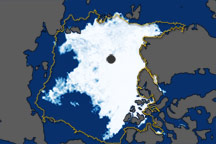
In September 2011, the extent of sea ice covering the Arctic Ocean declined to the second-lowest extent on record.
Published Oct 5, 2011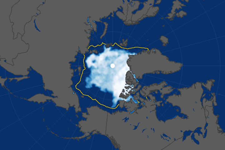
Arctic sea ice has been retreating the fastest in the Beaufort Sea.
Published Oct 18, 2017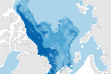
This pair of maps shows how the sea ice covering the Arctic at winter maximum in 2009 is younger than it was in the past.
Published Apr 10, 2009
New elevation measurements will give researchers an unprecedented understanding of the thickness of sea ice, which will be used to help improve climate modeling and forecasts.
Published Dec 18, 2018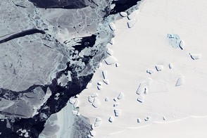
Acquired October 7, 2011, this natural-color image shows an ice menagerie off the coast of East Antarctica.
Published Oct 23, 2011
These images show overall Arctic sea ice extent on September 19, 2010 (the date of the 2010 minimum), and sea ice growth in mid-September 2010.
Published Oct 6, 2010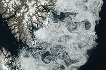
Sea ice formed delicate swirls along the coast of Baffin Island in this true-color image acquired July 11, 2009.
Published Jul 24, 2009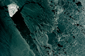
A diamond-shaped piece of ice is a stranger amid thin ice.
Published Mar 1, 2017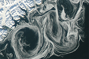
Thin sea ice swirled along the east coast of Greenland in October 2012, against a backdrop of overall thinning sea ice.
Published Oct 27, 2012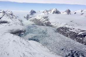
NASA aircraft return to the Arctic to assess the health of the region’s ice.
Published May 3, 2012