More than 64 million people are directly affected by drought in the Southwest and Southern Plains, and far more are indirectly affected because of the vast number of farms, orchards, and ranches that supply the rest of the United States.
Published Nov 27, 2014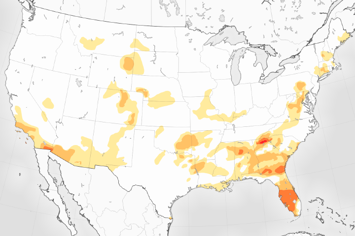
The U.S. Drought Monitor reports its lowest levels in 17 years.
Published May 5, 2017
By late February 2018, an estimated 55 percent of the continental U.S. was classified as abnormally dry.
Published Mar 2, 2018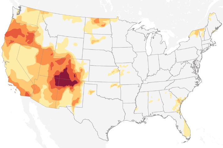
Drought conditions in 2018 are extreme over the Four Corners region of the United States.
Published Nov 8, 2018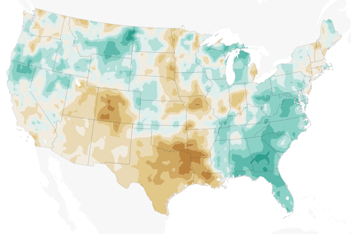
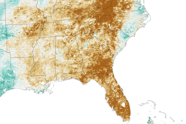
Temperatures across much of the region in 2018 have been well above the norms, while precipitation has been well below—a recipe for struggling farmers and concerned forest fire managers.
Published Jun 12, 2018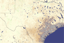
Most of Texas is brown in this vegetation index image, revealing the negative impact drought had on plants in August 2009.
Published Aug 12, 2009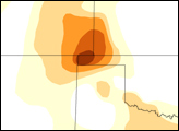
While autumn rains offered some relief to Northern California, drought still reigns in the southern part of the state.
Published Nov 16, 2016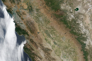
The typically green valleys and snow-covered mountains of California have grown dusty after three years of drought.
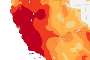
Published Jul 18, 2014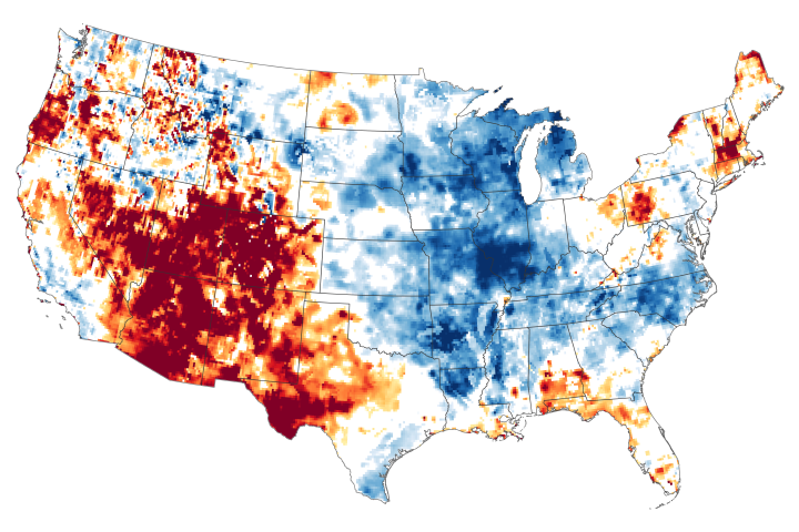
The failure of the summer monsoon and other moisture carrying systems has parched more than 90 percent of some states.
Published Aug 13, 2020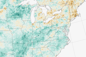
A dry summer is giving farmers in the Northeast one of their toughest seasons in years.
Published Sep 13, 2016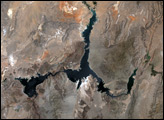
After a wet spring, a quick-onset drought has parched fields.
Published Oct 23, 2019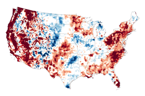
In mid-September 2015, water stored near the surface and underground in the U.S. West was far-below-normal.
Published Sep 18, 2015
Dry conditions at the surface in the continental United States are mirrored underground in many places.
Published Jul 24, 2014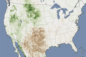
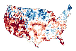
Extreme heat helped push as much as 26 percent of the contiguous United States into drought in July 2011. This image shows the impact on plants throughout the month.
Published Aug 11, 2011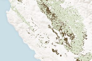
Analysis of Landsat and MODIS data showed where agricultural production was affected by long-term drought in California.
Published Jan 30, 2015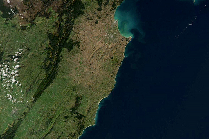
North Island vegetation shows signs of stress during one the region’s most severe droughts on record.
Published May 7, 2020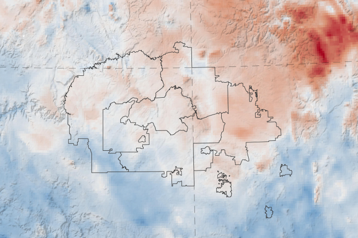
A new web tool designed by NASA applied scientists could help the tribe anticipate and respond to drought.
Published Apr 20, 2020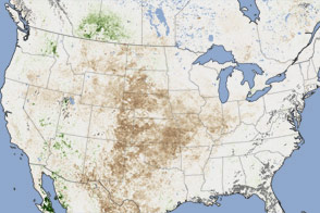
In August 2012, satellites observed the effects of drought and heat waves on vegetation from the Rocky Mountains to the Mississippi River.
Published Oct 3, 2012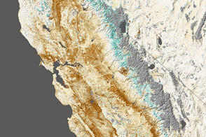
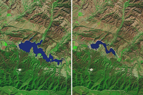
Nearly all of California was in a state of extreme drought at the end of January 2014. Forests and farms clearly showed the effects in satellite measurements of vegetation.
Published Feb 14, 2014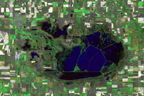
Kansas wetlands dry out across two rain-scarce summers.
Published Oct 7, 2012