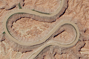
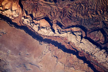
A double oxbow etched into the Colorado Plateau in Canyonlands National Park likely got its shape from an ancestral river.
Published Jun 18, 2014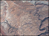
Situated in Utah, the park is home to 2,000 arches and windows in rock, as well as rock spires and pinnacles.
Published May 8, 2005
The highlights of this landscape in southern Utah tend to reach down into the Earth, rather than soaring above it.
Published Aug 20, 2017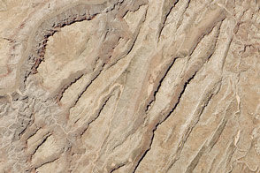
Sinking blocks of rock created this distinctive network of valleys.
Published Jun 6, 2014
One hundred million years of rock formation are visible in exposed layers at Waterpocket Fold in Capital Reef National Park. This astronaut photo from June 14, 2009, shows the layered, multi-colored rock formations.
Published Jul 6, 2009
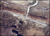
In the northwest corner of Colorado, the west-flowing Yampa River meets the south-flowing Green River, which runs into Utah. Stretches of both river canyons upstream and downstream from the junction make up Dinosaur National Monument. The monument takes its name, of course, from the abundant fossils found in exposed valleys and low ridges of the Morrison Formation, a series of rock layers that were formed late in the Jurassic Period, roughly 145 million years ago.
Published Oct 1, 2007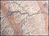
Sixty million years of erosion have exposed folded layers of rock.
Published Oct 3, 2007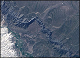
Black Canyon of the Gunnison National Park is a small park that encompasses the steep-walled canyons of the Gunnison River, which drains snowmelt from the Rocky Mountains in western Colorado.
Published Oct 2, 2005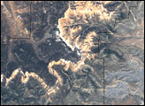
The park sits at the eastern edge of the Paunsaugant Plateau, and the ridgeline offers stunning views across southern Utah.
Published Jun 25, 2006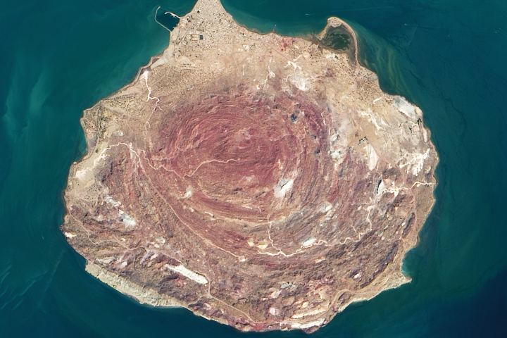
A mix of uplifting salt and other sedimentary and metamorphic rocks make for colorful landscapes in the Persian Gulf.
Published Oct 26, 2020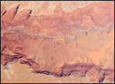
he largest tributary of the Colorado River between Lake Powell and the Grand Canyon, the Paria River flows southeast from its headwaters in southernmost Utah to join the Colorado River between Page, Arizona, and Marble Canyon. The Paria River provides spectacular scenery, and is known for the very narrow “slot” canyons that it cuts through the layered rocks of the Colorado Plateau.
Published Jun 23, 2008