A new map of the biomass in the United States allows scientists and land managers to see tree cover down to the scale of individual plots of land.
Published Feb 17, 2012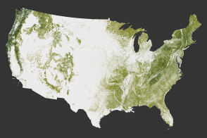
The National Biomass and Carbon Dataset reveals the location and the carbon storage of forests in the United States.
Published Jan 11, 2012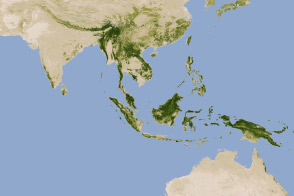
New maps show an estimate of the carbon stored in tropical forests and how sure scientists are about those estimates.
Published Jan 18, 2012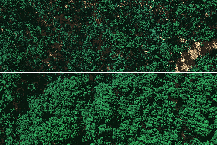
A research team has found that 40 to 60 percent of the tall trees surveyed on the island either lost large branches, were snapped in half, or were uprooted by strong winds from Hurricane Maria.
Published Feb 1, 2019Image of the Day Atmosphere Land Severe Storms Remote Sensing
The amount of carbon that is being stored by trees and how it has changed over time is the least understood aspect of the global carbon cycle.
Published Jan 27, 2020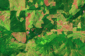
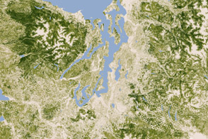
This pair of images show patterns of forest clearing and regrowth in Wasghington state over 26 years. Such images help scientists understand how human decisions impact the carbon cycle and Earth’s climate.
Published Jul 5, 2011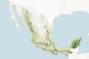
Mapping the density and location of tree cover can help the nation reduce deforestation and offset carbon emissions.
Published Nov 5, 2015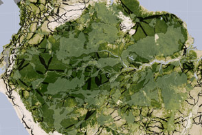
Researchers studying tropical forests have mapped out a way to preserve significant amounts of carbon-rich vegetation and biodiversity by connecting existing protected areas.
Published Apr 2, 2014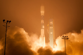
The Orbiting Carbon Observatory (OCO-2) may help scientists answer key questions about how carbon cycles between Earth’s atmosphere, ocean, and land.
Published Jul 3, 2014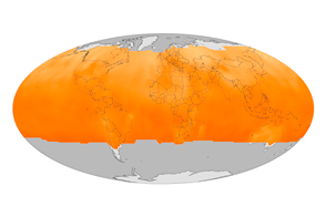
NASA’s Orbiting Carbon Observatory-2 has compiled its first year of data and started quantifying the cycles of emission and absorption of the greenhouse gas.
Published Dec 12, 2015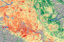
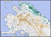
As the size of British Columbia’s pine beetle infestation has grown, forest managers have begun to need a technique to identify damage over large areas. Relying on a variety of data sources, including satellite data, scientists from Goddard Space Flight Center conducted a survey of insect-damaged forests in British Columbia. This image shows their assessment of insect damage overlain on a topography map.
Published Dec 19, 2008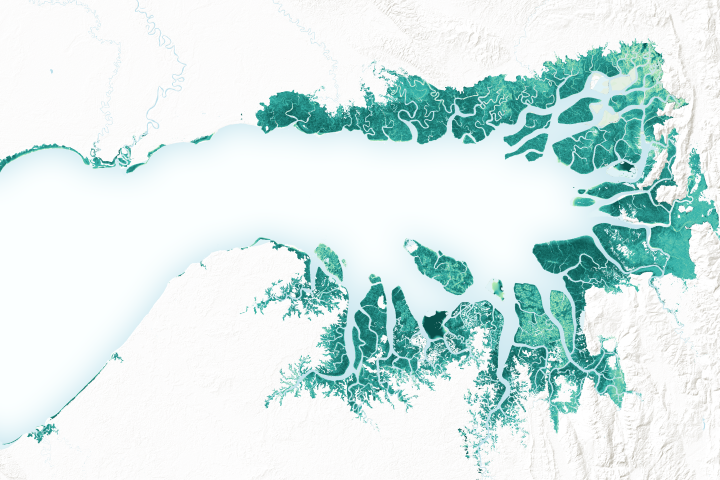
Mangrove forests are among the planet’s best carbon scrubbers.
Published Feb 27, 2019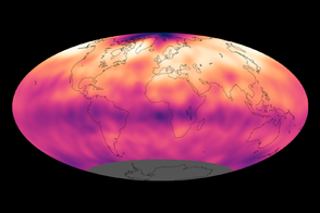
Atmospheric carbon dioxide concentrations reached record levels in 2013.
Published Sep 27, 2013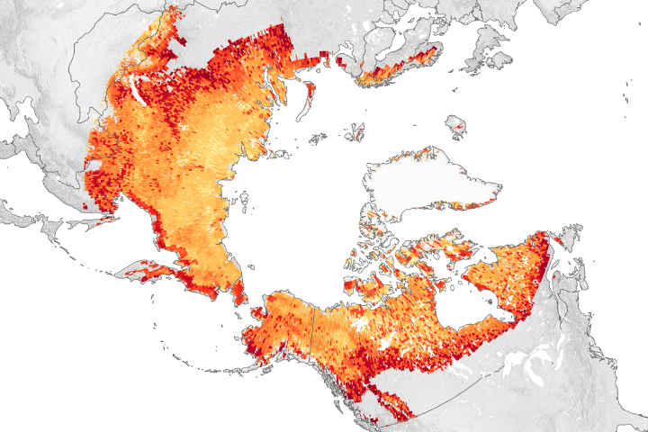
As global and regional warming continues, winter emissions of carbon dioxide from Arctic lands are offsetting what plants absorb in the summer.
Published Nov 19, 2019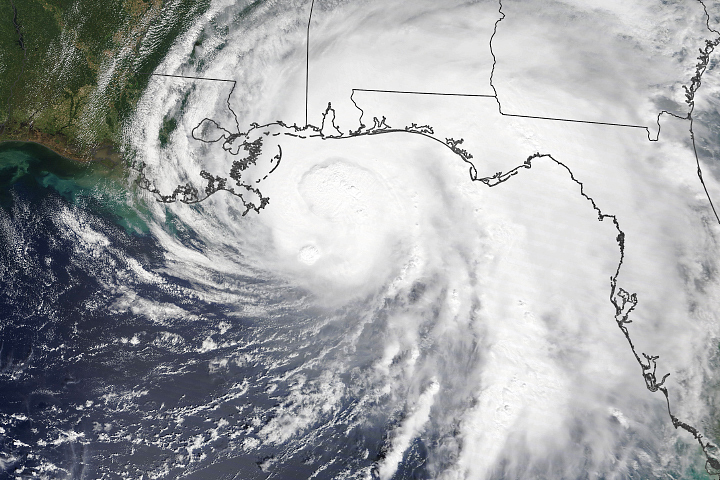
The slow-moving hurricane is predicted to produce life-threatening flash floods and storm surges.
Published Sep 15, 2020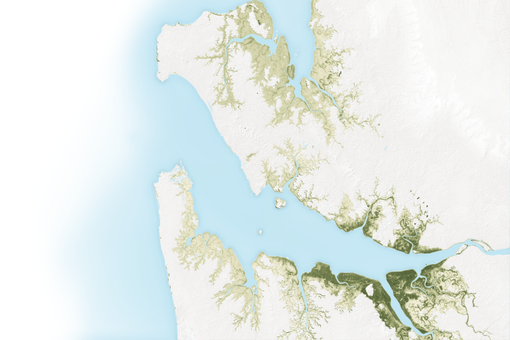
The mangroves in Pongara National Park are among the tallest in the world, towering up to 60 meters.
Published May 19, 2017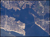
The port town of Biloxi, Mississippi, experienced significant damage when Hurricane Katrina came ashore on August 29, 2005. This astronaut photograph illustrates damage and flooding in the Biloxi area caused by Hurricane Katrina.
Published Sep 19, 2005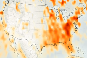
Measurements from OCO-2 will provide a baseline for monitoring changes in emissions.
Published Nov 17, 2016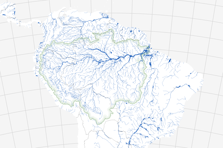
Long overlooked, it is increasingly clear that streams and rivers play a key role in the carbon cycle.
Published Jul 20, 2018
Researchers have turned to citizen scientists to help detect previously unknown or recently disrupted kelp forests in satellite imagery.
Published Jan 13, 2015
By providing a measurement of all of the carbon being stored in Earth’s plants, maps like these help scientists figure out what happens to the carbon people release by burning fossil fuels.
Published Jul 8, 2011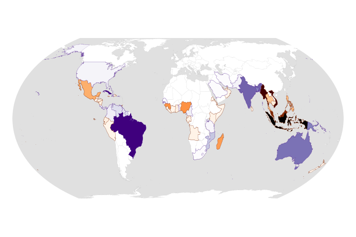
While the rate of losses has declined, the ecosystems are still threatened and are facing more environmental stress.
Published Aug 25, 2020Image of the Day Land Life Water Human Presence Remote Sensing
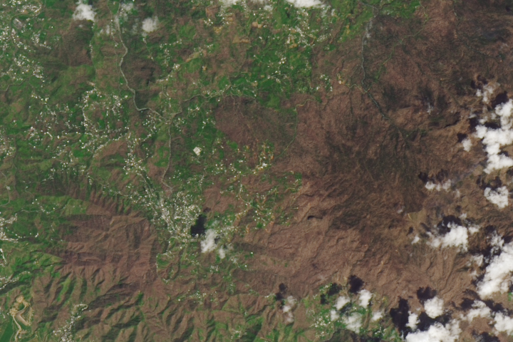
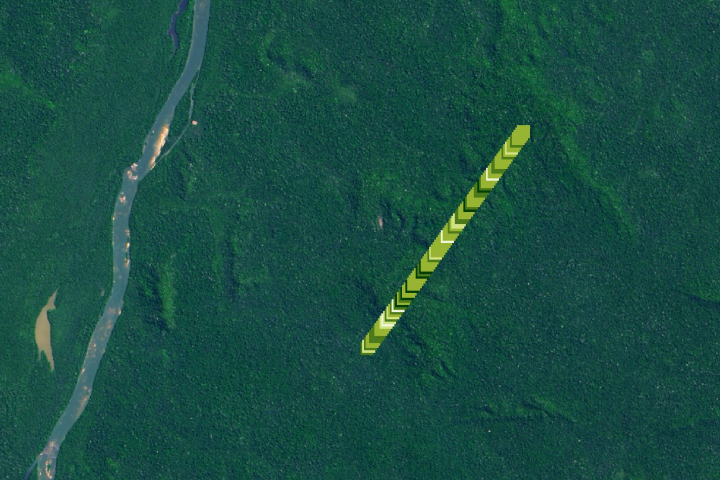
Forests are on the path to recovery even as many roof repairs remain undone.
Published Sep 26, 2018Image of the Day Atmosphere Land Life Severe Storms Human Presence Remote Sensing
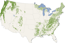
From the Pacific Northwest—home of the towering redwoods&mdash to the Southern Appalachians, this map shows forest canopy heights across the United States.
Published Jul 22, 2010
Forests in drylands are much more extensive than previously reported.
Published Aug 10, 2017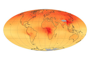
Concentrations of the gas, which is produced by burning carbon-based fuels, have decreased since 2000.
Published Jun 2, 2015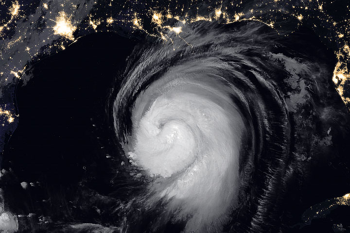
Hurricane Laura is poised to cause an unusually large and damaging storm surge.
Published Aug 26, 2020Image of the Day Atmosphere Land Water Floods Severe Storms Human Presence Remote Sensing
Potent storms and pesky predators—as well as climate change—are altering the dynamics of these underwater forests.
Published Jan 20, 2015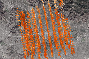
NASA’s new Orbiting Carbon Observatory-2 calibrated its sensors by taking data from an area where ground stations could provide ground truth.
Published Nov 7, 2014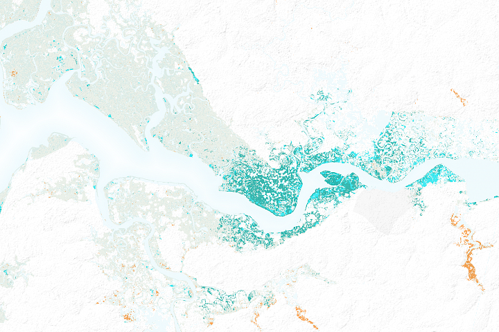
After decades of decline, satellites show mangrove forests are covering more area and growing more densely in this West African country.
Published Mar 21, 2018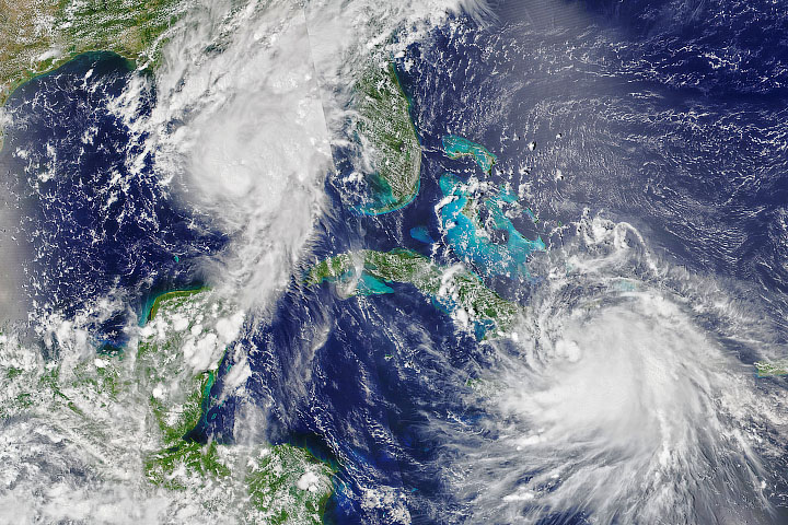
The 2020 Atlantic hurricane season continues to be unusually active.
Published Aug 24, 2020