Sea ice from the Foxe Basin tends to be rougher and more stained than other parts of the Arctic.
Published May 24, 2014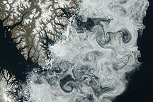
Sea ice formed delicate swirls along the coast of Baffin Island in this true-color image acquired July 11, 2009.
Published Jul 24, 2009
Carried by winds and currents, sea ice can reach the coast of Hokkaido, Japan.
Published Mar 19, 2020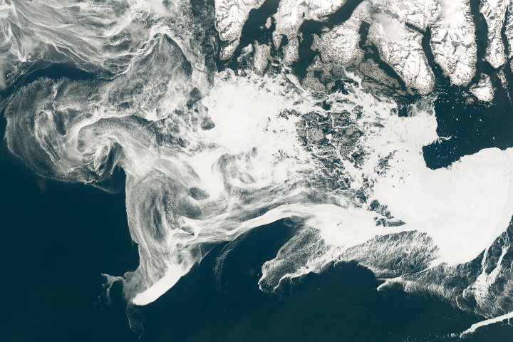
Filaments of sea ice stretch across the waters off southern Greenland, an area that is typically ice-free.
Published May 18, 2019
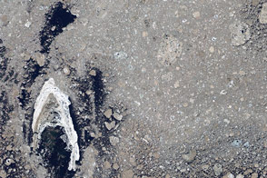
Acquired March 27, 2010, this natural-color image shows part of the southeastern coast of Greenland, fringed by multiple forms of sea ice: fast ice, multiyear ice fragments, and small pieces of ice shaped into swirls by currents.
Published Apr 2, 2010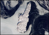
Belle Isle (center) is surrounded by sea ice in this winter viewtaken from the International Space Station. Belle Isle lies in the BelleIsle Strait between the island of Newfoundland and the Labrador mainland. A portion of a small island along the coast of Labrador appears in the top left corner. Ice patterns show that the island lies at the meeting point of two sea currents (larger arrows). The Labrador Current flows from the northwest (top left), and a smaller current, driven by dominant westerly winds, flows from the southwest (lower left). Flow lines in sea ice give a sense of the movement of the ice.
Published Mar 13, 2006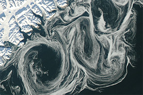
Thin sea ice swirled along the east coast of Greenland in October 2012, against a backdrop of overall thinning sea ice.
Published Oct 27, 2012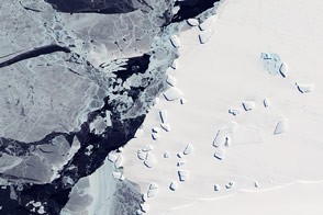
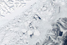
Acquired October 7, 2011, this natural-color image shows an ice menagerie off the coast of East Antarctica.
Published Oct 23, 2011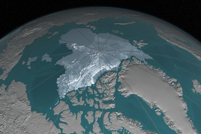
In 1984, there were 1.86 million square kilometers of old ice spread across the Arctic at its yearly minimum extent. In September 2016, there were only 110,000 square kilometers of old ice left.
Published Nov 4, 2016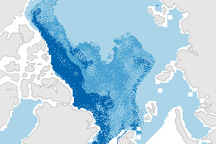
This pair of maps shows how the sea ice covering the Arctic at winter maximum in 2009 is younger than it was in the past.
Published Apr 10, 2009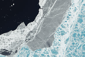
A mixture of ice types exists where frozen water meets open water.
Published Mar 11, 2015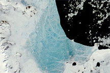
Changing weather conditions left their mark on sea ice along the Antarctic Peninsula in late 2008 and early 2009. In mid-December 2008, melt water resting on the sea ice colored it sky blue. At the beginning of 2009, however, the sea ice appeared snowy white, and cracks had begun along the ice margin.
Published Jan 9, 2009
New elevation measurements will give researchers an unprecedented understanding of the thickness of sea ice, which will be used to help improve climate modeling and forecasts.
Published Dec 18, 2018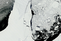
An area of sea ice larger than the state of Rhode Island can be seen breaking from the Ronne-Filchner Ice Shelf in this series of photo-like images.
Published Jan 15, 2010
As the Arctic experienced a new record summer minimum for ice extent, the Antarctic set a new record for maximum winter sea ice.
Published Oct 11, 2012