Floods and new infrastructure have long since separated the distinctive bend in the river that was portrayed by landscape painter Thomas Cole in 1836.
Published Oct 15, 2017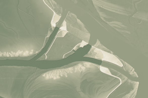
This model of the land elevation between the Mississippi, the Atchafalaya, and the Old River show the uphill fight to control river flow.
Published Jun 4, 2011
Trees have long been cherished here for timber and for the colors they bring to “the Fall Rhapsody.”
Published Oct 24, 2020
The wandering river is a boon to farming, but it has no interest in state borders.
Published Jul 19, 2020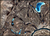
This false-color image from April 1, 2002, shows numerous braided channels and oxbow lakes along the Songhua River in northeastern China, just upstream of the city of Harbin.
Published Dec 27, 2005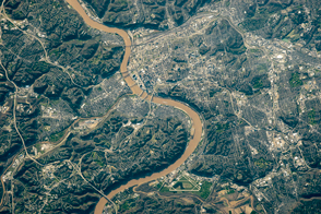
Steep bluffs and curving bends give this stretch of the Ohio River a distinctive look.
Published May 23, 2016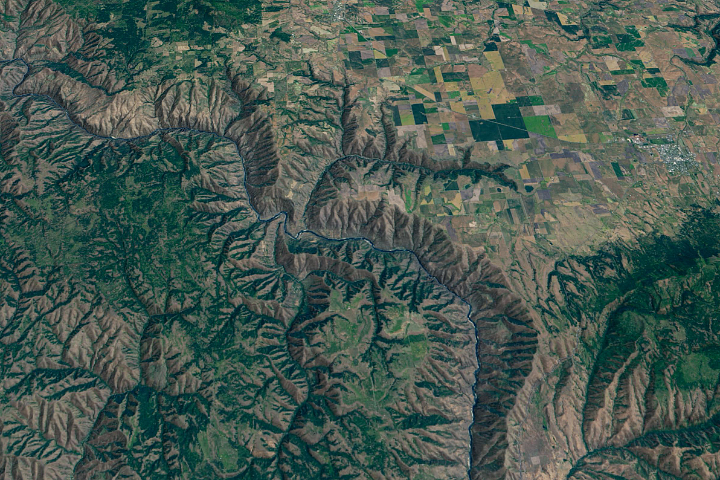
The Salmon River in Idaho, one of the longest free-flowing rivers in the United States, rushes through a geologic wonderland of wooded ridges, eroded bluffs, and stone towers and crags.
Published Jul 22, 2020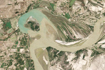
Between 1992 and 2009, a section of the lower Indus River changes course following the formation of an oxbow lake.
Published May 9, 2010
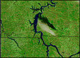
Acquired May 1, 2011, this natural-color image shows the James River completely filling the river valley near Jamesville, South Dakota.
Published May 3, 2011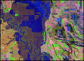
Meandering across a wide, relatively flat plain, the White River of Arkansas is no stranger to flooding. With regularity, spring rains push the river over its banks, inundating the flood-adapted forest that surrounds it. The river reached its fifth highest crest of 33.78 feet on April 19, 2008.
Published Apr 26, 2008
British Columbia's longest river delivers sediment and nutrients to the Strait of Georgia.
Published Jan 7, 2015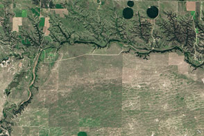
Cliffs, waterfalls, and a wide mix of vegetation line a river that winds through the Great Plains in Nebraska.
Published May 29, 2016
A satellite image offers inky evidence of the organic-rich freshwater that the Suwannee River delivers to the Gulf of Mexico.
Published Oct 27, 2018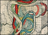

In the past few centuries, a river in northwestern Canada stopped wandering and assumed a more direct route to the sea.
Published Sep 4, 2012
As they prepare for a satellite that will measure the height and areal extent of rivers in unprecedented detail, hydrologists have released a better map of North American river widths.
Published Jul 9, 2015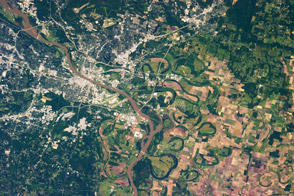
The landscape is defined by hills to the west and by the river running through it, not to mention the oxbow lakes that water left behind.
Published Jun 10, 2013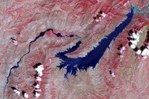
This false-color image shows the central part of the Vakhsh River, including the Nurek Dam and reservoir.
Published Nov 25, 2008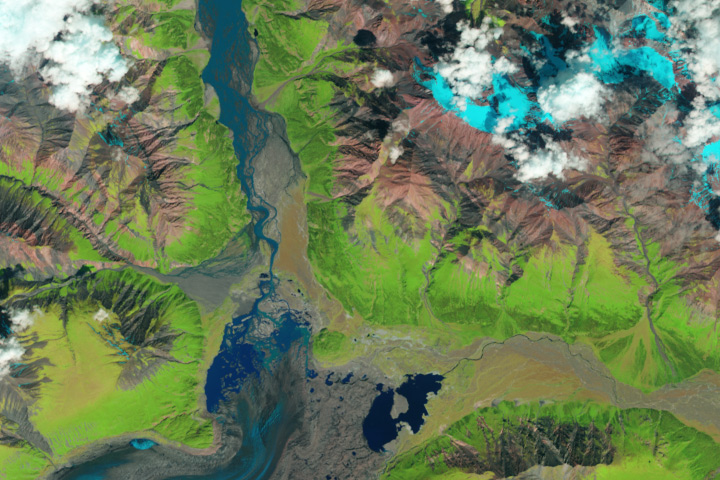
The Kaskawulsh River stole most of the water from the Slims River, dramatically reshaping the region’s drainage.
Published Apr 28, 2017