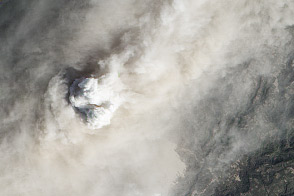
An intense eruption in Indonesia has covered the surrounding landscape in ash.
Published Jan 19, 2014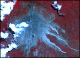
Explosive interactions between lava and snow mark the evolving eruption of Alaska’s Pavlof Volcano.
Published May 18, 2013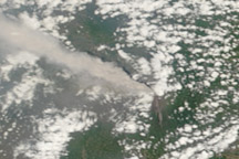
A thick plume of ash rose from Mount Merapi on November 10, 2010, when this photo-like image was taken. It is the most cloud-free image of the eruption to date.
Published Nov 11, 2010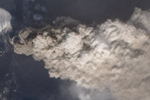
Increased activity at Eyjafjallajökull Volcano caused a new wave of flight cancellations in Ireland and Great Britain in early May 2010.
Published May 5, 2010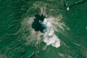
An ash plume billows above one of Mexico’s most active volcanoes.
Published Feb 23, 2015
For the first time in more than a century, Nicaragua’s Momotombo Volcano awoke with an explosive eruption.
Published Dec 9, 2015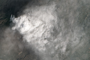
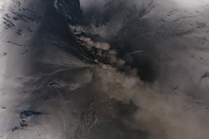
A cycle of lava dome growth and collapse is feeding pyrolcastic flows and ash plumes at the Indonesian volcano.
Published Jan 29, 2014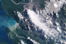
Chile’s Chaiten Volcano remained active in early 2009, releasing plumes of ash and steam.
Published Mar 11, 2009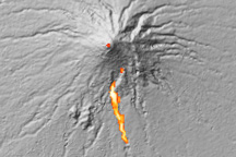
This visualization shows the approximate location of an avalanche of hot ash and volcanic gas flowing down Indonesia’s erupting Mount Merapi volcano on October 30, 2010.
Published Nov 5, 2010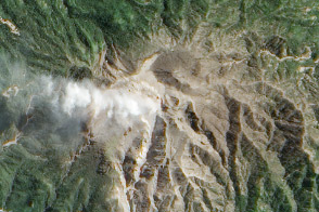
Ash and volcanic gases rise above this volcano in Indonesia.
Published Apr 25, 2013
NASA satellites detected ash from Mount Kelut nearly 20 kilometers (12 miles) in the atmosphere within two hours of the explosive February 13 eruption.
Published Feb 15, 2014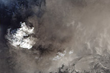
A pyrocumulus cloud rises through the ash above the summit of Iceland’s Eyjafjallajökull Volcano on April 24, 2010.
Published Apr 26, 2010