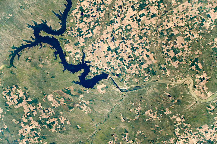
The fourth largest man-made reservoir in North America extends from Pierre, South Dakota, to Bismarck, North Dakota.
Published Dec 8, 2019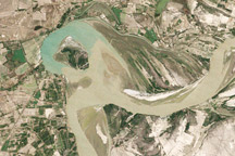
Between 1992 and 2009, a section of the lower Indus River changes course following the formation of an oxbow lake.
Published May 9, 2010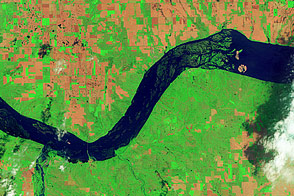
Acquired June 5, 2011, and May 19, 2005, these false-color images compare conditions around Lewis and Clark Lake in South Dakota.
Published Jun 7, 2011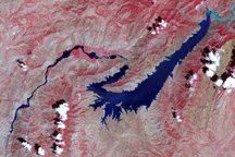
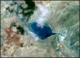
This false-color image shows the central part of the Vakhsh River, including the Nurek Dam and reservoir.
Published Nov 25, 2008
Acquired May 1, 2011, this natural-color image shows the James River completely filling the river valley near Jamesville, South Dakota.
Published May 3, 2011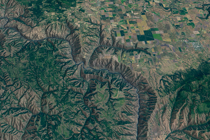
The Salmon River in Idaho, one of the longest free-flowing rivers in the United States, rushes through a geologic wonderland of wooded ridges, eroded bluffs, and stone towers and crags.
Published Jul 22, 2020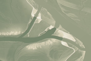
This model of the land elevation between the Mississippi, the Atchafalaya, and the Old River show the uphill fight to control river flow.
Published Jun 4, 2011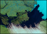

The wandering river is a boon to farming, but it has no interest in state borders.
Published Jul 19, 2020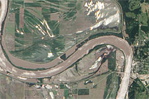
Acquired June 19, 2010, this natural-color image shows flooding along the banks of the Missouri River near the town of Glasgow.
Published Jun 22, 2010
Trees have long been cherished here for timber and for the colors they bring to “the Fall Rhapsody.”
Published Oct 24, 2020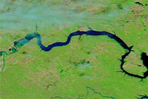
Acquired June 1, 2011, and June 4, 2010, these false-color images compare parts of the Missouri and Souris Rivers.
Published Jun 2, 2011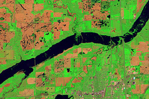
Acquired June 5, 2011, and May 19, 2005, these false-color images compare conditions along the James River near Mitchell, South Dakota.
Published Jun 7, 2011