
A submarine vehicle built by a JPL scientist and Arizona State University students surveys Lake Whillans, which is 800 meters below an ice sheet.
Published Mar 17, 2013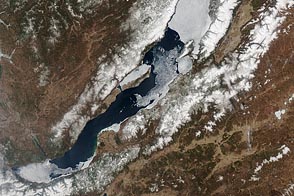
People and satellites keep an eye on when ice on the world’s deepest lake melts each year.
Published May 10, 2012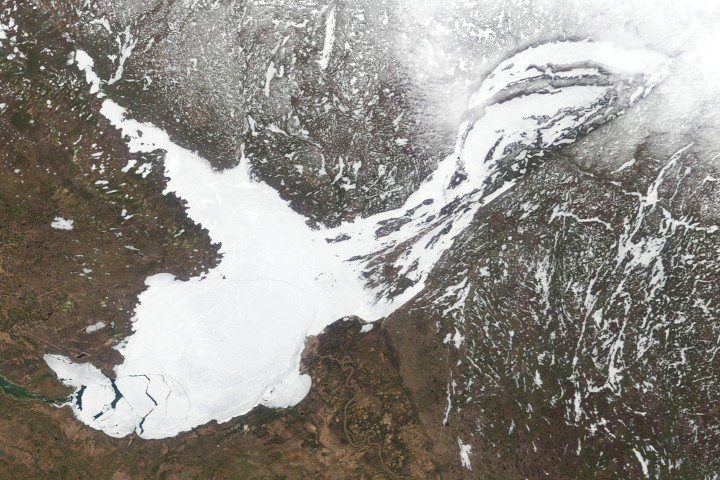
Roughly the same size of Belgium, Canada’s Great Slave Lake runs nearly 2,000 feet deep.
Published May 24, 2019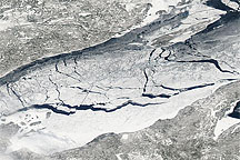
A relatively rare blanket of ice rested on the surface of Lake Superior in early March 2009.
Published Mar 13, 2009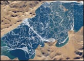
The alpine lakes of the Tibetan Plateau are some of the most remote in the world. This mosaic of astronaut photographs, taken along a single International Space Station orbit track, depicts Lake Puma Yumco during the winter season. The lake is located at an elevation of 5,030 meters above sea level (16,503 feet), and is considered ultraoligotrophic, meaning that nutrient concentrations in both the water column and lake sediments are extremely low. Water in such lakes tends to be blue to blue-green and to have high clarity due to low levels of photosynthesizing organisms such as phytoplankton. Color change in these lakes is usually due to shallowing of the water—blue indicating deeper water. A depth transition is visible along the west-southwest shoreline of Lake Puma Yumco at the lower left of image. The most striking feature of the image mosaic, however, is the intricate ice block pattern on the lake surface.
Published Feb 27, 2006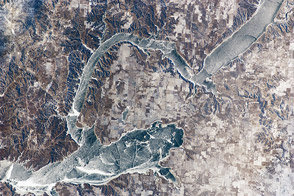
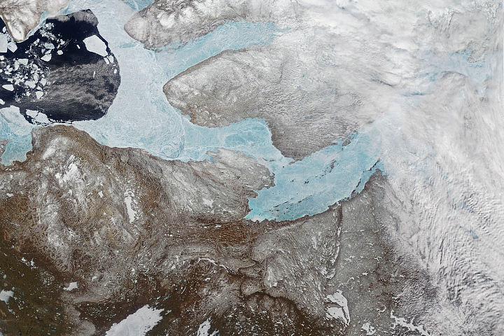
An astronaut aboard the International Space Station photographed frozen Lake Sakakawea while the air temperature near the lake was a frigid -24°C (-11°F).
Published Feb 27, 2012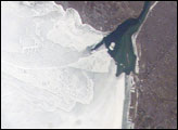
The eastern end of Lake Erie is clogged with ice that is pushed against the shoreline by the prevailing westerly wind. The ice collects in Lake Erie, and the Lake Erie-Niagara River Ice Boom prevents it from flowing down the Niagara River, which is the international boundary between the Canadian Province of Ontario, and New York State. A boom is deployed each December. Operational since 1964, the boom serves several functions: it protects the water intakes for the Niagara River power plants, and it minimizes ice runs (large blocks of ice flowing downstream as ice breaks up in the spring) and blockages that can create damage and flooding along the river.
Published May 21, 2007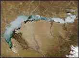
While most scientific and public attention goes to glaciers, lake and river ice have interesting stories to tell as well.
Published Jul 5, 2017
Accessed January 24, 2011, this natural-color image shows ice coating Lake Baikal.
Published Jan 24, 2011
A lake below the the Flade Isblink ice cap drained and created an unusual shape in the ice.
Published Mar 3, 2015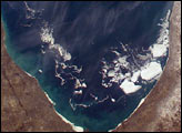
In 2003 a colder than normal North American winter saw the entire surface areas of Lakes Superior, Huron, and Erie frozen over for the first time in years. Although the open surface waters of Lake Michigan did not freeze this season, the southern portion experienced a higher than normal amount of ice. Winds and currents drove broken pieces of ice from the north to the south. This image taken from the International Space Station shows a number of large pieces of ice collected along and just off the shoreline southwest of Benton Harbor, Michigan. Smaller pieces trail northward offshore from Chicago, Illinois. Note the ice accumulation along the entire eastern shoreline of Lake Michigan as well as the wind-drive lake-effect snow cover over the western half of the lower Michigan Peninsula.
Published Mar 30, 2003