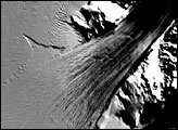
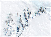
Named after American Antarctic explorer Richard E. Byrd, West Antarctica’s Byrd Glacier flows through a deep valley in the Transantarctic Mountains, covering a distance of 180 kilometers (112 miles) and descending more than 1,300 meters (4,300 feet) as it flows into the Ross Ice Shelf.
Published Jan 19, 2006
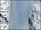
The Byrd Glacier plunges through a deep, 15-mile-wide valley in the Transatlantic Mountains to create a 100-mile-long, rock-floored ice stream.
Published Apr 1, 2007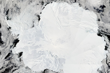
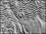
Relatively few people have seen Antarctica. But now, the MODIS Rapid Response System is producing daily photo-like images of Antarctica.
Published Jan 30, 2009
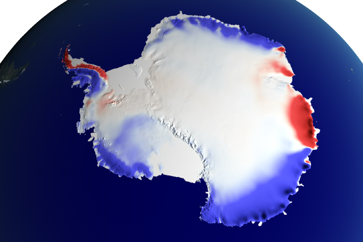
It snowed more, but the mass gained only compensates for some of the ice being lost in Antarctica.
Published Dec 26, 2018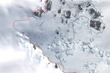
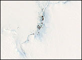
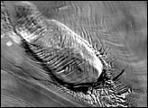
This image shows the latest estimate of the ice edge around Law Promontory, which juts out from East Antarctica’s coastline near Stefansson Bay.
Published Jul 23, 2010