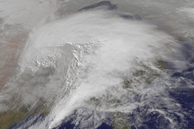
This animation shows a huge winter storm tracking across the United States between January 31 and February 2, 2011.
Published Feb 3, 2011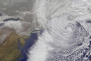
This time-lapse animation shows the merging of two storm fronts into a potent blizzard in February 2013.
Published Feb 13, 2013
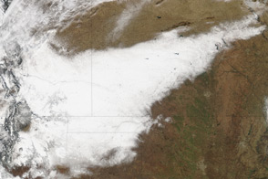
Snow covers the ground in a solid swath from eastern Arizona to the edge of a massive winter storm in Indiana and Michigan in these images from February 2, 2011.
Published Feb 2, 2011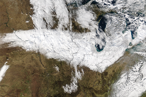
For a region that is quite familiar with snow, it was still a storm for the history books.
Published Nov 24, 2015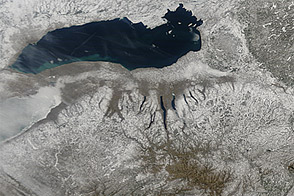
Snow cover sprawled across the northeastern United States in early March 2013, in the wake of a winter storm.
Published Mar 12, 2013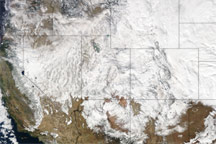
This image of the United States from December 8, 2009, shows a blanket of snow across the West along with a thick swirl of storm clouds over the Great Plains from North Dakota to Oklahoma.
Published Dec 10, 2009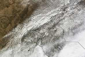
In January 2014, a large storm dropped snow and ice on a part of the United States unaccustomed to wintery weather.
Published Jan 31, 2014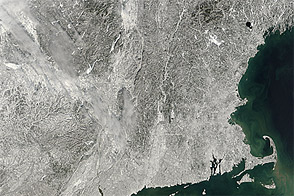
Acquired February 10, 2013, this image shows snow left in New England by a nor’easter.
Published Feb 11, 2013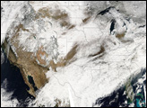
A strip of white defines the path of a deadly winter storm across New Mexico, Texas, Oklahoma, Colorado, and Kansas in this satellite image from December 21, 2011.
Published Dec 23, 2011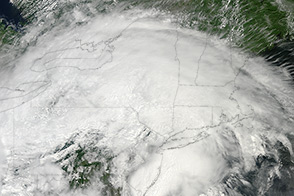
While not as damaging as the fierce line of storms that arrived in June 2012, the thunderstorms that struck the eastern United States on June 13, 2013, qualified as a “low-end” derecho.
Published Jun 15, 2013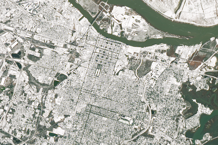
A cold snap and winter storm brought the Deep South a rare snowfall.
Published Jan 5, 2018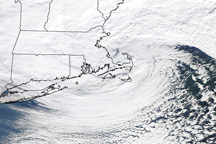
The storm that hammered New England on January 12, 2011, is a classic, comma shaped Nor’easter, as shown in this photo-like image.
Published Jan 13, 2011