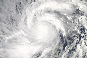
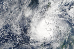
Early reports suggest the storm was one of the strongest typhoons to ever make landfall in Earth’s recorded history.
Published Nov 9, 2013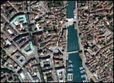
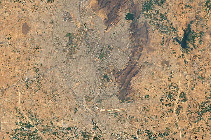
There were few Indian rulers as passionate about architecture as Maharaja Sawai Jai Singh, the founder of Jaipur.
Published Aug 24, 2019
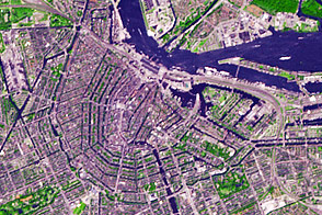
Planned at the end of the sixteenth century and built during the seventeenth, Amsterdam has inspired generations of city planners.
Published Jul 21, 2013
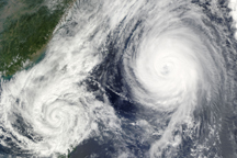
A little over 1,000 kilometers separated the center of Tropical Storm Parma from the center of Typhoon Melor on October 6, when the this composite image was taken.
Published Oct 7, 2009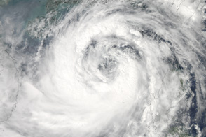
Moving northwest toward southern China and Vietnam, the massive Typhoon Nesat covers most of the South China Sea in this photo-like satellite image from September 28, 2011.
Published Sep 29, 2011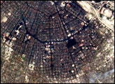
The typhoon was the strongest on record in the Northwest Pacific to make landfall so late in the year.
Published Dec 27, 2016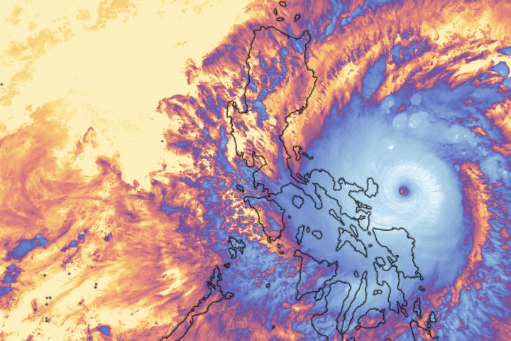
Super Typhoon Goni brought winds upwards of 300 kilometers (195 miles) per hour before making landfall on Catanduanes Island.
Published Nov 2, 2020Image of the Day Atmosphere Land Severe Storms Human Presence Remote Sensing
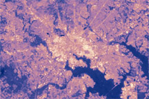
Maps of land surface type and temperature for Baltimore, Maryland, reveal the tight relationship between development and the urban heat island effect. Land temperatures in the densely developed city center are as much as 10 degrees Celsius higher than the surrounding forested landscape.
Published Dec 20, 2008