A one-time pulse of water is bringing a burst of new life to the lower Colorado River.
Published May 1, 2014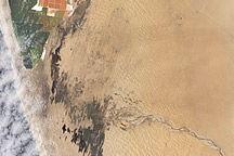
Acquired February 27, 2011, this natural-color image shows pools of water extending from the Kuiseb River to Walvis Bay, Namibia.
Published Mar 22, 2011
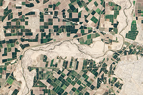
Natural vegetation and irrigated farmland along the Snake River Plain in Idaho use dramatically different amounts of water during the growing season.
Published Jan 26, 2010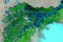
Acquired August 10, 2010, and almost exactly one year earlier, August 11, 2009, these false-color images show dramatic changes caused by torrential rains in the summer of 2010.
Published Aug 10, 2010
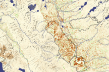
Dark brown squares mark fields that would ordinarily support irrigated crops in California’s Central Valley in this vegetation image. In 2009, a lack of water meant that the crops were not growing well or the fields lay fallow.
Published Aug 16, 2009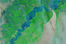
Acquired August 8,10, and 12, 2010, these false-color images show a substantial rise in water levels on the Indus River downstream from Sukkur, Pakistan.
Published Aug 12, 2010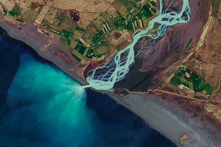
In a country rich with compelling geologic phenomena, even the rivers are connected to the landscape of fire and ice.
Published Aug 6, 2019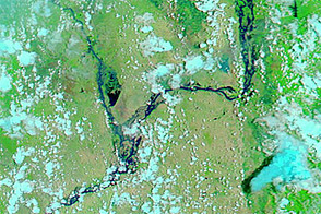
Acquired August 2, 2011, and March 6, 2011, these false-color images compare conditions along part of the Irrawaddy River in Burma, which rises substantially during the summer monsoon.
Published Aug 5, 2011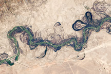
Acquired September 30, 2010, this astronaut photograph shows part of the Syr Darya River Floodplain in Kazakhstan, where the river flows through braided channels.
Published Nov 1, 2010
For more than 100 years, groups in the western United States have fought over water. During the 1880s, sheep ranchers and cattle ranchers argued over drinking water for their livestock on the high plains. In 1913, the city of Los Angeles began to draw water away from small agricultural communities in Owen Valley, leaving a dusty dry lake bed. In the late 1950s, construction of the Glen Canyon Dam catalyzed the American environmental movement. Today, farmers are fighting fishermen, environmentalists, and Native American tribes over the water in the Upper Klamath River Basin. The Landsat 7 satellite, launched by NASA and operated by the U.S. Geological Survey, documented an extreme drought in the area along the California/Oregon border in the spring of 2001.
Published Sep 8, 2001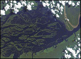
The wide, multi-island zone in the Rio Negro (Black River) shown in this astronaut photograph from September 2, 2006, is one of two, long “archipelagoes” upstream of the city of Manaus (not shown) in central Amazonia. Sixty kilometers of the total 120-kilemeter length of this archipelago appear in this image.
Published Dec 4, 2006