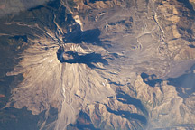
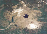
Nearly three decades after the catastrophic eruption of Mount St. Helens, the impact on the forest in the blast zone is still obvious in this astronaut photograph. South of the mountain, lush green forests cover the landscape, while north of the mountain, vegetation remains sparse.
Published Jan 1, 2009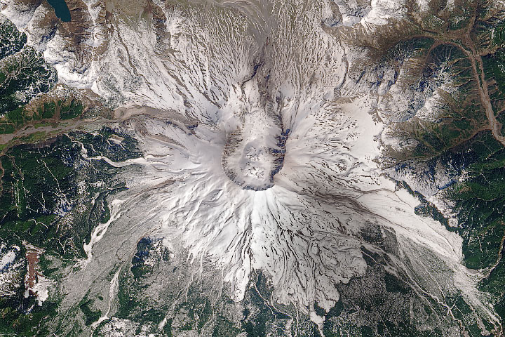
In May 1980, a satellite watched the mountain violently erupt; satellites over the next forty years watched it recover.
Published May 18, 2020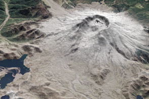
Satellites in orbit and scientists on the ground still monitor the mountain and track its recovery.
Published May 16, 2015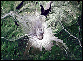
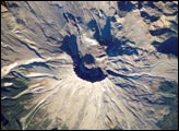
On May 18, 1980, Mount Saint Helens volcano erupted. Because the eruption occurred in an easily accessible region of the U.S., Mount St. Helens has provided unprecedented opportunities for U.S. researchers to collect scientific observations of the geology of an active volcano and document the regional ecological impact and recovery from an eruption.
Published May 17, 2004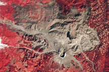
A trio of images documents the devastation and recovery of the landscape around Mt. St. Helens Volcano following its cataclysmic 1980 eruption.
Published May 18, 2010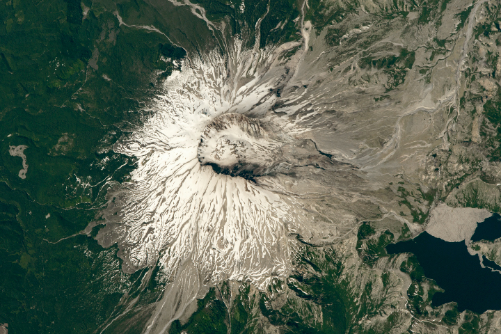
The area around the volcano has been left to recover naturally from the disaster, which it has done quite nicely, if slowly.
Published Jul 22, 2018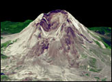
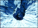
After more than a decade of inactivity, Mount St. Helens rumbled back to life in September 2004. An ongoing series of tremors within the volcano coupled with upward movement of magma toward its caldera prompted geologists to issue a Level 3 alert on October 2, stating that Mount St. Helens could experience a moderately severe eruption at any time. In order to help geologists and volcanologists assess the nature and magnitude of the risk, on September 24, 2004, NASA flew a low-altitude aircraft carrying the MODIS/ASTER Airborne Simulator (MASTER) directly over the volcano to obtain high-resolution images of its caldera.
Published Oct 7, 2004