This image shows the extent of Arizona’s Wallow Fire on June 15, 2011.
Published Jun 16, 2011
A wildfire in Fresno County, California has burned more than 28,000 acres.
Published Jul 20, 2020
In August 2013, the Silver Fire burned 20,000 acres near Banning, California.
Published Aug 14, 2013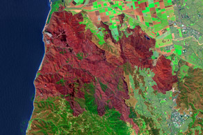
As wildfires wind down, teams of scientists hit the field to assess the damage. In many cases, they have help from satellites.
Published May 9, 2013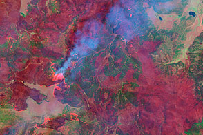
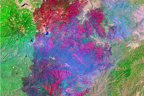
This false-color image taken by the Landsat-7 satellite on June 7, shows how completely the Wallow Fire is burning the forest in the mountains of eastern Arizona.
Published Jun 9, 2011
The blaze is the largest in Arizona this year and the largest in the United States right now.
Published Jun 16, 2020Image of the Day Heat Land Fires Human Presence Remote Sensing
The Landsat 8 satellite acquired a scene of contrasts in Siberia.
Published Apr 9, 2019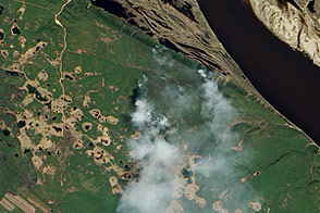
Needle-leaf forest stretches away from the Lena River in Russia’s remote eastern reaches. The EO-1 satellite captured these images just as fire swept through the area.
Published Jun 17, 2011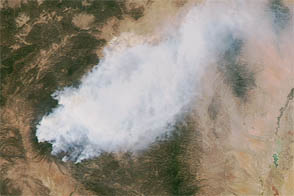
The Whitewater-Baldy wildfire is the largest on record in New Mexico.
Published May 30, 2012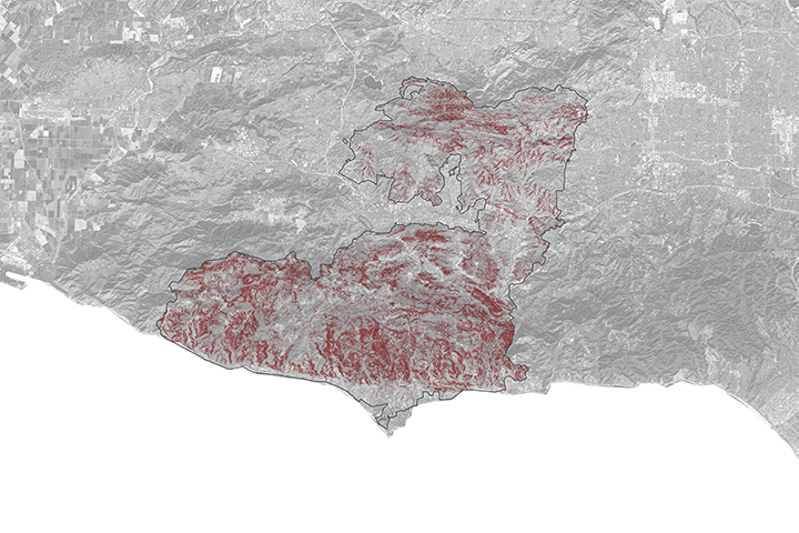
A NASA project is providing maps of satellite data to emergency response teams during the Woolsey Fire.
Published Nov 16, 2018
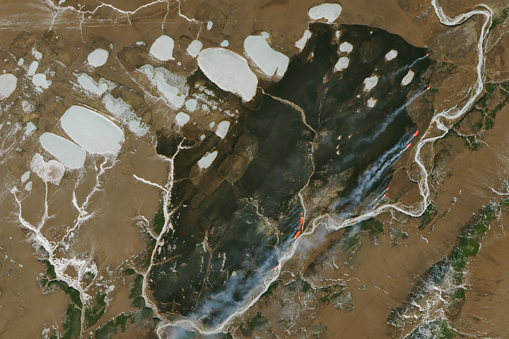
Temperature, humidity, and winds contributed to the rapid spread of fire in Lake County, about 100 miles northwest of Sacramento.
Published Jun 27, 2018
The fire is among the largest Los Angeles County has ever faced.
Published Sep 23, 2020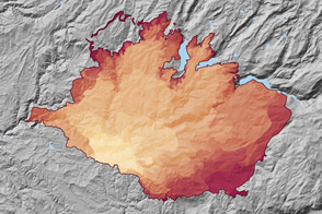
At 369 square miles in size, the Rim Fire is the largest in the United States in 2013.
Published Sep 4, 2013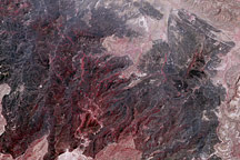
Taken on May 2, 2100, this image shows land burned in the large Rockhouse Fire in southwestern Texas.
Published May 3, 2011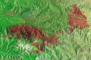
Little heat remained, but the California fire left behind a burn scar spanning almost 50 square miles.
Published Jul 7, 2015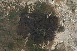
A suspicious fire leaves a large burn scar across Bosque de la Primavera.
Published May 23, 2012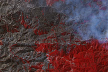
The charred landscape left by the Station Fire in southern California covers much of the San Gabriel Mountains, edging down into residential areas northwest of Pasadena. Smoke rolls off the eastern edge of the burned land in this image from September 6, 2009.
Published Sep 9, 2009