These Multi-angle Imaging Spectroradiometer (MISR) images from June 11, 2000 demonstrate a turbulent atmospheric flow pattern known as the von Karman vortex street.
Published Dec 7, 2000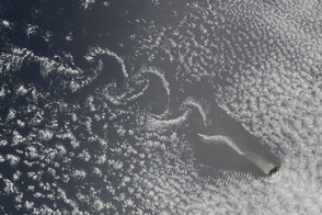
Mountain peaks slice through the clouds and air masses, creating Von Karman Vortices.
Published Nov 6, 2016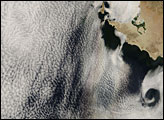
In this image, the swirling clouds known as vortex streets appear along the left edge of the image, stretching southward from Isla Guadalupe. Southeast of the vortex street, a glory, which resembles a rainbow, hovers above the cloud cover. The glory is faint but large, 200 to 300 kilometers long, along a north-south orientation.
Published Jun 22, 2007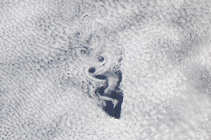
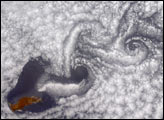
This Valentine in the sky is the visible expression of fluid dynamics at work.
Published Feb 14, 2019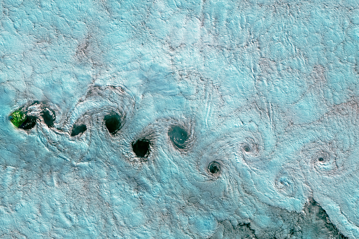
Chains of swirling clouds stream behind islands in both the Atlantic and Pacific oceans.
Published Aug 13, 2017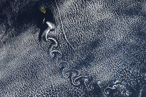
The Aqua satellite captured this image of von Kármán vortices downwind of Isla Socorro.
Published Aug 19, 2013
On September 25, 2002, astronauts aboard the International Space Station viewed Easter Island, one of the most remote locations on Earth. Easter Island is more than 2000 miles from the closest populations on Tahiti and Chile—even more remote than astronauts orbiting at 210 nautical miles above the Earth. Archaeologists believe the island was discovered and colonized by Polynesians at about 400 AD. Subsequently, a unique culture developed. The human population grew to levels that could not be sustained by the island. A civil war resulted, and the island’s deforestation and ecosystem collapse was nearly complete.
Published Oct 6, 2002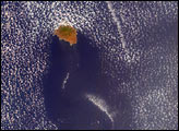
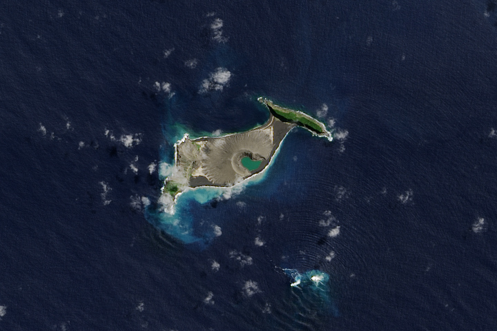
Hunga Tonga-Hunga Ha'apai is likely to persist for years, maybe decades.
Published Dec 11, 2017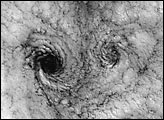
Clouds off the Chilean coast show a unique pattern called a “von Karman vortex street.”
Published May 30, 2000
In the western Pacific Ocean, a new volcanic island that formed in the shadow of Nishino-shima has merged with it. The island has doubled in size as the eruption continues.
Published Apr 4, 2014
An unnamed isle in Canada’s Nunavut Territory is the leading contender for this island superlative.
Published Feb 22, 2015
The ghostly white shapes northeast and immediately southwest of Wrangel Island are sea ice. Over the course of the satellite record, Arctic sea ice has advanced and retreated past Wrangel Island many times. From 1979 to 2000, the sea ice edge at the end of summer generally fell somewhere in the vicinity of Wrangel Island, but this is not the first summer when the sea ice edge has retreated well north of the island.
Published Aug 29, 2008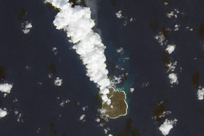
More than a year after emerging from the Pacific Ocean, a new Japanese island continues to grow.
Published Dec 2, 2014
This natural-color image shows Henrietta Island, with a smooth, dome-capped surface and a rugged coastline, illuminated by low-angled sunlight.
Published May 3, 2009
An undersea eruption at Lateiki Island in late October 2019 has brought new life to an older island in the Tonga chain.
Published Nov 26, 2019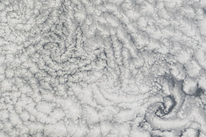
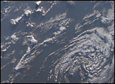
Clouds swirled in the southern Atlantic Ocean, northwest of St. Helena, in mid-November 2012.
Published Nov 25, 2012