
The most interesting geology lies just offshore and below the water line of this Northwest Australian island.
Published Aug 3, 2015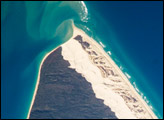
Fraser Island, the world’s largest sand island, is located along the coastline of Queensland, Australia, and it includes Great Sandy National Park. The island was designated a World Heritage site in 1992, in part due to its outstanding preservation of geological processes related to sand dune formation.
Published Oct 13, 2008
Once an important port during World War II, the bay is comprised of a complex delta system that makes it a very scenic and popular tourist destination in Australia.
Published May 30, 2020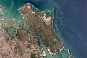
Is it a remote paradise, a major industrial complex, or somehow both?
Published Dec 28, 2013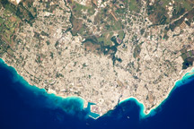
Taken December 16, 2009, this astronaut photograph shows the greater metropolitan area of Bridgetown, Barbados. Gray-and-white urban areas along the coast contrast with green vegetation inland.
Published Jan 18, 2010
The small island of Blanquilla is named for its white sand beaches, visible in this astronaut photograph as a bright border along the northeastern–eastern shoreline. Surface currents extending from the western coastline of the island are caused by easterly trade winds. This dominant wind has also caused movement of beach sand to form white “fingers” extending inland along the east coast.
Published Nov 26, 2007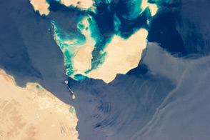
The narrow strait between Egypt’s Sinai Peninsula and Saudi Arabia is an important passage for ships trying to reach Israel and Jordan.
Published Aug 5, 2013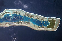
This astronaut photo of Millennium Island shows emerald islets surrounding a turquoise lagoon dotted with coral.
Published Jul 13, 2009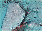
Akpatok Island lies in Ungava Bay in northern Quebec, Canada. Accessible only by air, Akpatok Island rises out of the water as sheer cliffs that soar 500 to 800 feet (150 to 243 m) above the sea surface. The island is an important sanctuary for cliff-nesting seabirds.
Published Feb 25, 2002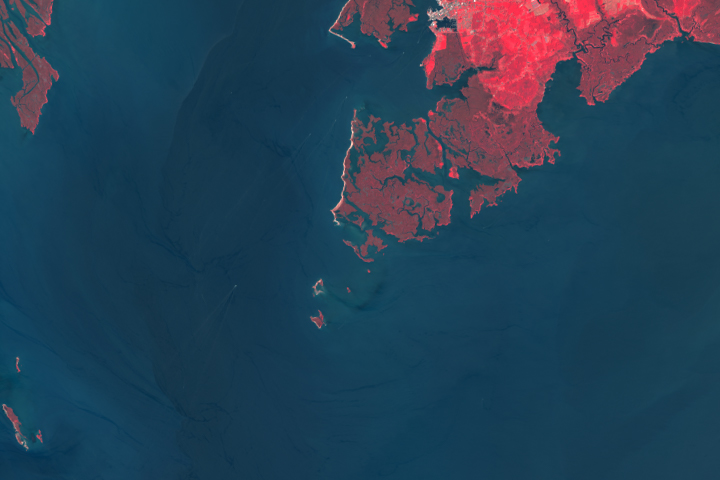
Rising waters are swallowing up another island in Chesapeake Bay.
Published Dec 2, 2019
The ghostly white shapes northeast and immediately southwest of Wrangel Island are sea ice. Over the course of the satellite record, Arctic sea ice has advanced and retreated past Wrangel Island many times. From 1979 to 2000, the sea ice edge at the end of summer generally fell somewhere in the vicinity of Wrangel Island, but this is not the first summer when the sea ice edge has retreated well north of the island.
Published Aug 29, 2008
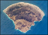
Named Isla de Aves in Spanish, (meaning “Island of the Birds”) Aves Island lies west of the Lesser Antilles in the Caribbean. It provides a nesting site to green sea turtles (Chelonia mydas) and, of course, birds. Because the abundant bird droppings, known as guano, could be used in fertilizer and gunpowder, guano miners worked on the island until they depleted the supply. Since its discovery by Europeans, likely in the late 16th century, Aves Island was subsequently claimed by several European nations. The island is currently claimed by Venezuela, although disputes about ownership of the island, and the surrounding exclusive economic zone in the Caribbean, continue today.
Published Jun 19, 2006
This photo-like image of Chincoteague Island and the southern section of Assateague was acquired by the IKONOS satellite on June 27, 2001.
Published Oct 28, 2008