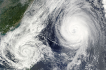
A little over 1,000 kilometers separated the center of Tropical Storm Parma from the center of Typhoon Melor on October 6, when the this composite image was taken.
Published Oct 7, 2009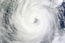
Acquired October 21, 2010, this natural-color image shows Typhoon Megi over the South China Sea.
Published Oct 21, 2010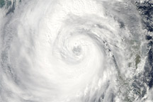
Category 4 Typhoon Megi sprawls over much of the South China Sea in this true-color image from October 20, 2010.
Published Oct 20, 2010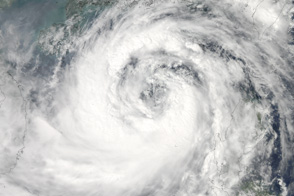
Moving northwest toward southern China and Vietnam, the massive Typhoon Nesat covers most of the South China Sea in this photo-like satellite image from September 28, 2011.
Published Sep 29, 2011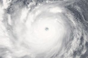
Acquired August 26, 2011, this natural-color image shows Super Typhoon Nanmadol over the northern Philippines.
Published Aug 26, 2011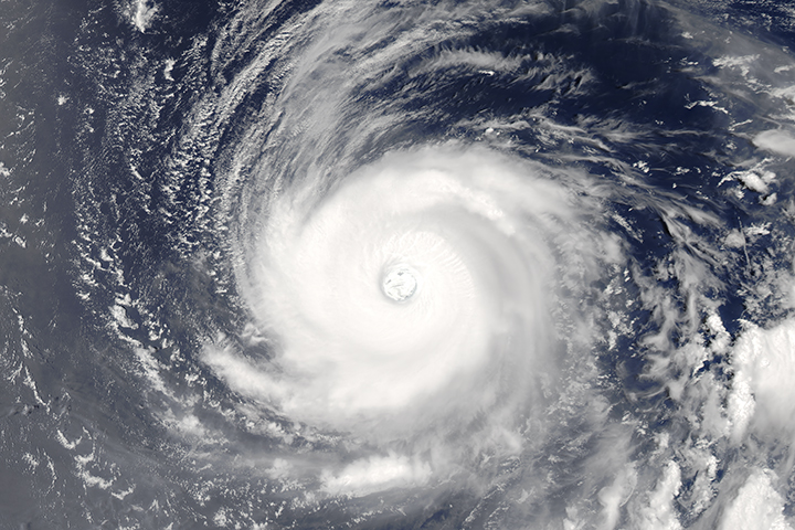
The powerful, well developed storm spins over the western tropical Pacific Ocean.
Published Aug 1, 2017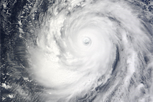
Super-Typhoon Choi-wan had a symmetrical shape, a trait of a strong, well-organized cyclone, when this photo-like image was taken on September 16, 2009.
Published Sep 16, 2009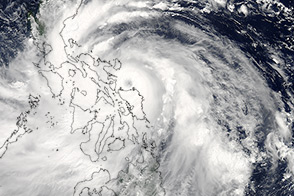
Eight months after Super Typhoon Haiyan, another powerful typhoon battered the Philippines.
Published Jul 17, 2014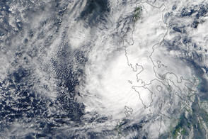
The typhoon was the strongest on record in the Northwest Pacific to make landfall so late in the year.
Published Dec 27, 2016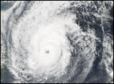
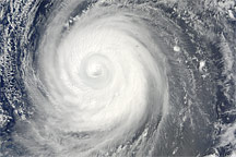
Though Typhoon Choi-wan maintains its tightly wound symmetric shape in this photo-like image from September 18, 2009, the striking clear eye of previous days is gone.
Published Sep 18, 2009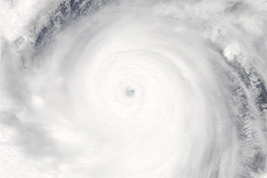
Acquired September 24, 2012, this natural-color image shows Super Typhoon Jelawat over the Philippine Sea.
Published Sep 24, 2012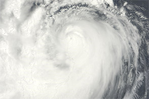
Acquired August 27, 2011, this natural-color image shows Typhoon Nanmadol over the northern Philippines and the southern tip of Taiwan.
Published Aug 29, 2011